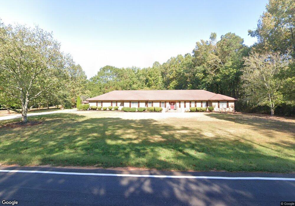
1695 Tyus Carrollton Rd Carrollton, GA 30117
Estimated Value: $515,000 - $600,000
4
Beds
4
Baths
3,747
Sq Ft
$148/Sq Ft
Est. Value
About This Home
This home is located at 1695 Tyus Carrollton Rd, Carrollton, GA 30117 and is currently estimated at $555,810, approximately $148 per square foot. 1695 Tyus Carrollton Rd is a home located in Carroll County with nearby schools including Roopville Elementary School, Central Middle School, and Central High School.
Ownership History
Date
Name
Owned For
Owner Type
Purchase Details
Closed on
Feb 3, 2021
Sold by
Swayngham Barbara
Bought by
Canova Robert Donald
Current Estimated Value
Home Financials for this Owner
Home Financials are based on the most recent Mortgage that was taken out on this home.
Original Mortgage
$324,000
Outstanding Balance
$289,531
Interest Rate
2.65%
Mortgage Type
New Conventional
Estimated Equity
$266,279
Purchase Details
Closed on
Jun 23, 1998
Sold by
Swayngham H E
Bought by
Swayngham Barbara
Purchase Details
Closed on
Apr 15, 1991
Bought by
Swayngham H E
Purchase Details
Closed on
Oct 31, 1990
Bought by
J & M Devlopment Inc
Create a Home Valuation Report for This Property
The Home Valuation Report is an in-depth analysis detailing your home's value as well as a comparison with similar homes in the area
Home Values in the Area
Average Home Value in this Area
Purchase History
| Date | Buyer | Sale Price | Title Company |
|---|---|---|---|
| Canova Robert Donald | $360,000 | -- | |
| Swayngham Barbara | -- | -- | |
| Swayngham H E | $25,000 | -- | |
| J & M Devlopment Inc | $32,000 | -- |
Source: Public Records
Mortgage History
| Date | Status | Borrower | Loan Amount |
|---|---|---|---|
| Open | Canova Robert Donald | $324,000 |
Source: Public Records
Tax History Compared to Growth
Tax History
| Year | Tax Paid | Tax Assessment Tax Assessment Total Assessment is a certain percentage of the fair market value that is determined by local assessors to be the total taxable value of land and additions on the property. | Land | Improvement |
|---|---|---|---|---|
| 2024 | $4,610 | $225,291 | $9,108 | $216,183 |
| 2023 | $4,610 | $204,319 | $7,287 | $197,032 |
| 2022 | $3,511 | $163,016 | $4,858 | $158,158 |
| 2021 | $3,590 | $140,051 | $3,886 | $136,165 |
| 2020 | $644 | $102,901 | $3,533 | $99,368 |
| 2019 | $662 | $94,731 | $3,533 | $91,198 |
| 2018 | $630 | $84,280 | $2,496 | $81,784 |
| 2017 | $636 | $84,280 | $2,496 | $81,784 |
| 2016 | $637 | $84,280 | $2,496 | $81,784 |
| 2015 | $656 | $85,963 | $4,661 | $81,302 |
| 2014 | $661 | $85,964 | $4,661 | $81,302 |
Source: Public Records
Map
Nearby Homes
- 1531 Tyus Carrollton Rd
- 20 Camp Ct
- 105 Woodbine Dr
- 95 Camp Ln
- 399 Old Camp Church Rd
- 345 Piney Grove Rd
- 0 Bonner Rd Unit 10635754
- 3680 W Highway 166
- 450 Baxter Rd
- 21 Crabapple Place
- The Coleman Plan at Summerfield Place
- The Pearson Plan at Summerfield Place
- The Piedmont Plan at Summerfield Place
- The Harrington Plan at Summerfield Place
- The McGinnis Plan at Summerfield Place
- The Telfair Plan at Summerfield Place
- 0 Buffalo Creek Rd Unit 10624169
- 533 Buffalo Creek Rd
- 102 Red Oak Dr
- 1695A Tyus Carrollton Rd
- 1697 Tyus Carrollton Rd
- 20 Owensby Cemetary Rd
- 19 Owensby Cemetary Rd
- 1693 Tyus Carrollton Rd
- 1715 Tyus Carrollton Rd
- 0 Bethesda Church Rd
- 0 Bethesda Church Rd Unit 7446141
- 0 Bethesda Church Rd Unit 7255535
- 0 Bethesda Church Rd Unit 3221231
- 0 Bethesda Church Rd Unit 8855756
- 0 Bethesda Church Rd Unit 8855295
- 0 Bethesda Church Rd Unit 8810155
- 0 Bethesda Church Rd Unit 8547292
- 0 Bethesda Church Rd Unit 8536522
- 0 Bethesda Church Rd Unit 8384690
- 0 Bethesda Church Rd Unit 8324865
- 0 Bethesda Church Rd Unit 7634887
- 0 Bethesda Church Rd Unit 8769618
- 0 Bethesda Church Rd Unit 8659687