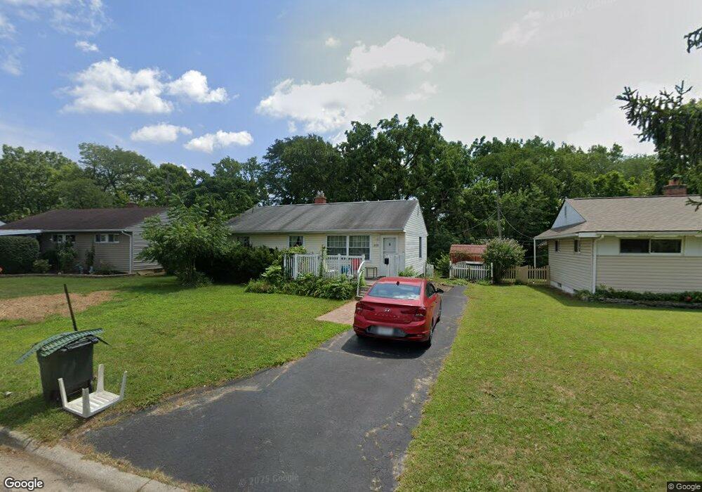
1698 Westbrook Dr Columbus, OH 43223
Estimated Value: $155,000 - $193,000
3
Beds
1
Bath
925
Sq Ft
$189/Sq Ft
Est. Value
About This Home
This home is located at 1698 Westbrook Dr, Columbus, OH 43223 and is currently estimated at $175,090, approximately $189 per square foot. 1698 Westbrook Dr is a home located in Franklin County with nearby schools including Finland Elementary School, Franklin Woods Intermediate School, and Finland Middle School.
Ownership History
Date
Name
Owned For
Owner Type
Purchase Details
Closed on
Jul 9, 2008
Sold by
Ebersole Mary D and Ebersole Roy W
Bought by
Ebersole Mary D and The Trust Of Mary D Ebersole
Current Estimated Value
Purchase Details
Closed on
Nov 20, 2007
Sold by
Clay Carl D and Clay Linda L
Bought by
Ebersole Mary D
Purchase Details
Closed on
Sep 30, 1997
Sold by
Stevens Debbie L
Bought by
Clay Carl D and Clay Linda L
Home Financials for this Owner
Home Financials are based on the most recent Mortgage that was taken out on this home.
Original Mortgage
$57,362
Interest Rate
7.7%
Mortgage Type
FHA
Purchase Details
Closed on
Jul 26, 1996
Sold by
Highsmith Connie S
Bought by
Debbie L Stevens
Purchase Details
Closed on
Jun 1, 1987
Create a Home Valuation Report for This Property
The Home Valuation Report is an in-depth analysis detailing your home's value as well as a comparison with similar homes in the area
Home Values in the Area
Average Home Value in this Area
Purchase History
| Date | Buyer | Sale Price | Title Company |
|---|---|---|---|
| Ebersole Mary D | -- | Attorney | |
| Ebersole Mary D | $88,900 | Valmer Land | |
| Clay Carl D | $60,000 | Chicago Title | |
| Debbie L Stevens | $20,000 | -- | |
| -- | $41,900 | -- |
Source: Public Records
Mortgage History
| Date | Status | Borrower | Loan Amount |
|---|---|---|---|
| Previous Owner | Clay Carl D | $57,362 |
Source: Public Records
Tax History Compared to Growth
Tax History
| Year | Tax Paid | Tax Assessment Tax Assessment Total Assessment is a certain percentage of the fair market value that is determined by local assessors to be the total taxable value of land and additions on the property. | Land | Improvement |
|---|---|---|---|---|
| 2024 | $1,966 | $48,340 | $8,020 | $40,320 |
| 2023 | $1,987 | $48,335 | $8,015 | $40,320 |
| 2022 | $933 | $21,390 | $9,210 | $12,180 |
| 2021 | $886 | $21,390 | $9,210 | $12,180 |
| 2020 | $884 | $21,390 | $9,210 | $12,180 |
| 2019 | $662 | $17,230 | $7,670 | $9,560 |
| 2018 | $788 | $17,230 | $7,670 | $9,560 |
| 2017 | $655 | $17,230 | $7,670 | $9,560 |
| 2016 | $987 | $20,720 | $3,430 | $17,290 |
| 2015 | $916 | $20,720 | $3,430 | $17,290 |
| 2014 | $916 | $20,720 | $3,430 | $17,290 |
| 2013 | $587 | $24,360 | $4,025 | $20,335 |
Source: Public Records
Map
Nearby Homes
- 1607 Red Leaf Ln
- 1543 Red Leaf Ln
- 2210 October Ridge Dr
- 1417 Fahy Dr
- 1948 Big Run Bluffs Blvd
- 1390 Gray Meadow Dr
- 1949 Big Run Bluffs Blvd
- 0 S Central Ave
- 1723 Farberdale Dr
- 4745 Big Run Rd E
- 1994 Little Ave
- 1532 Westmeadow Dr
- 2336 Woodbrook Cir N Unit 92 B
- 2436 Onyx Ct
- 2180 Eakin Rd
- 2362 Woodbrook Cir N Unit 81
- 1122 Harrisburg Pike
- 1119 Hardesty Place E Unit 1
- 1085 Hardesty Place E Unit 4
- 1663 Hopkins Ave
- 1704 Westbrook Dr
- 1694 Westbrook Dr
- 1712 Westbrook Dr
- 1688 Westbrook Dr
- 1895 Westfield Dr N
- 1906 Marsdale Ave
- 1720 Westbrook Dr
- 1680 Westbrook Dr
- 1905 Westfield Dr N
- 1730 Westbrook Dr
- 1914 Marsdale Ave
- 1888 Westfield Dr N
- 1911 Marsdale Ave
- 1672 Westbrook Dr
- 1896 Westfield Dr N
- 1911 Westfield Dr N
- 1740 Westbrook Dr
- 1920 Marsdale Ave
- 1743 Eastbrook Dr S
- 1904 Westfield Dr N