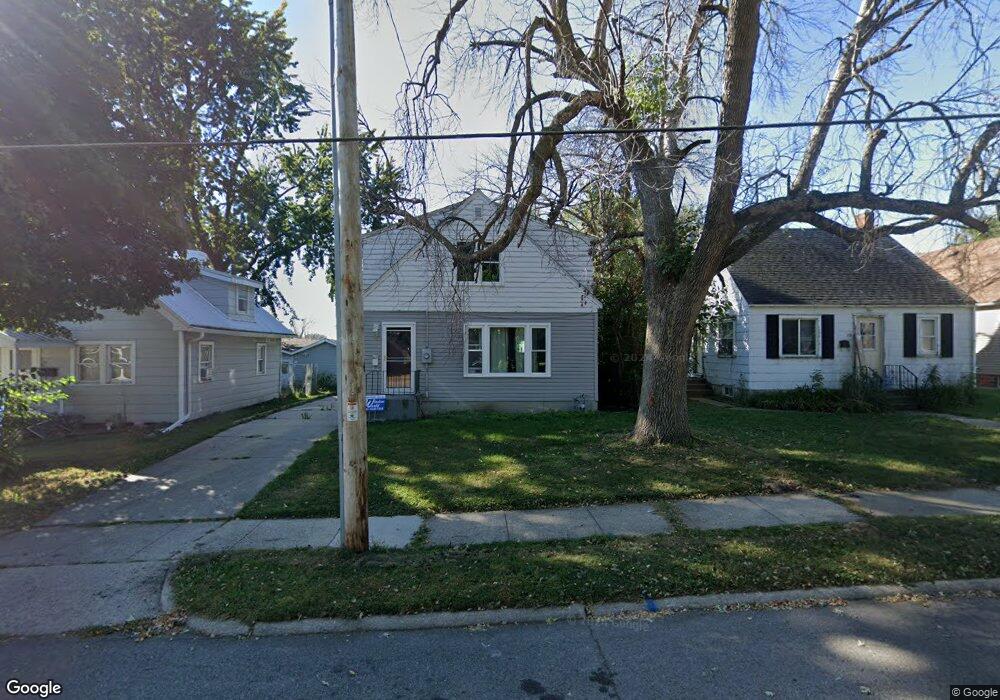
17 26th St SW Mason City, IA 50401
Estimated Value: $106,418 - $143,000
4
Beds
2
Baths
1,980
Sq Ft
$64/Sq Ft
Est. Value
About This Home
This home is located at 17 26th St SW, Mason City, IA 50401 and is currently estimated at $126,605, approximately $63 per square foot. 17 26th St SW is a home located in Cerro Gordo County with nearby schools including Mason City High School, North Iowa Christian School, and Newman Catholic Elementary School.
Ownership History
Date
Name
Owned For
Owner Type
Purchase Details
Closed on
Jun 17, 2010
Sold by
Erickson Dennis G and Erickson Nancy J
Bought by
Rolon Victor and Rolon Dena L
Current Estimated Value
Home Financials for this Owner
Home Financials are based on the most recent Mortgage that was taken out on this home.
Original Mortgage
$76,963
Outstanding Balance
$51,581
Interest Rate
4.97%
Mortgage Type
FHA
Estimated Equity
$75,024
Create a Home Valuation Report for This Property
The Home Valuation Report is an in-depth analysis detailing your home's value as well as a comparison with similar homes in the area
Home Values in the Area
Average Home Value in this Area
Purchase History
| Date | Buyer | Sale Price | Title Company |
|---|---|---|---|
| Rolon Victor | $78,000 | None Available |
Source: Public Records
Mortgage History
| Date | Status | Borrower | Loan Amount |
|---|---|---|---|
| Open | Rolon Victor | $76,963 |
Source: Public Records
Tax History Compared to Growth
Tax History
| Year | Tax Paid | Tax Assessment Tax Assessment Total Assessment is a certain percentage of the fair market value that is determined by local assessors to be the total taxable value of land and additions on the property. | Land | Improvement |
|---|---|---|---|---|
| 2024 | $1,078 | $77,610 | $10,400 | $67,210 |
| 2023 | $1,142 | $77,610 | $10,400 | $67,210 |
| 2022 | $1,160 | $66,570 | $8,000 | $58,570 |
| 2021 | $1,090 | $65,340 | $8,000 | $57,340 |
| 2020 | $1,276 | $58,850 | $8,000 | $50,850 |
| 2019 | $1,042 | $0 | $0 | $0 |
| 2018 | $1,280 | $0 | $0 | $0 |
| 2017 | $1,314 | $0 | $0 | $0 |
| 2016 | $1,278 | $0 | $0 | $0 |
| 2015 | $1,278 | $0 | $0 | $0 |
| 2014 | $1,212 | $0 | $0 | $0 |
| 2013 | $1,164 | $0 | $0 | $0 |
Source: Public Records
Map
Nearby Homes
- 54 Stony Way
- 82 Sunny Cir
- 0 28th SW
- 42 33rd St SE
- 0 33rd St SE
- 1960 S Federal Ave
- 3310 Delaware Ave
- 3310 S Delaware Ave
- 225 20th St SE
- 428 29th St SW
- 20 34th St SE
- 728 S Monroe Ct
- 1973 S Carolina Ave
- 512 17th St SE
- 308 15th St SE
- 1311 S Massachusetts Ave
- 702 17th St SE Unit 2
- 143 11th St SW
- 1424 S Hampshire Ave
- 677 14th St SE