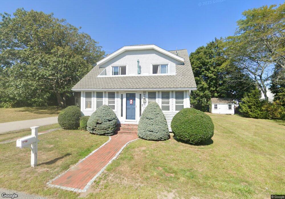
17 3rd Ave Unit 1 Scituate, MA 02066
Estimated Value: $888,623 - $1,014,000
3
Beds
2
Baths
1,560
Sq Ft
$611/Sq Ft
Est. Value
About This Home
This home is located at 17 3rd Ave Unit 1, Scituate, MA 02066 and is currently estimated at $952,406, approximately $610 per square foot. 17 3rd Ave Unit 1 is a home located in Plymouth County with nearby schools including Wampatuck Elementary School, Lester J. Gates Middle School, and Scituate High School.
Ownership History
Date
Name
Owned For
Owner Type
Purchase Details
Closed on
Feb 14, 2011
Sold by
Tatum Ft
Bought by
Tatum Ft
Current Estimated Value
Purchase Details
Closed on
Apr 3, 2009
Sold by
Tatum Barbara A
Bought by
Tatum Ft
Purchase Details
Closed on
Feb 24, 2009
Sold by
Tatum Barbara A
Bought by
Tatum Ft
Purchase Details
Closed on
Feb 10, 2009
Sold by
Tatum Christopher S
Bought by
Tatum Barbara A
Purchase Details
Closed on
Oct 17, 2008
Sold by
Tatum Barbara A
Bought by
Tatum Ft
Purchase Details
Closed on
Jan 1, 1966
Bought by
Tatum Christopher S and Tatum Gilma Elizabeth
Create a Home Valuation Report for This Property
The Home Valuation Report is an in-depth analysis detailing your home's value as well as a comparison with similar homes in the area
Home Values in the Area
Average Home Value in this Area
Purchase History
| Date | Buyer | Sale Price | Title Company |
|---|---|---|---|
| Tatum Ft | -- | -- | |
| Tatum Ft | -- | -- | |
| Tatum Barbara A | -- | -- | |
| Tatum Ft | -- | -- | |
| Tatum Barbara A | -- | -- | |
| Tatum Christopher S | -- | -- | |
| Tatum Ft | -- | -- | |
| Tatum Christopher S | -- | -- |
Source: Public Records
Mortgage History
| Date | Status | Borrower | Loan Amount |
|---|---|---|---|
| Previous Owner | Tatum Christopher S | $80,000 | |
| Previous Owner | Tatum Christopher S | $55,000 |
Source: Public Records
Tax History
| Year | Tax Paid | Tax Assessment Tax Assessment Total Assessment is a certain percentage of the fair market value that is determined by local assessors to be the total taxable value of land and additions on the property. | Land | Improvement |
|---|---|---|---|---|
| 2025 | $7,626 | $763,400 | $485,700 | $277,700 |
| 2024 | $7,437 | $717,900 | $441,600 | $276,300 |
| 2023 | $6,941 | $651,100 | $401,400 | $249,700 |
| 2022 | $6,941 | $550,000 | $340,300 | $209,700 |
| 2021 | $6,713 | $503,600 | $324,100 | $179,500 |
| 2020 | $6,518 | $482,800 | $311,600 | $171,200 |
| 2019 | $6,451 | $469,500 | $305,500 | $164,000 |
| 2018 | $6,236 | $447,000 | $299,200 | $147,800 |
| 2017 | $6,147 | $436,300 | $288,500 | $147,800 |
| 2016 | $6,089 | $430,600 | $288,500 | $142,100 |
| 2015 | $5,501 | $419,900 | $277,800 | $142,100 |
Source: Public Records
Map
Nearby Homes
- 3 Egypt Ave
- 92 Marion Rd
- 33 Oceanside Dr
- 23 Oceanside Dr
- 32 Barker Rd Unit 3
- 49 Jackson Rd
- 38 Lauren Ln
- 54 Woodland Rd
- 32 Ann Vinal Rd
- 11 Brookline Rd
- 59 Captain Peirce Rd
- 20 Lawson Rd
- 430 Hatherly Rd
- 430 Hatherly Rd Unit Exhibit “A”
- 430 Hatherly Rd Unit Exhibit “B”
- 74 Branch St Unit 15
- 1 Washington Ln
- 27 Curtis St
- 33 Beaver Dam Rd
- 46 Tilden Rd
Your Personal Tour Guide
Ask me questions while you tour the home.