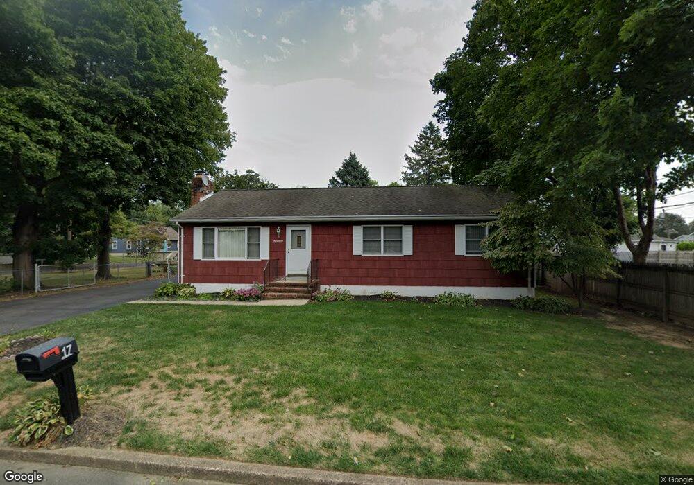
17 Allison Ave Ewing, NJ 08638
Braeburn Heights NeighborhoodEstimated Value: $280,000 - $400,000
Studio
--
Bath
1,248
Sq Ft
$261/Sq Ft
Est. Value
About This Home
This home is located at 17 Allison Ave, Ewing, NJ 08638 and is currently estimated at $325,906, approximately $261 per square foot. 17 Allison Ave is a home located in Mercer County with nearby schools including Ewing High School, Paul Robeson Charter School For The Humanities, and Trenton Stem-To-Civics Charter School.
Ownership History
Date
Name
Owned For
Owner Type
Purchase Details
Closed on
Nov 29, 1999
Sold by
Adams Carol
Bought by
Lewis Theodore
Current Estimated Value
Home Financials for this Owner
Home Financials are based on the most recent Mortgage that was taken out on this home.
Original Mortgage
$102,000
Interest Rate
7.83%
Purchase Details
Closed on
Oct 21, 1989
Sold by
Nami Carl
Bought by
Adams Carol
Purchase Details
Closed on
May 24, 1989
Sold by
Nami Carl
Bought by
Adams Carol
Create a Home Valuation Report for This Property
The Home Valuation Report is an in-depth analysis detailing your home's value as well as a comparison with similar homes in the area
Home Values in the Area
Average Home Value in this Area
Purchase History
| Date | Buyer | Sale Price | Title Company |
|---|---|---|---|
| Lewis Theodore | $108,000 | -- | |
| Adams Carol | -- | -- | |
| Adams Carol | $120,000 | -- |
Source: Public Records
Mortgage History
| Date | Status | Borrower | Loan Amount |
|---|---|---|---|
| Previous Owner | Lewis Theodore | $102,000 |
Source: Public Records
Tax History
| Year | Tax Paid | Tax Assessment Tax Assessment Total Assessment is a certain percentage of the fair market value that is determined by local assessors to be the total taxable value of land and additions on the property. | Land | Improvement |
|---|---|---|---|---|
| 2025 | $6,545 | $166,400 | $48,300 | $118,100 |
| 2024 | $6,152 | $166,400 | $48,300 | $118,100 |
Source: Public Records
Map
Nearby Homes
- 91 Groveland Ave
- 17 Hillman Ave
- 43 Iowana Ave
- 50 Groveland Ave
- 124 Hawthorne Ave
- 137 Ardsley Ave
- 1600 13th St
- 16 Bittersweet Rd
- 41 Poland St
- 28 Brattle Ave
- 200 Upland Ave
- 7 Mabel St
- 120 Sussex St
- 37 Central Ave
- 2269 Spruce St
- 40 Arden Ave
- 42 Hazelhurst Ave
- 4 New Hillcrest Ave
- 1410 Pennington Rd
- 140 Crescent Ave
Your Personal Tour Guide
Ask me questions while you tour the home.