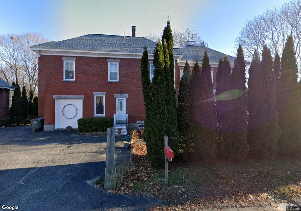
17 Brook St Westbrook, ME 04092
Estimated Value: $738,194 - $825,000
4
Beds
4
Baths
3,472
Sq Ft
$225/Sq Ft
Est. Value
About This Home
This home is located at 17 Brook St, Westbrook, ME 04092 and is currently estimated at $780,299, approximately $224 per square foot. 17 Brook St is a home located in Cumberland County with nearby schools including Westbrook High School, St. Brigid School, and Breakwater School.
Ownership History
Date
Name
Owned For
Owner Type
Purchase Details
Closed on
Oct 11, 2023
Sold by
Blue Blanket T and Blue Broder
Bought by
Madden Peter T
Current Estimated Value
Purchase Details
Closed on
Aug 5, 2022
Sold by
Madden Peter T
Bought by
Blue Blanket T and Blue Broder
Purchase Details
Closed on
Oct 17, 2007
Sold by
Small Duane L
Bought by
Madden Peter T
Home Financials for this Owner
Home Financials are based on the most recent Mortgage that was taken out on this home.
Original Mortgage
$304,000
Interest Rate
6.51%
Mortgage Type
Purchase Money Mortgage
Create a Home Valuation Report for This Property
The Home Valuation Report is an in-depth analysis detailing your home's value as well as a comparison with similar homes in the area
Purchase History
| Date | Buyer | Sale Price | Title Company |
|---|---|---|---|
| Madden Peter T | -- | None Available | |
| Blue Blanket T | -- | None Available | |
| Madden Peter T | -- | -- |
Source: Public Records
Mortgage History
| Date | Status | Borrower | Loan Amount |
|---|---|---|---|
| Previous Owner | Madden Peter T | $304,000 | |
| Previous Owner | Madden Peter T | $94,975 |
Source: Public Records
Tax History
| Year | Tax Paid | Tax Assessment Tax Assessment Total Assessment is a certain percentage of the fair market value that is determined by local assessors to be the total taxable value of land and additions on the property. | Land | Improvement |
|---|---|---|---|---|
| 2023 | $7,865 | $471,500 | $85,500 | $386,000 |
| 2022 | $7,159 | $395,500 | $71,300 | $324,200 |
| 2021 | $7,052 | $395,500 | $71,300 | $324,200 |
| 2020 | $7,064 | $395,500 | $71,300 | $324,200 |
| 2019 | $7,064 | $395,500 | $71,300 | $324,200 |
| 2018 | $7,129 | $367,200 | $62,000 | $305,200 |
| 2017 | $6,933 | $367,200 | $62,000 | $305,200 |
| 2016 | $6,756 | $367,200 | $62,000 | $305,200 |
| 2015 | $6,595 | $367,200 | $62,000 | $305,200 |
| 2014 | $6,316 | $367,200 | $62,000 | $305,200 |
| 2013 | $6,316 | $367,200 | $62,000 | $305,200 |
Source: Public Records
Map
Nearby Homes
- 169 Brook St
- 171 Brook St Unit 49
- 171 Brook St Unit 44
- 171 Brook St Unit 50
- 171 Brook St Unit 52
- 171 Brook St Unit 46
- 171 Brook St Unit 41
- 171 Brook St Unit 47
- 171 Brook St Unit 54
- 171 Brook St Unit 48
- 171 Brook St Unit 53
- 171 Brook St Unit 42
- 171 Brook St Unit 43
- 171 Brook St Unit 45
- 171 Brook St Unit 51
- 290 Bridgton Rd Unit 1
- 142 Brooks Edge Farm Rd Unit 75
- 151 Brooks Edge Farm Rd Unit 68
- 0 Reed St
- 858 Riverside St
- 13 Brook St Unit 13
- 20 Brook St
- 21 Brook St
- 381 Bridgton Rd
- 25 Brook St
- 387 Bridgton Rd
- 387 Bridgton Rd Unit 2
- 387 Bridgton Rd
- 44 Brook St
- 0 Brook St Unit 1435294
- 0 Brook St Unit 1237435
- 377 Bridgton Rd
- 395 Bridgton Rd
- 397 Bridgton Rd
- 46 Brook St
- 35 Brook St
- 53 Brook St
- 390 Bridgton Rd
- 48 Brook St
- 386 Bridgton Rd
Your Personal Tour Guide
Ask me questions while you tour the home.