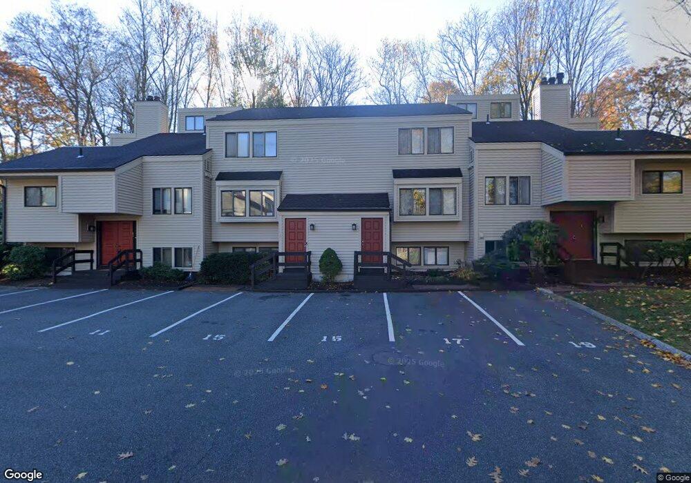
17 Brooks Ln Brookfield, CT 06804
Estimated Value: $314,000 - $357,000
2
Beds
3
Baths
1,373
Sq Ft
$250/Sq Ft
Est. Value
About This Home
This home is located at 17 Brooks Ln, Brookfield, CT 06804 and is currently estimated at $343,071, approximately $249 per square foot. 17 Brooks Ln is a home located in Fairfield County with nearby schools including Whisconier Middle School, Brookfield High School, and Christian Life Academy.
Ownership History
Date
Name
Owned For
Owner Type
Purchase Details
Closed on
Jul 29, 2016
Sold by
Bayview Loan Servicing
Bought by
Terracino Thomas J
Current Estimated Value
Purchase Details
Closed on
Dec 22, 1999
Sold by
Milstead Jessica
Bought by
Heinken Joel C
Purchase Details
Closed on
Mar 31, 1989
Sold by
Bruch Barbee
Bought by
Milstean Jessica
Create a Home Valuation Report for This Property
The Home Valuation Report is an in-depth analysis detailing your home's value as well as a comparison with similar homes in the area
Home Values in the Area
Average Home Value in this Area
Purchase History
| Date | Buyer | Sale Price | Title Company |
|---|---|---|---|
| Terracino Thomas J | $145,000 | -- | |
| Terracino Thomas J | $145,000 | -- | |
| Heinken Joel C | $160,000 | -- | |
| Heinken Joel C | $160,000 | -- | |
| Milstean Jessica | $181,000 | -- |
Source: Public Records
Mortgage History
| Date | Status | Borrower | Loan Amount |
|---|---|---|---|
| Previous Owner | Milstean Jessica | $189,500 | |
| Previous Owner | Milstean Jessica | $135,000 |
Source: Public Records
Tax History
| Year | Tax Paid | Tax Assessment Tax Assessment Total Assessment is a certain percentage of the fair market value that is determined by local assessors to be the total taxable value of land and additions on the property. | Land | Improvement |
|---|---|---|---|---|
| 2025 | $3,823 | $132,150 | $0 | $132,150 |
| 2024 | $3,687 | $132,150 | $0 | $132,150 |
| 2023 | $3,550 | $132,150 | $0 | $132,150 |
| 2022 | $3,420 | $132,150 | $0 | $132,150 |
| 2021 | $4,546 | $151,030 | $0 | $151,030 |
| 2020 | $4,478 | $151,030 | $0 | $151,030 |
| 2019 | $4,401 | $151,030 | $0 | $151,030 |
| 2018 | $4,280 | $151,030 | $0 | $151,030 |
| 2017 | $3,796 | $139,110 | $0 | $139,110 |
| 2016 | $3,506 | $132,800 | $0 | $132,800 |
| 2015 | $3,413 | $132,800 | $0 | $132,800 |
| 2014 | $3,413 | $132,800 | $0 | $132,800 |
Source: Public Records
Map
Nearby Homes
- 6 Comstock Trail Unit 6
- 29 Ledgewood Dr
- 18 Dean Rd
- 20 Brookfield Meadows
- 23 Sunset Hill Rd
- 5 Woodland Hills Terrace
- 10 Elmwood Ct
- 3 Bramble Way Unit Homesite 77
- 2 Elmwood Ct
- 5 Bramble Way Unit Homesite 76
- 7 Bramble Way Unit Homesite 75
- 7 Bramble Way
- 6 Bramble Way Unit Homesite 30
- 6 Bramble Way
- 2 Bramble Way
- 2 Bramble Way Unit Homesite 28
- 21 Bramble Way Unit Homesite 68
- 43 Bramble Way
- 70 Obtuse Hill Rd
- 37 Old Route 7 Unit 4
- 17 Brooks Ln Unit 17
- 11 Brooks Ln
- 9 Brooks Ln
- 7 Brooks Ln
- 7 Brooks Ln Unit 7
- 5 Brooks Ln
- 5 Brooks Ln Unit 3
- 13 Brooks Ln
- 13 Brooks Ln Unit 13
- 3 Brooks Ln
- 3 Brooks Ln Unit 3
- 1 Brooks Ln
- 15 Brooks Ln
- 15 Brooks Ln Unit 15
- 15 Bristol Path
- 11 Bristol Path
- 13 Bristol Path
- 16 Bristol Path
- 16 Bristol Path Unit 16
- 14 Bristol Path
Your Personal Tour Guide
Ask me questions while you tour the home.