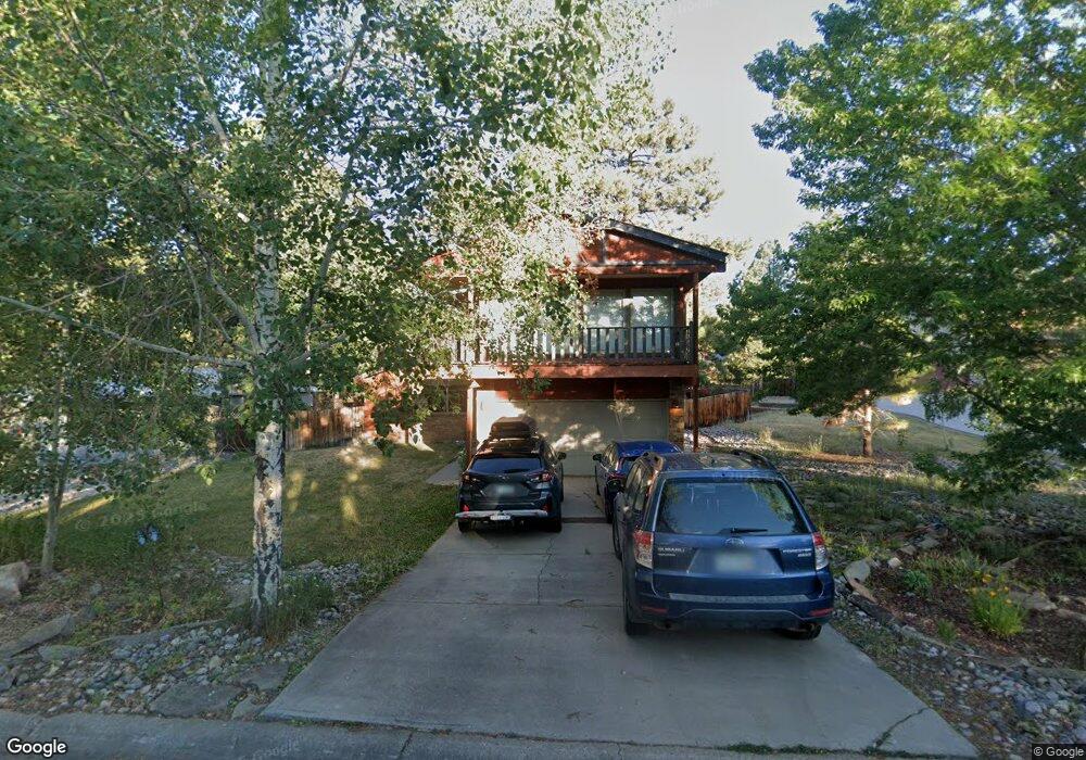
17 Cedar Ct Durango, CO 81301
Durango West NeighborhoodEstimated Value: $764,000 - $826,000
3
Beds
2
Baths
2,523
Sq Ft
$315/Sq Ft
Est. Value
About This Home
This home is located at 17 Cedar Ct, Durango, CO 81301 and is currently estimated at $794,911, approximately $315 per square foot. 17 Cedar Ct is a home located in La Plata County with nearby schools including Park Elementary School, Escalante Middle School, and Durango High School.
Ownership History
Date
Name
Owned For
Owner Type
Purchase Details
Closed on
Dec 30, 2025
Sold by
Oxford Land Company Llc
Bought by
Moon Matthew and Moon Ashley
Current Estimated Value
Purchase Details
Closed on
Mar 22, 2016
Sold by
Cioppa Darren M and Cioppa Jennifer L
Bought by
Cioppa Jennifer L
Purchase Details
Closed on
Nov 2, 2005
Sold by
Durango Mountain Land Company Llc
Bought by
Adams Carl B
Home Financials for this Owner
Home Financials are based on the most recent Mortgage that was taken out on this home.
Original Mortgage
$127,543
Interest Rate
5.92%
Mortgage Type
Credit Line Revolving
Purchase Details
Closed on
Jul 18, 2005
Sold by
Bloom John and Bloom Charla J
Bought by
Cioppa Darren M and Cioppa Jennifer L
Home Financials for this Owner
Home Financials are based on the most recent Mortgage that was taken out on this home.
Original Mortgage
$257,500
Interest Rate
5.58%
Mortgage Type
New Conventional
Create a Home Valuation Report for This Property
The Home Valuation Report is an in-depth analysis detailing your home's value as well as a comparison with similar homes in the area
Home Values in the Area
Average Home Value in this Area
Purchase History
| Date | Buyer | Sale Price | Title Company |
|---|---|---|---|
| Moon Matthew | $4,200 | Colorado Title | |
| Cioppa Jennifer L | -- | None Available | |
| Adams Carl B | $195,900 | Colorado Land Title Co | |
| Cioppa Darren M | $321,900 | Colorado Land Title Co |
Source: Public Records
Mortgage History
| Date | Status | Borrower | Loan Amount |
|---|---|---|---|
| Previous Owner | Adams Carl B | $127,543 | |
| Previous Owner | Cioppa Darren M | $257,500 |
Source: Public Records
Tax History
| Year | Tax Paid | Tax Assessment Tax Assessment Total Assessment is a certain percentage of the fair market value that is determined by local assessors to be the total taxable value of land and additions on the property. | Land | Improvement |
|---|---|---|---|---|
| 2025 | $1,676 | $48,130 | $9,010 | $39,120 |
| 2024 | $1,435 | $34,180 | $7,060 | $27,120 |
| 2023 | $1,435 | $37,210 | $7,680 | $29,530 |
| 2022 | $1,323 | $39,270 | $8,110 | $31,160 |
| 2021 | $1,330 | $32,060 | $7,850 | $24,210 |
| 2020 | $1,305 | $32,440 | $7,360 | $25,080 |
| 2019 | $1,251 | $32,440 | $7,360 | $25,080 |
| 2018 | $1,155 | $29,970 | $7,410 | $22,560 |
| 2017 | $1,130 | $29,970 | $7,410 | $22,560 |
| 2016 | $1,088 | $31,260 | $8,190 | $23,070 |
| 2015 | $1,023 | $31,260 | $8,190 | $23,070 |
| 2014 | -- | $26,260 | $8,190 | $18,070 |
| 2013 | -- | $26,260 | $8,190 | $18,070 |
Source: Public Records
Map
Nearby Homes
- 199 Timber Dr
- 40 Hidden Ln
- 136 Oak Dr
- 59 Holly Hock Trail
- 178 Canyon Creek Trail
- 31 Wood Haven Way
- 31 Valley View Way
- 678 N Lakeside Dr
- 222 Pine Ridge Loop Unit A4
- 607 Oak Dr
- 49 Hunter Ct
- 23 Hunter Ct
- 841 Oak Dr
- TBD Vaquero Way
- 719 Terlun Dr
- 351 Cherry Gulch Rd
- 717 Zane Dr
- 269 North Rd
- 307 Deer Trail Rd
- 21121 Highway 140
- 153 Cedar Dr
- 25 Cedar Ct
- 0 Cedar Dr Unit 627922
- 0 Cedar Dr Unit 637469
- 0 Cedar Dr Unit 640246
- 0 Cedar Dr Unit 646292
- 0 Cedar Dr Unit 652300
- 0 Cedar Dr Unit Durango West II
- 0 Cedar Dr
- 33 Cedar Ct
- 185 Cedar Dr Unit II
- 20 Spruce Dr
- 10 Cedar Ct
- 34 Cedar Ct
- 166 Cedar Dr
- 154 Cedar Dr
- 22 Cedar Ct
- 184 Cedar Dr
- 142 Cedar Dr
- 28 Cedar Ct
Your Personal Tour Guide
Ask me questions while you tour the home.