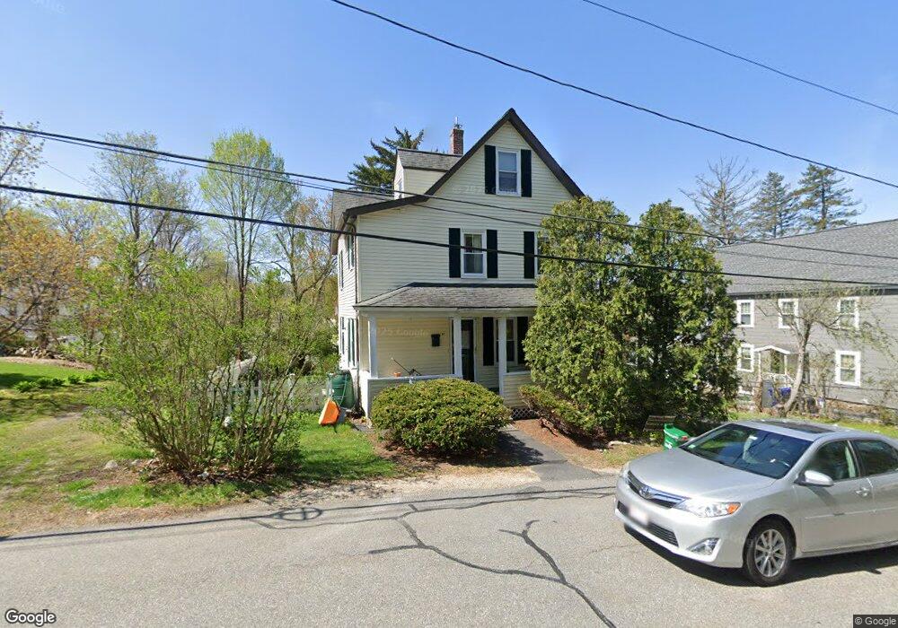
17 Crane Ave Maynard, MA 01754
Estimated Value: $626,204 - $714,000
4
Beds
2
Baths
1,798
Sq Ft
$370/Sq Ft
Est. Value
About This Home
This home is located at 17 Crane Ave, Maynard, MA 01754 and is currently estimated at $664,801, approximately $369 per square foot. 17 Crane Ave is a home located in Middlesex County with nearby schools including Green Meadow School, Fowler School, and Maynard High School.
Ownership History
Date
Name
Owned For
Owner Type
Purchase Details
Closed on
May 1, 2008
Sold by
Wielblad Linda A
Bought by
Kirshtein Kelli L and Angus Wendy E
Current Estimated Value
Home Financials for this Owner
Home Financials are based on the most recent Mortgage that was taken out on this home.
Original Mortgage
$296,000
Interest Rate
5.99%
Mortgage Type
Purchase Money Mortgage
Purchase Details
Closed on
Jul 15, 2005
Sold by
Bauer Julie A and Bauer Kent
Bought by
Wielblad Linda A
Home Financials for this Owner
Home Financials are based on the most recent Mortgage that was taken out on this home.
Original Mortgage
$298,400
Interest Rate
5.67%
Mortgage Type
Purchase Money Mortgage
Purchase Details
Closed on
Aug 28, 2000
Sold by
Holt Carol
Bought by
Bauer Kent and Bauer Julie A
Home Financials for this Owner
Home Financials are based on the most recent Mortgage that was taken out on this home.
Original Mortgage
$246,525
Interest Rate
8.06%
Mortgage Type
Purchase Money Mortgage
Purchase Details
Closed on
Oct 14, 1998
Sold by
Holt John M and Holt Marie L
Bought by
Pedersen Brad T and Holt-Pedersen Carol
Home Financials for this Owner
Home Financials are based on the most recent Mortgage that was taken out on this home.
Original Mortgage
$161,000
Interest Rate
6.8%
Mortgage Type
Purchase Money Mortgage
Purchase Details
Closed on
Jun 19, 1996
Sold by
Holt David W and Holt John M
Bought by
Holt John M and Holt Marie L
Create a Home Valuation Report for This Property
The Home Valuation Report is an in-depth analysis detailing your home's value as well as a comparison with similar homes in the area
Home Values in the Area
Average Home Value in this Area
Purchase History
| Date | Buyer | Sale Price | Title Company |
|---|---|---|---|
| Kirshtein Kelli L | $329,000 | -- | |
| Wielblad Linda A | $378,400 | -- | |
| Bauer Kent | $259,500 | -- | |
| Pedersen Brad T | $170,000 | -- | |
| Holt John M | $157,000 | -- |
Source: Public Records
Mortgage History
| Date | Status | Borrower | Loan Amount |
|---|---|---|---|
| Open | Holt John M | $284,500 | |
| Closed | Kirshtein Kelli L | $296,000 | |
| Previous Owner | Wielblad Linda A | $298,400 | |
| Previous Owner | Holt John M | $246,525 | |
| Previous Owner | Holt John M | $161,000 |
Source: Public Records
Tax History
| Year | Tax Paid | Tax Assessment Tax Assessment Total Assessment is a certain percentage of the fair market value that is determined by local assessors to be the total taxable value of land and additions on the property. | Land | Improvement |
|---|---|---|---|---|
| 2025 | $8,587 | $481,600 | $271,200 | $210,400 |
| 2024 | $8,026 | $448,900 | $258,300 | $190,600 |
| 2023 | $8,002 | $421,800 | $246,000 | $175,800 |
| 2022 | $7,847 | $382,400 | $206,600 | $175,800 |
| 2021 | $3,340 | $387,200 | $206,600 | $180,600 |
| 2020 | $5,473 | $367,600 | $187,000 | $180,600 |
| 2019 | $7,261 | $345,100 | $178,600 | $166,500 |
| 2018 | $2,996 | $304,200 | $162,400 | $141,800 |
| 2017 | $6,695 | $304,200 | $162,400 | $141,800 |
| 2016 | $6,464 | $304,200 | $162,400 | $141,800 |
| 2015 | $6,153 | $275,800 | $155,000 | $120,800 |
| 2014 | $6,038 | $270,900 | $150,100 | $120,800 |
Source: Public Records
Map
Nearby Homes
- 28 Waltham St Unit A
- 5 Hayes St Unit 5
- 13 Arthur St Unit 15
- 37 Glendale St
- 66 Powder Mill Rd
- 31-33 Roosevelt St
- 68 Powder Mill Rd
- 17 Prospect St
- 70 Powder Mill Rd
- 2 & 6 Powder Mill Rd
- 24 Deer Path Unit 5
- 12 Brown St
- 2 Marble Farm Rd
- 63 Conant St
- 10 Mill St Unit Q
- 10 Mill St Unit B
- 41 Taylor Rd
- 96 Forest Ridge Rd Unit 96
- 57 Longfellow Rd
- 29 Black Birch Ln Unit 29
Your Personal Tour Guide
Ask me questions while you tour the home.