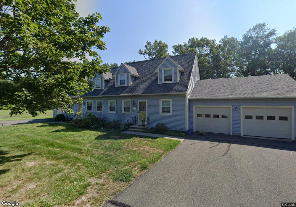
17 Duncan Dr Unit B South Deerfield, MA 01373
Estimated Value: $312,000 - $458,000
2
Beds
2
Baths
1,418
Sq Ft
$267/Sq Ft
Est. Value
About This Home
This home is located at 17 Duncan Dr Unit B, South Deerfield, MA 01373 and is currently estimated at $378,757, approximately $267 per square foot. 17 Duncan Dr Unit B is a home located in Franklin County with nearby schools including Deerfield Elementary School and Frontier Regional School.
Ownership History
Date
Name
Owned For
Owner Type
Purchase Details
Closed on
Nov 4, 2019
Sold by
Shippee Dorothy M and Shippee Patrick M
Bought by
Int Gordon B Parker
Current Estimated Value
Purchase Details
Closed on
May 9, 2018
Sold by
Shippee Dorothy M
Bought by
Shippee Patrick M and Shippee David J
Purchase Details
Closed on
Jun 18, 2004
Sold by
Schabacker Carol J
Bought by
Shippee Dorothy M
Purchase Details
Closed on
Apr 30, 1996
Sold by
Vinskey Michael A and Vinskey Patricia A
Bought by
Schabacker Donald W and Schwabacker Carol J
Home Financials for this Owner
Home Financials are based on the most recent Mortgage that was taken out on this home.
Original Mortgage
$80,000
Interest Rate
7.81%
Mortgage Type
Purchase Money Mortgage
Create a Home Valuation Report for This Property
The Home Valuation Report is an in-depth analysis detailing your home's value as well as a comparison with similar homes in the area
Home Values in the Area
Average Home Value in this Area
Purchase History
| Date | Buyer | Sale Price | Title Company |
|---|---|---|---|
| Int Gordon B Parker | $227,500 | -- | |
| Shippee Patrick M | -- | -- | |
| Shippee Patrick M | -- | -- | |
| Shippee Dorothy M | $220,000 | -- | |
| Schabacker Donald W | $105,000 | -- |
Source: Public Records
Mortgage History
| Date | Status | Borrower | Loan Amount |
|---|---|---|---|
| Previous Owner | Schabacker Donald W | $80,000 |
Source: Public Records
Tax History Compared to Growth
Tax History
| Year | Tax Paid | Tax Assessment Tax Assessment Total Assessment is a certain percentage of the fair market value that is determined by local assessors to be the total taxable value of land and additions on the property. | Land | Improvement |
|---|---|---|---|---|
| 2025 | $4,534 | $342,200 | $0 | $342,200 |
| 2024 | $4,676 | $337,600 | $0 | $337,600 |
| 2023 | $3,992 | $266,700 | $0 | $266,700 |
| 2022 | $3,648 | $240,500 | $0 | $240,500 |
| 2021 | $3,844 | $242,500 | $0 | $242,500 |
| 2020 | $3,756 | $239,400 | $0 | $239,400 |
| 2019 | $3,801 | $238,900 | $0 | $238,900 |
| 2018 | $3,453 | $216,500 | $0 | $216,500 |
| 2017 | $3,242 | $210,500 | $0 | $210,500 |
| 2016 | $3,230 | $211,800 | $0 | $211,800 |
| 2015 | $3,188 | $213,400 | $0 | $213,400 |
Source: Public Records
Map
Nearby Homes
- 30 Lee Rd
- 71 Mathews Rd
- 345 Greenfield Rd
- 208 Greenfield Rd
- 13 Capt Lathrop Dr
- 7 Stage Rd
- 24 Elm St
- 24 Graves St
- 0 Pocumtuck Dr Unit 73379330
- 33 Eastern Ave
- 40 Eastern Ave
- 15 Crestview Dr
- 14 River St
- Lot C Mountain Rd
- Lot A Mountain Rd
- Lot B Mountain Rd
- 0 Pleasant St
- 238 N Main St
- 134 Montague Rd
- 132 Meadow Rd
- 17 Duncan Dr Unit A
- 17 Duncan Dr Unit 2
- 17 Duncan Dr Unit 17B
- 19 Duncan Dr Unit B
- 19 Duncan Dr Unit A
- 15 Duncan Dr Unit B
- 15 Duncan Dr Unit A
- 15 Duncan Dr Unit 15A
- 13 Duncan Dr Unit B
- 13 Duncan Dr Unit A
- 11 Duncan Dr Unit B
- 11 Duncan Dr Unit A
- 9 Duncan Dr Unit B
- 9 Duncan Dr Unit A
- 2 Tyler Way Unit B
- 2 Tyler Way Unit A
- 2 Tyler Way Unit 2B
- 4 Tyler Way Unit A
- 4 Tyler Way Unit B
- 18 Duncan Dr Unit A