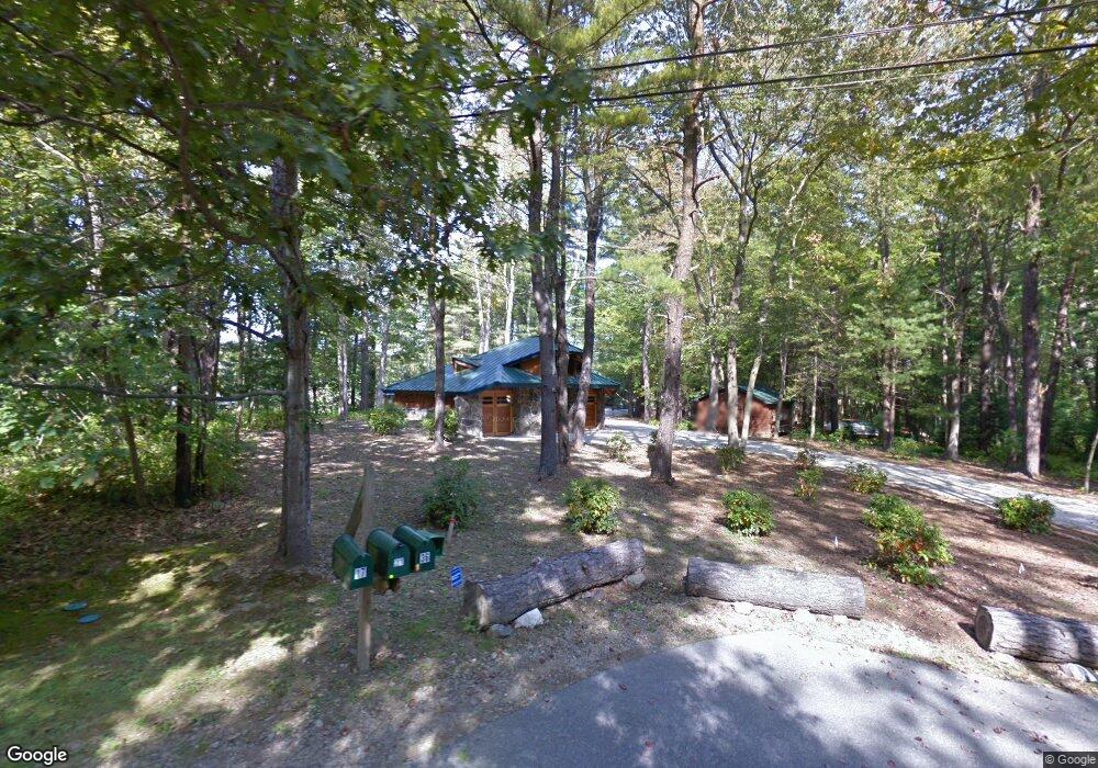
17 Folcutt Rd Kittery Point, ME 03905
Kittery Point NeighborhoodEstimated Value: $985,000 - $2,479,000
9
Beds
7
Baths
6,000
Sq Ft
$305/Sq Ft
Est. Value
About This Home
This home is located at 17 Folcutt Rd, Kittery Point, ME 03905 and is currently estimated at $1,830,901, approximately $305 per square foot. 17 Folcutt Rd is a home located in York County with nearby schools including Horace Mitchell Primary School, Shapleigh School, and Robert W Traip Academy.
Ownership History
Date
Name
Owned For
Owner Type
Purchase Details
Closed on
Aug 22, 2014
Sold by
Raymond T Adams Ret
Bought by
Bronislaw Rt Llc
Current Estimated Value
Purchase Details
Closed on
Jul 7, 2009
Sold by
Lord Robert A
Bought by
Normandeau Robert L
Home Financials for this Owner
Home Financials are based on the most recent Mortgage that was taken out on this home.
Original Mortgage
$568,000
Interest Rate
4.86%
Mortgage Type
Unknown
Create a Home Valuation Report for This Property
The Home Valuation Report is an in-depth analysis detailing your home's value as well as a comparison with similar homes in the area
Home Values in the Area
Average Home Value in this Area
Purchase History
| Date | Buyer | Sale Price | Title Company |
|---|---|---|---|
| Bronislaw Rt Llc | -- | -- | |
| Normandeau Robert L | -- | -- | |
| Lord Robert A | -- | -- |
Source: Public Records
Mortgage History
| Date | Status | Borrower | Loan Amount |
|---|---|---|---|
| Previous Owner | Lord Robert A | $568,000 | |
| Previous Owner | Lord Robert A | $45,000 |
Source: Public Records
Tax History Compared to Growth
Tax History
| Year | Tax Paid | Tax Assessment Tax Assessment Total Assessment is a certain percentage of the fair market value that is determined by local assessors to be the total taxable value of land and additions on the property. | Land | Improvement |
|---|---|---|---|---|
| 2024 | $17,120 | $1,205,600 | $472,300 | $733,300 |
| 2023 | $16,408 | $1,205,600 | $472,300 | $733,300 |
| 2022 | $16,203 | $1,202,000 | $472,300 | $729,700 |
| 2021 | $15,626 | $1,202,000 | $472,300 | $729,700 |
| 2020 | $15,506 | $1,202,000 | $472,300 | $729,700 |
| 2019 | $18,785 | $1,079,600 | $495,200 | $584,400 |
| 2018 | $18,137 | $1,079,600 | $495,200 | $584,400 |
| 2017 | $17,813 | $1,079,600 | $495,200 | $584,400 |
| 2016 | $17,352 | $1,081,100 | $495,200 | $585,900 |
| 2015 | $16,917 | $1,079,600 | $495,200 | $584,400 |
| 2014 | $16,755 | $1,079,600 | $495,200 | $584,400 |
| 2013 | $16,138 | $1,060,300 | $495,200 | $565,100 |
Source: Public Records
Map
Nearby Homes
- 205 Whipple Rd
- 72 Pepperrell Rd
- 299 Haley Rd
- 42 Tilton Ave
- 132 Pepperrell Rd
- 12 Gillis Dr Unit 3
- 2 Wainwright Ave
- 8 Spruce Point Rd
- 19 Debra Ln
- 39 Tenney Hill Rd
- 17 Elm Ct
- 15 Atkinson St
- 24 Seabreeze Ln
- 14 Colonial Ln
- 100 Shepards Cove Rd Unit F204
- 100 Shepards Cove Rd Unit G204
- 36 Traip Ave
- 25 Bartlett Rd
- 165 Rogers Rd
- 10-12 Pine St
- 17 Folcutt Rd
- 21 Folcutt Rd
- 15 Folcutt Rd
- 39 Crockett Neck Rd
- 36 Folcutt Rd
- TBD Folcutt
- 32 Folcutt Rd
- 54 Heron Point Ln
- 45 Crockett Neck Rd
- 30 Folcutt Rd
- 11 Folcutt Rd
- 51 Crockett Neck Rd
- 28 Folcutt Rd
- 22 Folcutt Rd
- 20 Folcutt Rd
- 7 Folcutt Rd
- 26 Folcutt Rd
- 5 Folcutt Rd
- 37 Crockett Neck Rd
- TBD Fletcher Ln