H
Seller's Agent in 2025
Harry Goddard
Epique Realty
(269) 832-8661
1 in this area
14 Total Sales
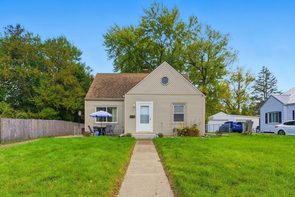
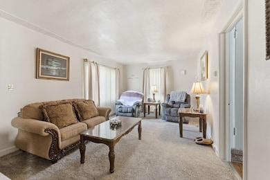
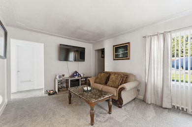
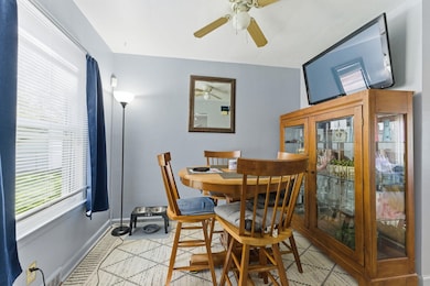
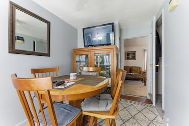
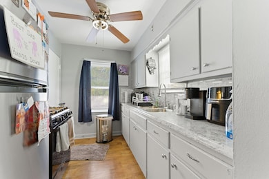
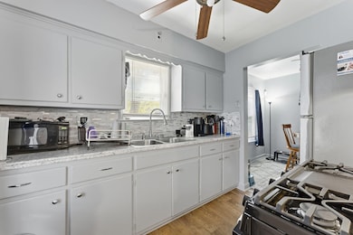
Welcome home to this well-kept 3-bedroom, 1-bath home offering space, comfort, and updates throughout. With more than 2,000 total square feet including a half-finished basement, this northside gem is move-in ready and full of potential. Step inside to a light-filled living area with plush carpet and original hardwood floors beneath, a cozy dining nook, and an efficient kitchen with modern finishes. The updated bathroom adds a fresh touch, while a new roof from 2017, a new hot water heater, and central air ensure year-round comfort. Upstairs, you'll find a spacious bedroom with extra sitting or storage space that provides a quiet retreat at the end of the day. The lower level offers additional living space and storage. Outside, enjoy a large fenced backyard with mature trees and a two-car garage with electric, perfect for parking, projects, or play. Conveniently located near parks, schools, and shopping, this inviting home blends character, updates, and value in one welcoming package.
Last Agent to Sell the Property
Epique Realty License #6501452001 Listed on: 10/23/2025
| Date | Type | Sale Price | Title Company |
|---|---|---|---|
| Warranty Deed | $165,000 | Ata National Title Group | |
| Quit Claim Deed | -- | None Available | |
| Warranty Deed | $84,900 | Chicago Title | |
| Warranty Deed | $68,400 | -- |
| Date | Status | Loan Amount | Loan Type |
|---|---|---|---|
| Open | $6,655 | No Value Available | |
| Open | $160,050 | New Conventional | |
| Previous Owner | $67,920 | Fannie Mae Freddie Mac |
| Date | Event | Price | List to Sale | Price per Sq Ft |
|---|---|---|---|---|
| 12/31/2025 12/31/25 | Sold | $165,000 | 0.0% | $92 / Sq Ft |
| 11/18/2025 11/18/25 | Pending | -- | -- | -- |
| 11/03/2025 11/03/25 | Price Changed | $165,000 | -5.7% | $92 / Sq Ft |
| 10/31/2025 10/31/25 | Price Changed | $175,000 | -4.4% | $97 / Sq Ft |
| 10/29/2025 10/29/25 | Price Changed | $183,000 | -3.2% | $102 / Sq Ft |
| 10/23/2025 10/23/25 | For Sale | $189,000 | -- | $105 / Sq Ft |
| Year | Tax Paid | Tax Assessment Tax Assessment Total Assessment is a certain percentage of the fair market value that is determined by local assessors to be the total taxable value of land and additions on the property. | Land | Improvement |
|---|---|---|---|---|
| 2025 | -- | $68,700 | $0 | $0 |
| 2024 | $327 | $64,589 | $0 | $0 |
| 2023 | $1,350 | $53,159 | $0 | $0 |
| 2022 | $1,067 | $44,445 | $0 | $0 |
| 2021 | $1,273 | $39,629 | $0 | $0 |
| 2020 | $1,198 | $34,925 | $0 | $0 |
| 2019 | $1,193 | $31,134 | $0 | $0 |
| 2018 | $1,193 | $29,177 | $875 | $28,302 |
| 2017 | $1,157 | $34,863 | $0 | $0 |
| 2016 | $1,154 | $26,811 | $0 | $0 |
| 2015 | $1,131 | $27,364 | $2,456 | $24,908 |
| 2014 | $1,131 | $24,543 | $2,456 | $22,087 |
H
Seller's Agent in 2025
Harry Goddard
Epique Realty
(269) 832-8661
1 in this area
14 Total Sales
C
Buyer's Agent in 2025
Chris Flach
Berkshire Hathaway HomeServices MI
(269) 447-1458
1 in this area
199 Total Sales

Buyer Co-Listing Agent in 2025
Greg Miller
Berkshire Hathaway HomeServices MI
(269) 743-4817
7 in this area
1,334 Total Sales
Source: MichRIC
MLS Number: 25054489
APN: 6290-00-159-0
Disclaimer: Certain information contained herein is derived from information provided by parties other than Homes.com. All information provided is deemed reliable, but is not guaranteed to be accurate and should be independently verified.
![]() Information is deemed reliable but not guaranteed.
Information is deemed reliable but not guaranteed.
Copyright 2026 MichRIC, LLC. All rights reserved.
Ask me questions while you tour the home.