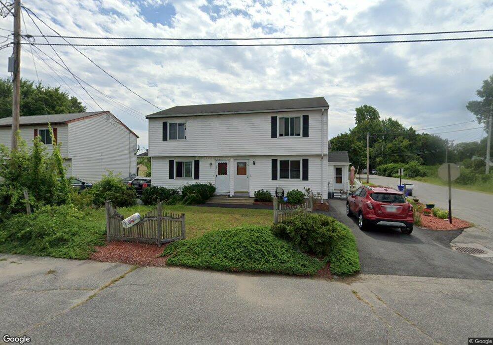
17 Hampton St Manchester, NH 03103
Bakersville NeighborhoodEstimated Value: $223,000 - $311,000
2
Beds
2
Baths
1,119
Sq Ft
$241/Sq Ft
Est. Value
About This Home
This home is located at 17 Hampton St, Manchester, NH 03103 and is currently estimated at $269,497, approximately $240 per square foot. 17 Hampton St is a home located in Hillsborough County with nearby schools including Bakersville School, Southside Middle School, and Manchester Memorial High School.
Ownership History
Date
Name
Owned For
Owner Type
Purchase Details
Closed on
Jun 29, 2021
Sold by
Denoncourt Diane
Bought by
Denoncourt Kayla M and Denoncourt Jeffrey
Current Estimated Value
Home Financials for this Owner
Home Financials are based on the most recent Mortgage that was taken out on this home.
Original Mortgage
$85,000
Outstanding Balance
$77,124
Interest Rate
2.9%
Mortgage Type
Purchase Money Mortgage
Estimated Equity
$192,373
Purchase Details
Closed on
Dec 30, 2009
Sold by
Home Sales Inc
Bought by
Denoncourt Diane
Home Financials for this Owner
Home Financials are based on the most recent Mortgage that was taken out on this home.
Original Mortgage
$78,400
Interest Rate
4.85%
Mortgage Type
Purchase Money Mortgage
Purchase Details
Closed on
Sep 22, 2009
Sold by
Shackelford Ann E
Bought by
Homesales Inc
Create a Home Valuation Report for This Property
The Home Valuation Report is an in-depth analysis detailing your home's value as well as a comparison with similar homes in the area
Home Values in the Area
Average Home Value in this Area
Purchase History
| Date | Buyer | Sale Price | Title Company |
|---|---|---|---|
| Denoncourt Kayla M | $150,000 | None Available | |
| Denoncourt Diane | $98,000 | -- | |
| Homesales Inc | $33,500 | -- |
Source: Public Records
Mortgage History
| Date | Status | Borrower | Loan Amount |
|---|---|---|---|
| Open | Denoncourt Kayla M | $85,000 | |
| Previous Owner | Homesales Inc | $78,400 | |
| Previous Owner | Homesales Inc | $97,000 |
Source: Public Records
Tax History Compared to Growth
Tax History
| Year | Tax Paid | Tax Assessment Tax Assessment Total Assessment is a certain percentage of the fair market value that is determined by local assessors to be the total taxable value of land and additions on the property. | Land | Improvement |
|---|---|---|---|---|
| 2024 | $3,540 | $180,800 | $0 | $180,800 |
| 2023 | $3,410 | $180,800 | $0 | $180,800 |
| 2022 | $3,298 | $180,800 | $0 | $180,800 |
| 2021 | $3,197 | $180,800 | $0 | $180,800 |
| 2020 | $3,100 | $125,700 | $0 | $125,700 |
| 2019 | $3,057 | $125,700 | $0 | $125,700 |
| 2018 | $2,977 | $125,700 | $0 | $125,700 |
| 2017 | $2,931 | $125,700 | $0 | $125,700 |
| 2016 | $2,909 | $125,700 | $0 | $125,700 |
| 2015 | $2,644 | $112,800 | $0 | $112,800 |
| 2014 | $2,651 | $112,800 | $0 | $112,800 |
| 2013 | $2,557 | $112,800 | $0 | $112,800 |
Source: Public Records
Map
Nearby Homes
- 131 Calef Rd
- 47 Rosedale Ave
- 152 Oakdale Ave
- 33 W Elmhurst Ave Unit B
- 507 Clay St
- 106 W Hillcrest Ave
- 87 S Wilson St
- 118 W Hillcrest Ave
- 60 W Elmwood Ave
- 615 Clay St
- 56 Robert Ct Unit H
- 186 Bell St
- 618 Prescott St
- 700 S Beech St
- 65 Taylor St
- 80 Billings St
- 545 Calef Rd Unit 26
- 832 Clay St
- 165 Taylor St
- 323 Seames Dr