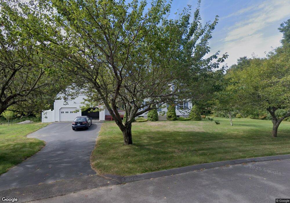
17 Hesspar Dr Westerly, RI 02891
Estimated Value: $489,000 - $597,000
2
Beds
2
Baths
1,704
Sq Ft
$320/Sq Ft
Est. Value
About This Home
This home is located at 17 Hesspar Dr, Westerly, RI 02891 and is currently estimated at $545,555, approximately $320 per square foot. 17 Hesspar Dr is a home located in Washington County with nearby schools including Westerly High School and St. Michael School.
Create a Home Valuation Report for This Property
The Home Valuation Report is an in-depth analysis detailing your home's value as well as a comparison with similar homes in the area
Home Values in the Area
Average Home Value in this Area
Tax History Compared to Growth
Tax History
| Year | Tax Paid | Tax Assessment Tax Assessment Total Assessment is a certain percentage of the fair market value that is determined by local assessors to be the total taxable value of land and additions on the property. | Land | Improvement |
|---|---|---|---|---|
| 2025 | $3,471 | $488,200 | $202,800 | $285,400 |
| 2024 | $3,848 | $392,300 | $145,100 | $247,200 |
| 2023 | $3,774 | $392,300 | $145,100 | $247,200 |
| 2022 | $3,750 | $392,300 | $145,100 | $247,200 |
| 2021 | $3,629 | $315,000 | $126,300 | $188,700 |
| 2020 | $3,563 | $315,000 | $126,300 | $188,700 |
| 2019 | $3,528 | $315,000 | $126,300 | $188,700 |
| 2018 | $3,364 | $283,200 | $126,300 | $156,900 |
| 2017 | $3,282 | $283,200 | $126,300 | $156,900 |
| 2016 | $3,308 | $283,200 | $126,300 | $156,900 |
| 2015 | $3,008 | $278,000 | $122,200 | $155,800 |
| 2014 | $2,958 | $278,000 | $122,200 | $155,800 |
Source: Public Records
Map
Nearby Homes
- 37 Pound Rd
- 35 Pound Rd
- 23 Pond St
- 11 Apache Dr Unit D
- 17 Apache Dr Unit G
- 9 Apache Dr Unit C
- 0 Iroquois Ave
- 118 Dunns Corner Rd
- 16 Boiling Spring Ave
- 28 Whipple Ave
- 53 Bradford Rd
- 5 Boy Scout Dr
- 101 Ashaway Rd
- 103 Ashaway Rd
- 94 Ashaway Rd
- 67 Cross St
- 57 School St
- 54 Sherwood Dr
- 24 George St
- 44 George St