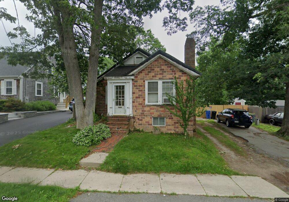
17 High St Whitman, MA 02382
Estimated Value: $471,000 - $592,000
2
Beds
1
Bath
1,264
Sq Ft
$408/Sq Ft
Est. Value
About This Home
This home is located at 17 High St, Whitman, MA 02382 and is currently estimated at $515,426, approximately $407 per square foot. 17 High St is a home located in Plymouth County with nearby schools including Trinity Catholic Academy and Cardinal Spellman High School.
Ownership History
Date
Name
Owned For
Owner Type
Purchase Details
Closed on
Jul 11, 2000
Sold by
Moore Edward and Moore Jean
Bought by
Traynor Melody J and Traynor Minnie
Current Estimated Value
Home Financials for this Owner
Home Financials are based on the most recent Mortgage that was taken out on this home.
Original Mortgage
$159,683
Interest Rate
8.55%
Mortgage Type
Purchase Money Mortgage
Purchase Details
Closed on
Nov 24, 1997
Sold by
Tupper William C Est
Bought by
Moore Edward and Moore Jean
Create a Home Valuation Report for This Property
The Home Valuation Report is an in-depth analysis detailing your home's value as well as a comparison with similar homes in the area
Home Values in the Area
Average Home Value in this Area
Purchase History
| Date | Buyer | Sale Price | Title Company |
|---|---|---|---|
| Traynor Melody J | $161,000 | -- | |
| Moore Edward | $105,000 | -- |
Source: Public Records
Mortgage History
| Date | Status | Borrower | Loan Amount |
|---|---|---|---|
| Open | Moore Edward | $201,000 | |
| Closed | Moore Edward | $159,691 | |
| Closed | Moore Edward | $159,683 | |
| Previous Owner | Moore Edward | $21,000 |
Source: Public Records
Tax History
| Year | Tax Paid | Tax Assessment Tax Assessment Total Assessment is a certain percentage of the fair market value that is determined by local assessors to be the total taxable value of land and additions on the property. | Land | Improvement |
|---|---|---|---|---|
| 2025 | $5,340 | $407,000 | $201,900 | $205,100 |
| 2024 | $5,069 | $397,900 | $198,000 | $199,900 |
| 2023 | $4,623 | $340,700 | $171,600 | $169,100 |
| 2022 | $4,388 | $301,400 | $156,000 | $145,400 |
| 2021 | $4,388 | $283,100 | $143,400 | $139,700 |
| 2020 | $4,121 | $260,000 | $136,500 | $123,500 |
| 2019 | $3,999 | $260,000 | $136,500 | $123,500 |
| 2018 | $3,873 | $241,900 | $128,700 | $113,200 |
| 2017 | $3,648 | $241,900 | $128,700 | $113,200 |
| 2016 | $3,572 | $229,100 | $121,900 | $107,200 |
| 2015 | $3,348 | $214,500 | $107,300 | $107,200 |
Source: Public Records
Map
Nearby Homes
- 66 Belmont St
- 603 Temple St
- 300 High St
- 90 Loring Ave
- 42 Rock St
- 262 Homeland Dr
- 360 High St
- 184 Joyce Terrace
- 118 Temple St
- 56-58 Vernon St
- 48 Sullivan Terrace
- 95 Temple St
- 1190 Bedford St Unit G3
- 501 Auburn St Unit 508
- 725 Auburn St
- 151 Windsor Dr
- 78 Linda St
- 1142 Washington St
- 28 Linda St
- 293 Bedford St
Your Personal Tour Guide
Ask me questions while you tour the home.