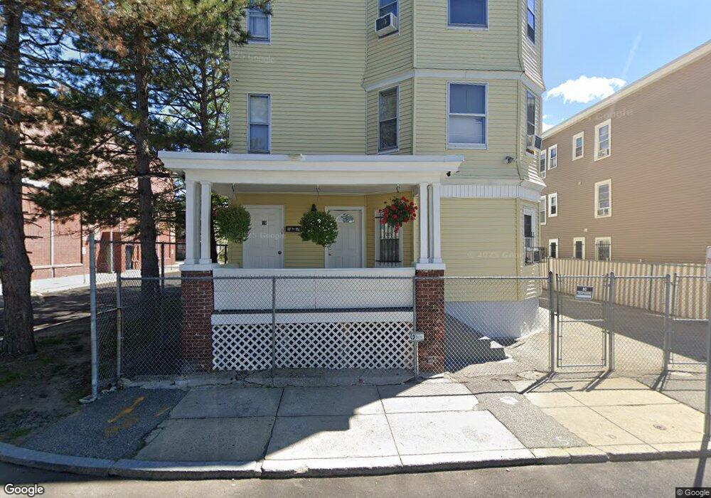
17 Huse St Unit 19 Lawrence, MA 01841
Arlington NeighborhoodEstimated Value: $843,000 - $940,000
6
Beds
3
Baths
3,879
Sq Ft
$233/Sq Ft
Est. Value
About This Home
This home is located at 17 Huse St Unit 19, Lawrence, MA 01841 and is currently estimated at $904,000, approximately $233 per square foot. 17 Huse St Unit 19 is a home located in Essex County with nearby schools including Arlington Elementary School, School For Exceptional Studies, and Lawrence Family Development Charter School.
Ownership History
Date
Name
Owned For
Owner Type
Purchase Details
Closed on
Aug 1, 1994
Sold by
Fnma
Bought by
Rios Maria
Current Estimated Value
Home Financials for this Owner
Home Financials are based on the most recent Mortgage that was taken out on this home.
Original Mortgage
$28,400
Interest Rate
8.25%
Mortgage Type
Purchase Money Mortgage
Create a Home Valuation Report for This Property
The Home Valuation Report is an in-depth analysis detailing your home's value as well as a comparison with similar homes in the area
Home Values in the Area
Average Home Value in this Area
Purchase History
| Date | Buyer | Sale Price | Title Company |
|---|---|---|---|
| Rios Maria | $29,900 | -- |
Source: Public Records
Mortgage History
| Date | Status | Borrower | Loan Amount |
|---|---|---|---|
| Closed | Rios Maria | $28,400 |
Source: Public Records
Tax History
| Year | Tax Paid | Tax Assessment Tax Assessment Total Assessment is a certain percentage of the fair market value that is determined by local assessors to be the total taxable value of land and additions on the property. | Land | Improvement |
|---|---|---|---|---|
| 2025 | $6,095 | $692,600 | $103,900 | $588,700 |
| 2024 | $5,664 | $612,300 | $109,200 | $503,100 |
| 2023 | $5,809 | $571,800 | $105,400 | $466,400 |
| 2022 | $5,475 | $478,600 | $99,400 | $379,200 |
| 2021 | $5,204 | $424,100 | $99,400 | $324,700 |
| 2020 | $4,819 | $387,700 | $82,800 | $304,900 |
| 2019 | $4,486 | $327,900 | $61,600 | $266,300 |
| 2018 | $4,383 | $306,100 | $55,800 | $250,300 |
| 2017 | $4,094 | $266,900 | $52,800 | $214,100 |
| 2016 | $3,822 | $246,400 | $41,300 | $205,100 |
| 2015 | $3,665 | $242,400 | $41,300 | $201,100 |
Source: Public Records
Map
Nearby Homes
- 434-438 Hampshire St
- 27 Willow St Unit A
- 36 Manchester St
- 29 Center St
- 10 Holly St
- 29-31 Washington St
- 179-181 West St
- 7-9 Bennington St
- 23 Chase St
- 324-326 Broadway
- 129-131 Lexington St
- 9-11 Horne St
- 6 Huse Rd
- 123 Lawrence St
- 131A Lawrence St Unit 40
- 97 Kenwood Rd
- 202 Broadway Unit 3-2
- 202 Broadway Unit 3-3
- 24 Railroad St
- 42 Morton St
- 11 Huse St Unit 13
- 16 Huse St
- 15-17 Tenney St
- 11 Tenney St
- 15 Tenney St Unit 17
- 311 Park St
- 85 Spruce St Unit 87
- 317 Park St
- 317 Park St Unit 327
- 317-319 Park St
- 71 Spruce St
- 83 Spruce St Unit 83A
- 8 Tenney St
- 279-289 Park St
- 279 Park St
- 279 Park St Unit 289
- 93 Spruce St
- 300 Park St Unit 310
- 300-310 Park St
- 24 Tenney St Unit 26
Your Personal Tour Guide
Ask me questions while you tour the home.