
Seller's Agent in 2025
Jen Brooke
Comey & Shepherd
(513) 535-3396
2 in this area
81 Total Sales
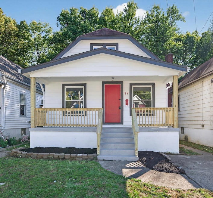
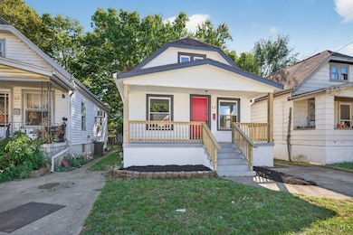
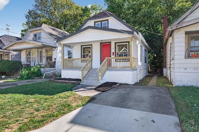
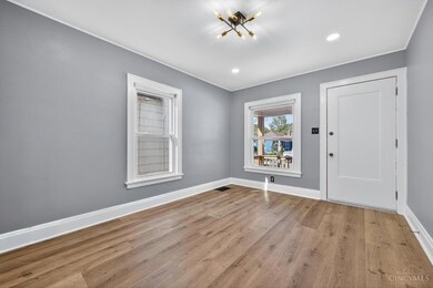
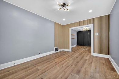
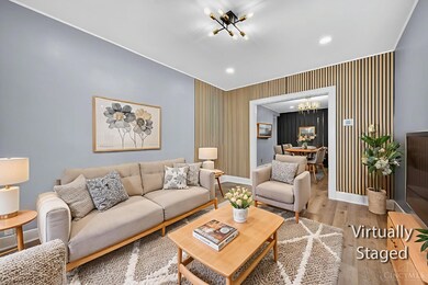
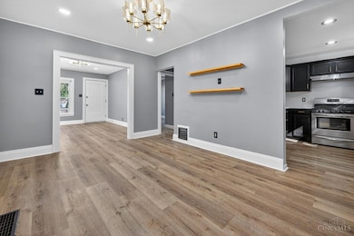
Welcome to this beautifully renovated 3-bedroom home that blends modern finishes with creative use of space This home offers three spacious bedrooms plus a versatile lower level flex room ideal for a home office, playroom or media space. Wall to wall carpet in lower level with plenty of room to spread out comfortably - great area for a Family room or Rec room. Enjoy updated Kitchen and Bath, brand new flooring throughout and large, usable backyard. Every detail has been thoughtfully updated. Move-in ready and waiting for you!
Last Agent to Sell the Property
Comey & Shepherd License #2019001518 Listed on: 10/17/2025
| Date | Type | Sale Price | Title Company |
|---|---|---|---|
| Warranty Deed | $200,000 | None Listed On Document | |
| Warranty Deed | $85,000 | None Listed On Document | |
| Warranty Deed | $79,900 | Chicago Title Insurance Co | |
| Quit Claim Deed | -- | -- |
| Date | Status | Loan Amount | Loan Type |
|---|---|---|---|
| Open | $200,000 | VA | |
| Previous Owner | $117,500 | New Conventional | |
| Previous Owner | $23,000 | Unknown |
| Date | Event | Price | List to Sale | Price per Sq Ft |
|---|---|---|---|---|
| 11/17/2025 11/17/25 | Sold | $200,000 | +2.6% | $144 / Sq Ft |
| 10/20/2025 10/20/25 | Pending | -- | -- | -- |
| 10/17/2025 10/17/25 | For Sale | $195,000 | -- | $141 / Sq Ft |
| Year | Tax Paid | Tax Assessment Tax Assessment Total Assessment is a certain percentage of the fair market value that is determined by local assessors to be the total taxable value of land and additions on the property. | Land | Improvement |
|---|---|---|---|---|
| 2024 | $1,715 | $25,614 | $3,770 | $21,844 |
| 2023 | $1,659 | $25,614 | $3,770 | $21,844 |
| 2022 | $778 | $9,762 | $3,542 | $6,220 |
| 2021 | $759 | $9,762 | $3,542 | $6,220 |
| 2020 | $771 | $9,762 | $3,542 | $6,220 |
| 2019 | $698 | $8,274 | $3,003 | $5,271 |
| 2018 | $699 | $8,274 | $3,003 | $5,271 |
| 2017 | $670 | $8,274 | $3,003 | $5,271 |
| 2016 | $1,600 | $19,562 | $3,966 | $15,596 |
| 2015 | $1,464 | $19,562 | $3,966 | $15,596 |
| 2014 | $1,473 | $19,562 | $3,966 | $15,596 |
| 2013 | $1,549 | $20,595 | $4,176 | $16,419 |
Seller's Agent in 2025
Jen Brooke
Comey & Shepherd
(513) 535-3396
2 in this area
81 Total Sales
Buyer's Agent in 2025
Gabe Fraley
Coldwell Banker Heritage
(513) 505-7507
5 in this area
26 Total Sales
Source: MLS of Greater Cincinnati (CincyMLS)
MLS Number: 1859009
APN: 590-0071-0263
Disclaimer: Certain information contained herein is derived from information provided by parties other than Homes.com. All information provided is deemed reliable, but is not guaranteed to be accurate and should be independently verified.
![]() The data relating to real estate for sale on this website comes in part from the Broker Reciprocity programs of the MLS of Greater Cincinnati, Inc.. Those listings held by brokerage firms other than Ten-X are marked with the Broker Reciprocity logo and house icon. The properties displayed may not be all of the properties available through Broker Reciprocity.
The data relating to real estate for sale on this website comes in part from the Broker Reciprocity programs of the MLS of Greater Cincinnati, Inc.. Those listings held by brokerage firms other than Ten-X are marked with the Broker Reciprocity logo and house icon. The properties displayed may not be all of the properties available through Broker Reciprocity.
IDX information is provided exclusively for personal, non-commercial use, and may not be used for any purpose other than to identify prospective properties consumers may be interested in purchasing.
Information is deemed reliable but not guaranteed.
Ten-X does not display the entire Cincinnati MLS Broker Reciprocity™ database on this web site. The listings of some real estate brokerage firms have been excluded.
Copyright 2025, MLS of Greater Cincinnati, Inc. All rights reserved