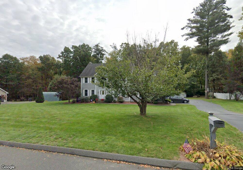
17 Lookout Landing Ellington, CT 06029
Estimated Value: $600,762 - $732,000
4
Beds
3
Baths
2,666
Sq Ft
$245/Sq Ft
Est. Value
About This Home
This home is located at 17 Lookout Landing, Ellington, CT 06029 and is currently estimated at $653,691, approximately $245 per square foot. 17 Lookout Landing is a home located in Tolland County with nearby schools including Ellington High School.
Ownership History
Date
Name
Owned For
Owner Type
Purchase Details
Closed on
Mar 23, 2004
Sold by
Savage Cinda
Bought by
Bilbie Stephen and Bilbie Cherie
Current Estimated Value
Home Financials for this Owner
Home Financials are based on the most recent Mortgage that was taken out on this home.
Original Mortgage
$324,800
Interest Rate
5.71%
Purchase Details
Closed on
Oct 30, 2002
Sold by
J&K Assoc Llc
Bought by
Regan Kevin and Regan Jeannna
Purchase Details
Closed on
Mar 1, 2002
Sold by
Pioneer Bldrs
Bought by
Savage Cinda
Create a Home Valuation Report for This Property
The Home Valuation Report is an in-depth analysis detailing your home's value as well as a comparison with similar homes in the area
Home Values in the Area
Average Home Value in this Area
Purchase History
| Date | Buyer | Sale Price | Title Company |
|---|---|---|---|
| Bilbie Stephen | $406,000 | -- | |
| Regan Kevin | $80,000 | -- | |
| Savage Cinda | $212,000 | -- |
Source: Public Records
Mortgage History
| Date | Status | Borrower | Loan Amount |
|---|---|---|---|
| Open | Savage Cinda | $359,590 | |
| Closed | Savage Cinda | $373,500 | |
| Closed | Savage Cinda | $324,800 |
Source: Public Records
Tax History Compared to Growth
Tax History
| Year | Tax Paid | Tax Assessment Tax Assessment Total Assessment is a certain percentage of the fair market value that is determined by local assessors to be the total taxable value of land and additions on the property. | Land | Improvement |
|---|---|---|---|---|
| 2025 | $10,018 | $270,020 | $64,430 | $205,590 |
| 2024 | $9,721 | $270,020 | $64,430 | $205,590 |
| 2023 | $9,262 | $270,020 | $64,430 | $205,590 |
| 2022 | $8,776 | $270,020 | $64,430 | $205,590 |
| 2021 | $8,533 | $270,020 | $64,430 | $205,590 |
| 2020 | $8,737 | $268,000 | $65,050 | $202,950 |
| 2019 | $8,737 | $268,000 | $65,050 | $202,950 |
| 2016 | $8,174 | $268,000 | $65,050 | $202,950 |
| 2015 | $8,174 | $274,320 | $65,050 | $209,270 |
| 2014 | $7,873 | $274,320 | $65,050 | $209,270 |
Source: Public Records
Map
Nearby Homes
- 19 Lookout Landing
- 15 Lookout Landing
- 1 David Dr
- 3 David Dr
- 13 Lookout Landing
- 49 Hillside Dr
- 18 Lookout Landing
- 8 David Dr
- 7 David Dr
- 14 Lookout Landing
- 23 Overhill Rd
- 10 Lookout Landing
- 47 Hillside Dr
- 51 Hillside Dr
- 6 David Dr
- 4 David Dr
- 25 Overhill Rd
- 14 Overlook Pass
- 45 Hillside Dr
- 48 Hillside Dr