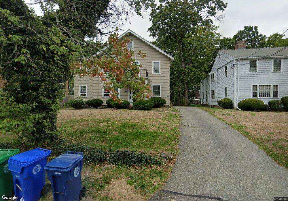
17 Maple St Unit 19 Auburndale, MA 02466
Auburndale NeighborhoodEstimated Value: $1,304,481 - $1,399,000
5
Beds
3
Baths
3,062
Sq Ft
$442/Sq Ft
Est. Value
About This Home
This home is located at 17 Maple St Unit 19, Auburndale, MA 02466 and is currently estimated at $1,353,120, approximately $441 per square foot. 17 Maple St Unit 19 is a home located in Middlesex County with nearby schools including Williams Elementary School, Charles E Brown Middle School, and Newton South High School.
Ownership History
Date
Name
Owned For
Owner Type
Purchase Details
Closed on
Jul 18, 2025
Sold by
Robert W Johnston Ret and Levy
Bought by
Maza Hector A and Ponce Gabriela
Current Estimated Value
Home Financials for this Owner
Home Financials are based on the most recent Mortgage that was taken out on this home.
Original Mortgage
$944,999
Outstanding Balance
$939,318
Interest Rate
6.85%
Mortgage Type
New Conventional
Estimated Equity
$413,802
Purchase Details
Closed on
Mar 12, 2014
Sold by
Johnston Robert W and Johnston Shirley A
Bought by
Robert W Johnston Ret and Johnson
Create a Home Valuation Report for This Property
The Home Valuation Report is an in-depth analysis detailing your home's value as well as a comparison with similar homes in the area
Home Values in the Area
Average Home Value in this Area
Purchase History
| Date | Buyer | Sale Price | Title Company |
|---|---|---|---|
| Maza Hector A | $1,350,000 | -- | |
| Maza Hector A | $1,350,000 | -- | |
| Robert W Johnston Ret | -- | -- | |
| Robert W Johnston Ret | -- | -- | |
| Robert W Johnston Ret | -- | -- |
Source: Public Records
Mortgage History
| Date | Status | Borrower | Loan Amount |
|---|---|---|---|
| Open | Maza Hector A | $944,999 | |
| Closed | Maza Hector A | $944,999 |
Source: Public Records
Tax History
| Year | Tax Paid | Tax Assessment Tax Assessment Total Assessment is a certain percentage of the fair market value that is determined by local assessors to be the total taxable value of land and additions on the property. | Land | Improvement |
|---|---|---|---|---|
| 2025 | $11,680 | $1,191,800 | $812,100 | $379,700 |
| 2024 | $11,293 | $1,157,100 | $788,400 | $368,700 |
| 2023 | $10,843 | $1,065,100 | $634,900 | $430,200 |
| 2022 | $10,375 | $986,200 | $587,900 | $398,300 |
| 2021 | $9,736 | $904,800 | $539,400 | $365,400 |
| 2020 | $9,446 | $904,800 | $539,400 | $365,400 |
| 2019 | $8,837 | $845,600 | $504,100 | $341,500 |
| 2018 | $8,975 | $829,500 | $477,400 | $352,100 |
| 2017 | $8,462 | $761,000 | $438,000 | $323,000 |
| 2016 | $7,946 | $698,200 | $401,800 | $296,400 |
| 2015 | $7,576 | $652,500 | $375,500 | $277,000 |
Source: Public Records
Map
Nearby Homes
- 226 Auburn St Unit 226
- 194 Auburn St
- 1919 Commonwealth Ave Unit 1919
- 1917 Commonwealth Ave Unit 1917
- 7 Sharon Ave Unit 7
- 283 Melrose St
- 17 Lasell St
- 305 Webster St Unit 2
- 232 Melrose St Unit 2
- 10 Higgins St
- 2202 Commonwealth Ave Unit 1
- 187 Melrose St
- 0 Duncan Rd Unit 72925240
- 160 Pine St Unit 15
- 160 Pine St Unit 12
- 12 Oakwood Rd
- 27 Tennyson Rd
- 49 Staniford St
- 126 Charles St (Aub)
- 90 Auburndale Ave
- 17 Maple St Unit 17
- 17 Maple St Unit 2
- 17-19 Maple St Unit 1
- 17-19 Maple St Unit 2
- 19 Maple St Unit 19
- 23 Maple St
- 23 Maple St
- 25 Maple St Unit 1
- 9 Maple St Unit 11
- 9 Maple St Unit 9
- 23 Maple St Unit 25
- 23 Maple St Unit right side
- 214 Auburn St
- 85 Central St
- 75 Central St Unit 77
- 220 Auburn St
- 22 Maple St
- 26 Maple St
- 81 Central St
- 12 Maple St
Your Personal Tour Guide
Ask me questions while you tour the home.