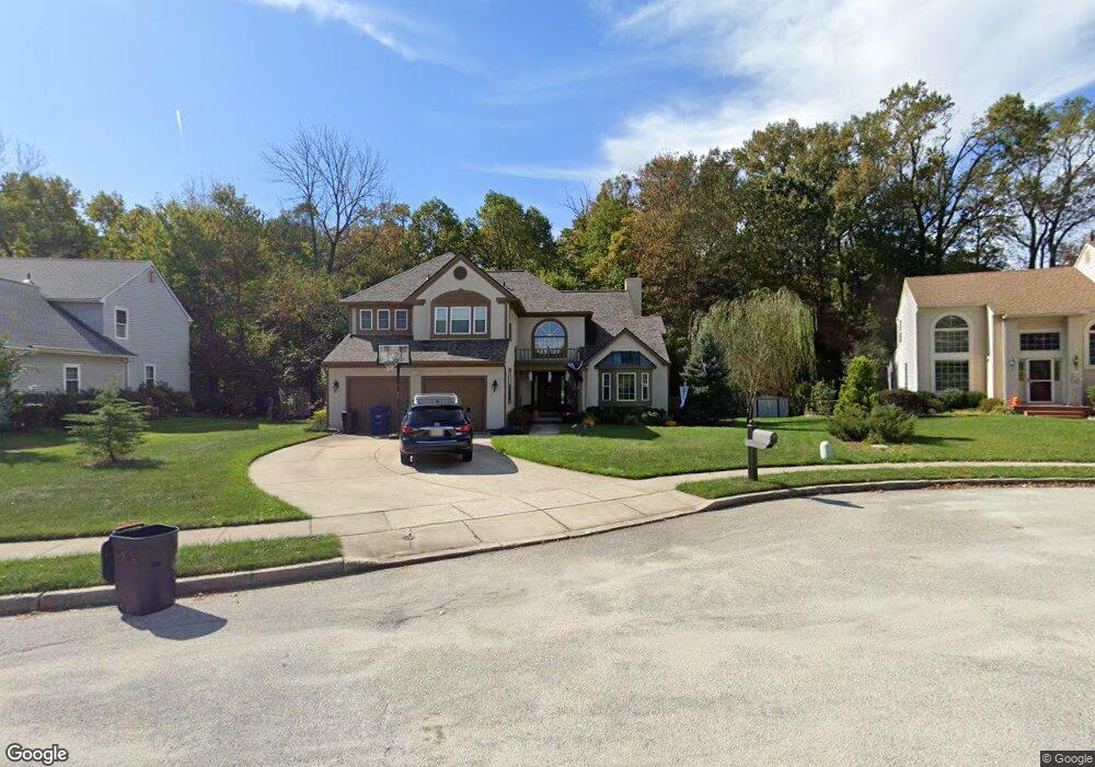
17 Michaelson Dr Mount Laurel, NJ 08054
Estimated Value: $552,000 - $690,150
4
Beds
3
Baths
2,255
Sq Ft
$281/Sq Ft
Est. Value
About This Home
This home is located at 17 Michaelson Dr, Mount Laurel, NJ 08054 and is currently estimated at $632,788, approximately $280 per square foot. 17 Michaelson Dr is a home located in Burlington County with nearby schools including Countryside Elementary School, T.E. Harrington Middle School, and Mount Laurel Hartford School.
Ownership History
Date
Name
Owned For
Owner Type
Purchase Details
Closed on
Jul 8, 2004
Sold by
Maggs Robert E and Maggs Regina
Bought by
Mcdonald John T and Mcdonald Deneen A
Current Estimated Value
Home Financials for this Owner
Home Financials are based on the most recent Mortgage that was taken out on this home.
Original Mortgage
$246,000
Outstanding Balance
$123,380
Interest Rate
6.28%
Mortgage Type
Purchase Money Mortgage
Estimated Equity
$509,408
Purchase Details
Closed on
Jun 1, 1998
Sold by
Drass Charles F and Drass Margaret M
Bought by
Maggs Robert E and Maggs Regina
Create a Home Valuation Report for This Property
The Home Valuation Report is an in-depth analysis detailing your home's value as well as a comparison with similar homes in the area
Home Values in the Area
Average Home Value in this Area
Purchase History
| Date | Buyer | Sale Price | Title Company |
|---|---|---|---|
| Mcdonald John T | $346,000 | Commonwealth Land Title Insu | |
| Maggs Robert E | $182,800 | -- |
Source: Public Records
Mortgage History
| Date | Status | Borrower | Loan Amount |
|---|---|---|---|
| Open | Mcdonald John T | $246,000 |
Source: Public Records
Tax History
| Year | Tax Paid | Tax Assessment Tax Assessment Total Assessment is a certain percentage of the fair market value that is determined by local assessors to be the total taxable value of land and additions on the property. | Land | Improvement |
|---|---|---|---|---|
| 2025 | $11,646 | $368,900 | $106,300 | $262,600 |
| 2024 | $11,207 | $368,900 | $106,300 | $262,600 |
| 2023 | $11,207 | $368,900 | $106,300 | $262,600 |
| 2022 | $11,170 | $368,900 | $106,300 | $262,600 |
| 2021 | $10,960 | $368,900 | $106,300 | $262,600 |
| 2020 | $10,746 | $368,900 | $106,300 | $262,600 |
| 2019 | $10,635 | $368,900 | $106,300 | $262,600 |
| 2018 | $10,554 | $368,900 | $106,300 | $262,600 |
| 2017 | $10,281 | $368,900 | $106,300 | $262,600 |
| 2016 | $10,126 | $368,900 | $106,300 | $262,600 |
| 2015 | $10,008 | $368,900 | $106,300 | $262,600 |
| 2014 | $9,909 | $368,900 | $106,300 | $262,600 |
Source: Public Records
Map
Nearby Homes
- 35 Sisters Farmstead Dr
- 120 Canterbury Rd
- 206 Meadow Dr
- 217 Hooton Rd
- 104 Mount Laurel Rd
- 111 Fellowship Rd
- 660 S Church St
- 8 S Close Unit 8
- 127 Schooley St
- 129 S Church St
- 22 E Close Unit 22
- 15 W Close Unit 15
- 133 Plum St Unit 6
- 80 E 3rd St
- 66 E 3rd St
- 228 Mill St
- 308 Elm St
- 325 E 2nd St
- 337 E 2nd St
- 30 Leighton Dr
- 15 Michaelson Dr
- 19 Michaelson Dr
- 21 Michaelson Dr
- 13 Michaelson Dr
- 14 Michaelson Dr
- 23 Michaelson Dr
- 12 Michaelson Dr
- 11 Michaelson Dr
- 16 Michaelson Dr
- 10 Michaelson Dr
- 25 Michaelson Dr
- 140 W Route 38
- 77 Michaelson Dr
- 18 Michaelson Dr
- 8 Michaelson Dr
- 27 Michaelson Dr
- 75 Michaelson Dr
- 29 Michaelson Dr
- 22 Michaelson Dr
- 31 Michaelson Dr
Your Personal Tour Guide
Ask me questions while you tour the home.