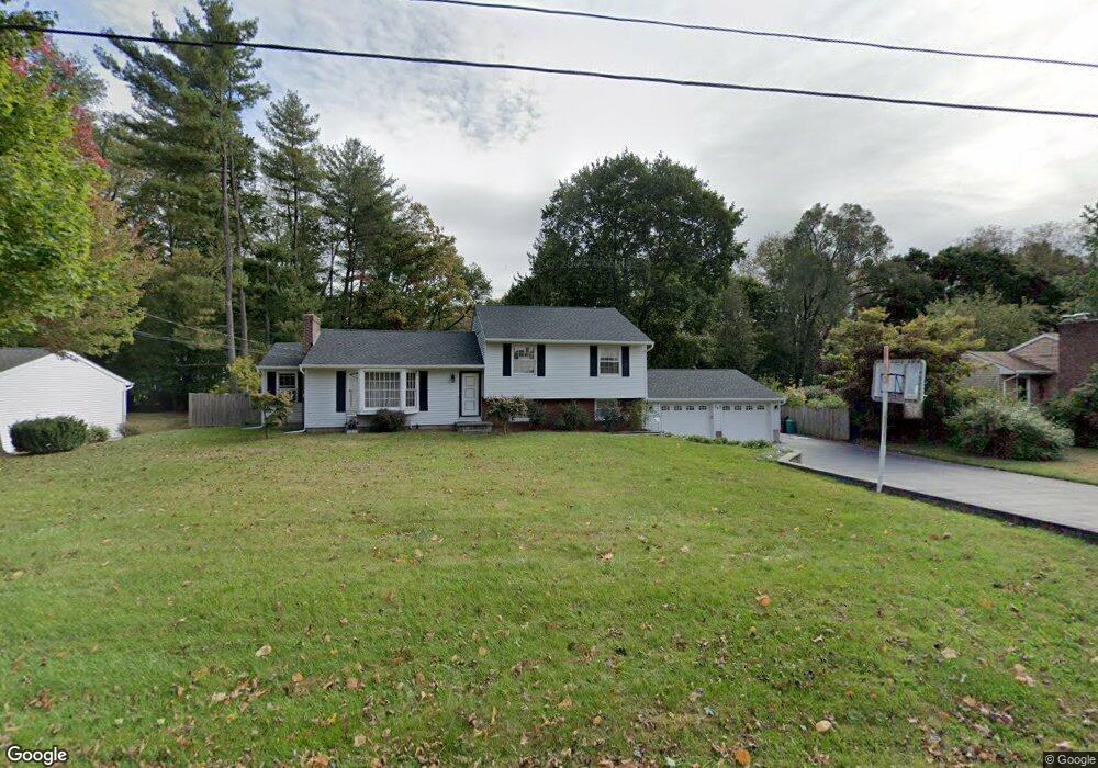
17 Monroe Dr Poughkeepsie, NY 12601
Estimated Value: $482,000 - $522,000
3
Beds
2
Baths
2,046
Sq Ft
$246/Sq Ft
Est. Value
About This Home
This home is located at 17 Monroe Dr, Poughkeepsie, NY 12601 and is currently estimated at $502,869, approximately $245 per square foot. 17 Monroe Dr is a home located in Dutchess County with nearby schools including Oak Grove Elementary School, Wappingers Junior High School, and Roy C. Ketcham Senior High School.
Ownership History
Date
Name
Owned For
Owner Type
Purchase Details
Closed on
Mar 31, 2009
Sold by
Peragallo Rita
Bought by
Zahra Scott
Current Estimated Value
Home Financials for this Owner
Home Financials are based on the most recent Mortgage that was taken out on this home.
Original Mortgage
$296,530
Outstanding Balance
$161,562
Interest Rate
5.02%
Mortgage Type
Purchase Money Mortgage
Estimated Equity
$341,307
Create a Home Valuation Report for This Property
The Home Valuation Report is an in-depth analysis detailing your home's value as well as a comparison with similar homes in the area
Home Values in the Area
Average Home Value in this Area
Purchase History
| Date | Buyer | Sale Price | Title Company |
|---|---|---|---|
| Zahra Scott | $302,000 | -- |
Source: Public Records
Mortgage History
| Date | Status | Borrower | Loan Amount |
|---|---|---|---|
| Open | Zahra Scott | $296,530 |
Source: Public Records
Tax History
| Year | Tax Paid | Tax Assessment Tax Assessment Total Assessment is a certain percentage of the fair market value that is determined by local assessors to be the total taxable value of land and additions on the property. | Land | Improvement |
|---|---|---|---|---|
| 2024 | $9,345 | $404,500 | $81,900 | $322,600 |
| 2023 | $14,143 | $404,500 | $81,900 | $322,600 |
| 2022 | $13,091 | $364,000 | $74,400 | $289,600 |
| 2021 | $11,427 | $291,500 | $74,400 | $217,100 |
| 2020 | $6,946 | $272,000 | $74,400 | $197,600 |
| 2019 | $6,765 | $272,000 | $74,400 | $197,600 |
| 2018 | $6,131 | $241,500 | $74,400 | $167,100 |
| 2017 | $5,975 | $237,000 | $74,400 | $162,600 |
| 2016 | $5,587 | $224,500 | $74,400 | $150,100 |
| 2015 | -- | $224,500 | $78,500 | $146,000 |
| 2014 | -- | $224,500 | $78,500 | $146,000 |
Source: Public Records
Map
Nearby Homes
- 35 Sandi Dr
- 22 Wendover Dr
- 15 Sandi Dr
- 13 Glen Dr
- 680 Vassar Rd
- 8 Toms Way
- 5 Wildwood Dr Unit 8B
- 5 Wildwood Dr Unit 15D
- 5 Wildwood Dr Unit 9A
- 5 Wildwood Dr Unit 11A
- 1668 Route 9 Unit 11G
- 1668 Route 9 Unit 3C
- 1668 Route 9 Unit 4A
- 21 Tanglewood Dr
- 93 Widmer Rd
- 0 Brown Ave
- 2748 W Main St
- 2738 W Main St
- 67 Jackson Rd
- 2 Merrywood Rd
Your Personal Tour Guide
Ask me questions while you tour the home.