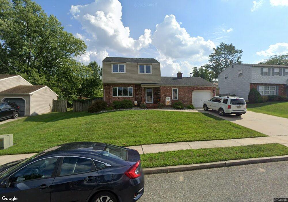
17 N Fork Rd Clementon, NJ 08021
Estimated Value: $378,244 - $413,000
Studio
--
Bath
1,568
Sq Ft
$252/Sq Ft
Est. Value
About This Home
This home is located at 17 N Fork Rd, Clementon, NJ 08021 and is currently estimated at $395,061, approximately $251 per square foot. 17 N Fork Rd is a home located in Camden County with nearby schools including Glen Landing Middle School, Highland Regional High School, and St. Teresa Regional School.
Ownership History
Date
Name
Owned For
Owner Type
Purchase Details
Closed on
Jul 21, 2006
Sold by
Defulio Nicholas
Bought by
Felice Richard J and Felice Kelisa
Current Estimated Value
Home Financials for this Owner
Home Financials are based on the most recent Mortgage that was taken out on this home.
Original Mortgage
$225,920
Interest Rate
6.52%
Create a Home Valuation Report for This Property
The Home Valuation Report is an in-depth analysis detailing your home's value as well as a comparison with similar homes in the area
Home Values in the Area
Average Home Value in this Area
Purchase History
| Date | Buyer | Sale Price | Title Company |
|---|---|---|---|
| Felice Richard J | $282,400 | -- |
Source: Public Records
Mortgage History
| Date | Status | Borrower | Loan Amount |
|---|---|---|---|
| Previous Owner | Felice Richard J | $225,920 |
Source: Public Records
Tax History
| Year | Tax Paid | Tax Assessment Tax Assessment Total Assessment is a certain percentage of the fair market value that is determined by local assessors to be the total taxable value of land and additions on the property. | Land | Improvement |
|---|---|---|---|---|
| 2025 | $9,366 | $213,400 | $59,900 | $153,500 |
| 2024 | $8,901 | $213,400 | $59,900 | $153,500 |
| 2023 | $8,901 | $213,400 | $59,900 | $153,500 |
| 2022 | $8,837 | $213,400 | $59,900 | $153,500 |
| 2021 | $8,619 | $213,400 | $59,900 | $153,500 |
| 2020 | $8,619 | $213,400 | $59,900 | $153,500 |
| 2019 | $8,431 | $213,400 | $59,900 | $153,500 |
| 2018 | $8,397 | $213,400 | $59,900 | $153,500 |
| 2017 | $8,135 | $213,400 | $59,900 | $153,500 |
| 2016 | $7,960 | $213,400 | $59,900 | $153,500 |
| 2015 | $7,399 | $213,400 | $59,900 | $153,500 |
| 2014 | $7,369 | $213,400 | $59,900 | $153,500 |
Source: Public Records
Map
Nearby Homes
- 24 Brandywine Rd
- 27 Lincoln Drive Ls
- 30 Cedar Creek Dr
- 113 Parkview Rd
- 12 Royalty Ln
- 16 Hillside Rd
- 1199 Chews Land Clem
- 18 Sleepy Hollow Rd
- 357 Harford Rd
- 10 Little Pond Dr
- 8 Little Pond Dr
- 6 Little Pond Dr
- 4 Little Pond Dr
- 11 Silas Ln
- 13 Silas Ln
- 16 Silas Ln
- 22 Silas Ln
- 12 Silas Ln
- 15 Silas Ln
- 19 Silas Ln
- 15 N Fork Rd
- 19 N Fork Rd
- 14 Stone River Rd
- 12 Stone River Rd
- 16 Stone River Rd
- 13 N Fork Rd
- 20 N Fork Rd
- 25 Spring Hill Dr
- 23 Spring Hill Dr
- 10 Stone River Rd
- 18 N Fork Rd
- 18 Stone River Rd
- 27 Spring Hill Dr
- 11 N Fork Rd
- 16 N Fork Rd
- 8 Stone River Rd
- 21 Spring Hill Dr
- 9 N Fork Rd
- 29 Spring Hill Dr
- 13 Stone River Rd
Your Personal Tour Guide
Ask me questions while you tour the home.