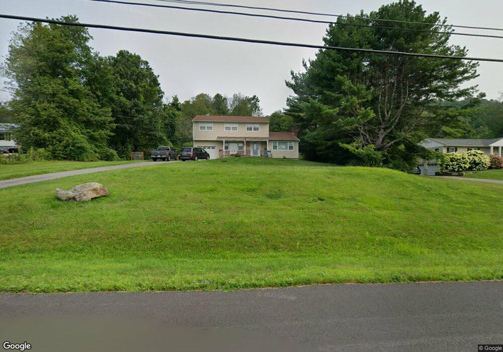
17 Overlook Rd Pawling, NY 12564
Estimated Value: $532,000 - $637,000
4
Beds
3
Baths
2,228
Sq Ft
$268/Sq Ft
Est. Value
About This Home
This home is located at 17 Overlook Rd, Pawling, NY 12564 and is currently estimated at $596,824, approximately $267 per square foot. 17 Overlook Rd is a home located in Dutchess County with nearby schools including Pawling Elementary School, Pawling Middle School, and Pawling High School.
Ownership History
Date
Name
Owned For
Owner Type
Purchase Details
Closed on
Aug 13, 2012
Sold by
Galiano Peter
Bought by
Tunney Matthew
Current Estimated Value
Home Financials for this Owner
Home Financials are based on the most recent Mortgage that was taken out on this home.
Original Mortgage
$261,260
Outstanding Balance
$180,989
Interest Rate
3.67%
Mortgage Type
New Conventional
Estimated Equity
$415,835
Purchase Details
Closed on
Apr 19, 2006
Sold by
Kurtz Patricia K
Bought by
6Th Avenue Development Co Rp
Purchase Details
Closed on
Feb 23, 2006
Sold by
Kurtz Joseph
Bought by
Kurtz Patricia
Purchase Details
Closed on
Aug 17, 2000
Purchase Details
Closed on
Jan 14, 2000
Sold by
Defance Kimberly
Bought by
Kurtz Joseph F
Purchase Details
Closed on
Sep 10, 1996
Create a Home Valuation Report for This Property
The Home Valuation Report is an in-depth analysis detailing your home's value as well as a comparison with similar homes in the area
Home Values in the Area
Average Home Value in this Area
Purchase History
| Date | Buyer | Sale Price | Title Company |
|---|---|---|---|
| Tunney Matthew | $275,000 | -- | |
| 6Th Avenue Development Co Rp | $310,000 | Alan Merovitch | |
| Kurtz Patricia | -- | -- | |
| -- | -- | -- | |
| Kurtz Joseph F | $177,500 | Robert A Fitzgerald | |
| -- | -- | -- |
Source: Public Records
Mortgage History
| Date | Status | Borrower | Loan Amount |
|---|---|---|---|
| Open | Tunney Matthew | $261,260 |
Source: Public Records
Tax History Compared to Growth
Tax History
| Year | Tax Paid | Tax Assessment Tax Assessment Total Assessment is a certain percentage of the fair market value that is determined by local assessors to be the total taxable value of land and additions on the property. | Land | Improvement |
|---|---|---|---|---|
| 2024 | $8,831 | $129,100 | $28,700 | $100,400 |
| 2023 | $9,261 | $129,100 | $28,700 | $100,400 |
| 2022 | $8,995 | $129,100 | $28,700 | $100,400 |
| 2021 | $8,876 | $129,100 | $28,700 | $100,400 |
| 2020 | $8,018 | $129,100 | $28,700 | $100,400 |
| 2019 | $7,875 | $129,100 | $28,700 | $100,400 |
| 2018 | $7,855 | $129,100 | $28,700 | $100,400 |
| 2017 | $7,873 | $129,100 | $28,700 | $100,400 |
| 2016 | $8,015 | $129,100 | $28,700 | $100,400 |
| 2015 | -- | $129,100 | $28,700 | $100,400 |
| 2014 | -- | $129,100 | $28,700 | $100,400 |
Source: Public Records
Map
Nearby Homes
- 85 Harmony Hill Rd
- 2 Bridle Way
- 29 Cunningham Ln
- 27 Millstream Ct
- 5 Perri Ln
- 12 Anderson Way
- 48 W Main St
- 23 Union St
- 0 Walnut St
- 36 Elm St
- 2 Spruce St
- 33 Spruce St
- 23 Juniper Ln
- 202 Bundy Hill Rd
- 16 Townsend Blvd
- 101 Bundy Hill Rd
- 750 Route 292
- 178 Charles Colman Blvd
- 215 Little Pond Rd
- 120 Harmony Rd