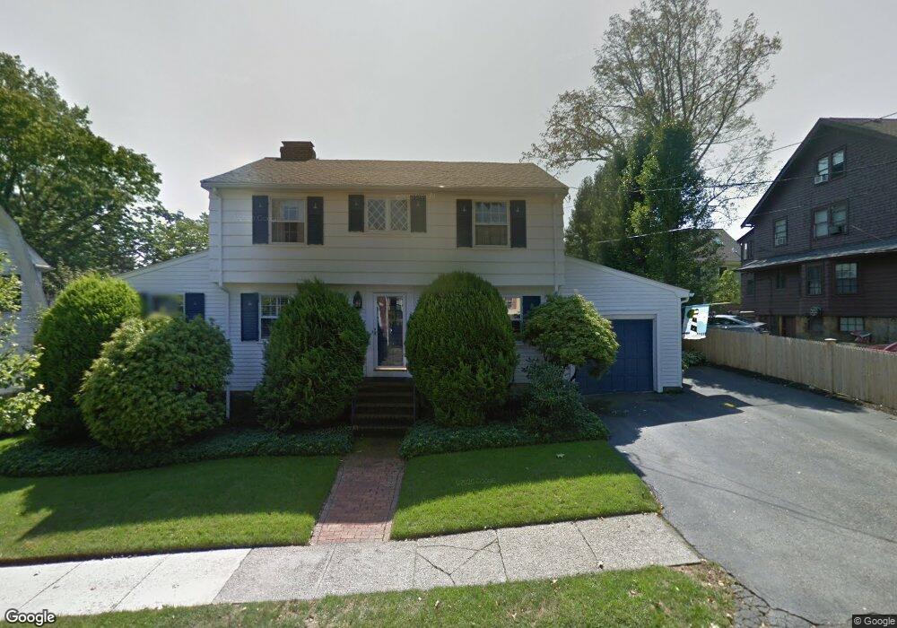
17 Pequossette Rd Belmont, MA 02478
Cushing Square NeighborhoodEstimated Value: $1,620,000 - $1,671,289
3
Beds
4
Baths
1,978
Sq Ft
$834/Sq Ft
Est. Value
About This Home
This home is located at 17 Pequossette Rd, Belmont, MA 02478 and is currently estimated at $1,650,072, approximately $834 per square foot. 17 Pequossette Rd is a home located in Middlesex County with nearby schools including Roger Wellington Elementary School, Winthrop L Chenery Middle School, and Belmont High School.
Ownership History
Date
Name
Owned For
Owner Type
Purchase Details
Closed on
Nov 2, 1998
Sold by
Wang Daniel I and Wang Victoria D
Bought by
Zolner Joseph P and Mcdonough Kathleen E
Current Estimated Value
Home Financials for this Owner
Home Financials are based on the most recent Mortgage that was taken out on this home.
Original Mortgage
$340,400
Outstanding Balance
$74,889
Interest Rate
6.68%
Mortgage Type
Purchase Money Mortgage
Estimated Equity
$1,575,183
Create a Home Valuation Report for This Property
The Home Valuation Report is an in-depth analysis detailing your home's value as well as a comparison with similar homes in the area
Home Values in the Area
Average Home Value in this Area
Purchase History
| Date | Buyer | Sale Price | Title Company |
|---|---|---|---|
| Zolner Joseph P | $425,500 | -- |
Source: Public Records
Mortgage History
| Date | Status | Borrower | Loan Amount |
|---|---|---|---|
| Open | Zolner Joseph P | $340,400 | |
| Previous Owner | Zolner Joseph P | $40,000 |
Source: Public Records
Tax History Compared to Growth
Tax History
| Year | Tax Paid | Tax Assessment Tax Assessment Total Assessment is a certain percentage of the fair market value that is determined by local assessors to be the total taxable value of land and additions on the property. | Land | Improvement |
|---|---|---|---|---|
| 2025 | $18,418 | $1,617,000 | $808,000 | $809,000 |
| 2024 | $17,097 | $1,619,000 | $957,000 | $662,000 |
| 2023 | $16,916 | $1,505,000 | $902,000 | $603,000 |
| 2022 | $18,372 | $1,388,000 | $826,000 | $562,000 |
| 2021 | $13,717 | $1,592,000 | $1,033,000 | $559,000 |
| 2020 | $13,246 | $1,427,000 | $883,000 | $544,000 |
| 2019 | $13,210 | $1,132,000 | $668,000 | $464,000 |
| 2018 | $11,773 | $969,000 | $608,000 | $361,000 |
| 2017 | $11,358 | $895,000 | $534,000 | $361,000 |
| 2016 | $11,204 | $892,000 | $534,000 | $358,000 |
| 2015 | $10,539 | $817,000 | $459,000 | $358,000 |
Source: Public Records
Map
Nearby Homes
- 7 Pine St
- 456 Belmont St Unit 10
- 456 Belmont St Unit 21
- 15 Cushing Ave Unit 2
- 532 Belmont St
- 276 Belmont St Unit 1
- 68 Payson Rd
- 11 Payson Rd Unit 11
- 354 School St Unit 354
- 147 Langdon Ave Unit 147
- 147 Langdon Ave Unit 149
- 125 Trapelo Rd Unit 23
- 125 Trapelo Rd Unit 21
- 172 Maplewood St
- 133 Hillside Rd Unit 2
- 133 Hillside Rd Unit 1
- 81 Winsor Ave
- 79 Livermore Rd
- 30 Merrill Rd
- 56-58 Edgecliff Rd
- 21 Pequossette Rd
- 15 Pequossette Rd
- 3 Pequossette Rd
- 14 Lawndale St
- 18 Lawndale St
- 18 Lawndale St Unit 2
- 20 Lawndale St
- 20 Pequossette Rd
- 4 Pequossette Rd
- 10 Lawndale St
- 29 Pequossette Rd
- 22 Lawndale St Unit 24
- 26 Pequossette Rd
- 23 Oakley Rd
- 23 Benton Rd
- 23 Benton Rd Unit 23
- 4 Lawndale St
- 28 Lawndale St
- 29 Benton Rd
- 19 Benton Rd