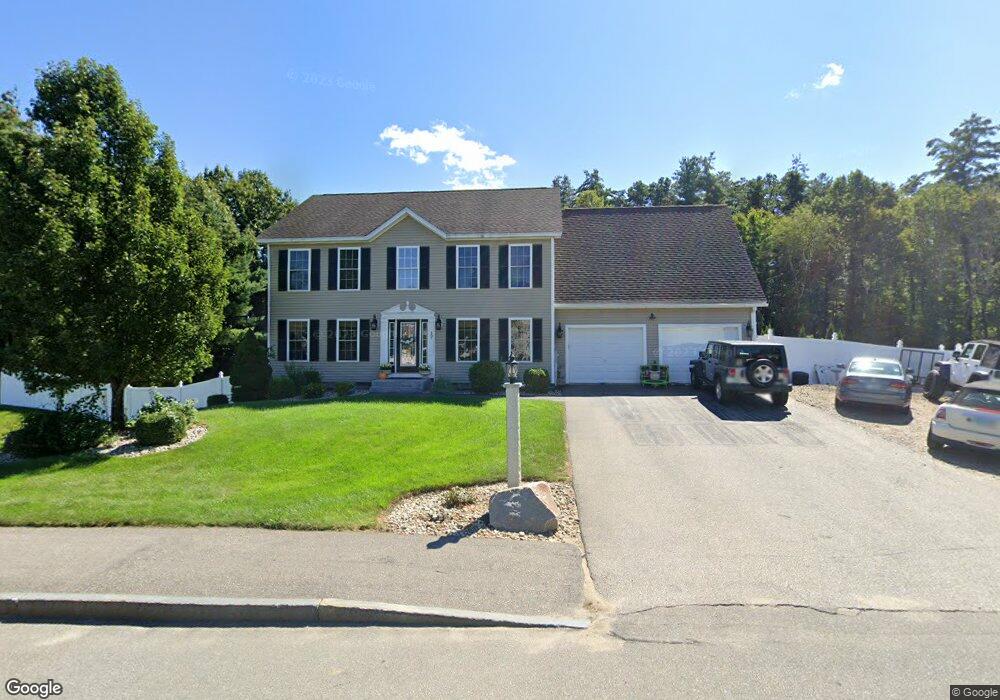
17 Preston St Goffstown, NH 03045
Estimated Value: $672,000 - $722,193
3
Beds
4
Baths
2,314
Sq Ft
$305/Sq Ft
Est. Value
About This Home
This home is located at 17 Preston St, Goffstown, NH 03045 and is currently estimated at $705,798, approximately $305 per square foot. 17 Preston St is a home with nearby schools including Mountain View Middle School, Goffstown High School, and Polaris Charter School.
Ownership History
Date
Name
Owned For
Owner Type
Purchase Details
Closed on
Nov 12, 2004
Sold by
Brookfield Invest Grou
Bought by
Raymond Albert Z and Raymond Kimberly A
Current Estimated Value
Home Financials for this Owner
Home Financials are based on the most recent Mortgage that was taken out on this home.
Original Mortgage
$311,000
Outstanding Balance
$154,889
Interest Rate
5.75%
Mortgage Type
Purchase Money Mortgage
Estimated Equity
$550,909
Create a Home Valuation Report for This Property
The Home Valuation Report is an in-depth analysis detailing your home's value as well as a comparison with similar homes in the area
Home Values in the Area
Average Home Value in this Area
Purchase History
| Date | Buyer | Sale Price | Title Company |
|---|---|---|---|
| Raymond Albert Z | $345,600 | -- |
Source: Public Records
Mortgage History
| Date | Status | Borrower | Loan Amount |
|---|---|---|---|
| Open | Raymond Albert Z | $58,975 | |
| Open | Raymond Albert Z | $311,000 |
Source: Public Records
Tax History Compared to Growth
Tax History
| Year | Tax Paid | Tax Assessment Tax Assessment Total Assessment is a certain percentage of the fair market value that is determined by local assessors to be the total taxable value of land and additions on the property. | Land | Improvement |
|---|---|---|---|---|
| 2024 | $12,530 | $613,000 | $199,400 | $413,600 |
| 2023 | $11,561 | $613,000 | $199,400 | $413,600 |
| 2022 | $10,671 | $405,600 | $128,900 | $276,700 |
| 2021 | $10,067 | $405,600 | $128,900 | $276,700 |
| 2020 | $10,067 | $405,600 | $128,900 | $276,700 |
| 2019 | $9,970 | $405,600 | $128,900 | $276,700 |
| 2018 | $7,141 | $383,900 | $128,900 | $255,000 |
| 2017 | $9,438 | $344,200 | $111,600 | $232,600 |
| 2016 | $9,110 | $344,700 | $111,600 | $233,100 |
| 2015 | $9,358 | $332,300 | $109,800 | $222,500 |
| 2014 | $8,972 | $332,300 | $109,800 | $222,500 |
Source: Public Records
Map
Nearby Homes
- 21 Katherine St
- 46 Moose Club Park Rd
- 43 Bay St
- 39 Bay St
- 11 Oakwood Cir Unit 9
- 2B Dearborn Cir
- 1B Dearborn Cir
- 2 Shore Dr
- 2 Larch St Unit 22
- 4 Arabian Ct Unit B
- 39 Larch St
- 62 Larch St
- 27 Larch St
- 61 Larch St
- 11-1 Chatel Rd
- 37 Chatel Rd
- 10 Conestoga Ct Unit 10A
- 3 Arabian Ct Unit A
- 26 College Rd
- 0 Mast Rd Unit 49 5054665