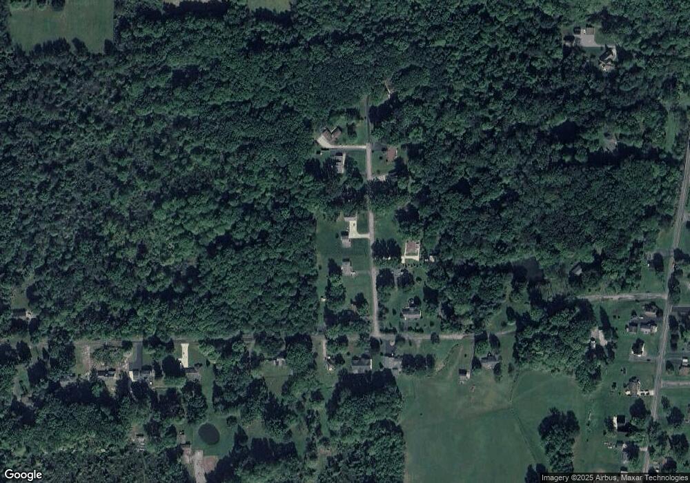
17 Raymond Dr West Middlesex, PA 16159
Estimated Value: $109,342 - $212,000
3
Beds
2
Baths
--
Sq Ft
0.45
Acres
About This Home
This home is located at 17 Raymond Dr, West Middlesex, PA 16159 and is currently estimated at $173,586. 17 Raymond Dr is a home located in Mercer County with nearby schools including Luther W Low Elementary School, Oakview Elementary School, and West Middlesex Junior/Senior High School.
Ownership History
Date
Name
Owned For
Owner Type
Purchase Details
Closed on
Aug 28, 2014
Sold by
Davis Joshua J and Davis April Marie
Bought by
Jones Brad A and Jones Alexis M
Current Estimated Value
Home Financials for this Owner
Home Financials are based on the most recent Mortgage that was taken out on this home.
Original Mortgage
$133,200
Outstanding Balance
$101,973
Interest Rate
4.14%
Mortgage Type
New Conventional
Estimated Equity
$71,613
Purchase Details
Closed on
Feb 3, 2010
Sold by
Webb Janet S
Bought by
Davis Joshua J
Home Financials for this Owner
Home Financials are based on the most recent Mortgage that was taken out on this home.
Original Mortgage
$71,000
Interest Rate
5.11%
Mortgage Type
New Conventional
Create a Home Valuation Report for This Property
The Home Valuation Report is an in-depth analysis detailing your home's value as well as a comparison with similar homes in the area
Purchase History
| Date | Buyer | Sale Price | Title Company |
|---|---|---|---|
| Jones Brad A | $148,000 | None Available | |
| Davis Joshua J | $97,500 | None Available |
Source: Public Records
Mortgage History
| Date | Status | Borrower | Loan Amount |
|---|---|---|---|
| Open | Jones Brad A | $133,200 | |
| Previous Owner | Davis Joshua J | $71,000 |
Source: Public Records
Tax History
| Year | Tax Paid | Tax Assessment Tax Assessment Total Assessment is a certain percentage of the fair market value that is determined by local assessors to be the total taxable value of land and additions on the property. | Land | Improvement |
|---|---|---|---|---|
| 2025 | $2,131 | $18,900 | $600 | $18,300 |
| 2024 | $2,131 | $18,900 | $600 | $18,300 |
| 2023 | $2,065 | $18,900 | $600 | $18,300 |
| 2022 | $2,046 | $18,900 | $600 | $18,300 |
| 2021 | $2,015 | $18,900 | $600 | $18,300 |
| 2020 | $2,015 | $18,900 | $600 | $18,300 |
| 2019 | $1,946 | $18,900 | $600 | $18,300 |
| 2018 | $1,905 | $18,900 | $600 | $18,300 |
| 2017 | $1,876 | $18,900 | $600 | $18,300 |
| 2016 | -- | $18,900 | $600 | $18,300 |
| 2015 | -- | $18,900 | $600 | $18,300 |
| 2014 | -- | $18,900 | $600 | $18,300 |
Source: Public Records
Map
Nearby Homes
- 00 Lilac Dr
- 3404 Hubbard-Middlesex Rd
- 774 Wheatland Rd
- 880 Wheatland Rd
- 3134 Main St Unit 180
- 940 Wheatland Rd
- 0 Sr-318 & Executive Ct Unit 1725969
- 3037 E Main St
- Lot 28 Wheatland Rd
- 3406 New Castle Rd
- 27 Hnida Rd
- 1 Grandview Dr
- 3070 Spangler Rd
- 11 Clubhouse Dr
- 13 Oak Tree Ct
- 2801 Mercer West Middlesex Rd
- 2617 S Hermitage Rd
- 0 Hoezle Rd
- 400 Oak Hill Rd
- 2341 S Hermitage Rd
- 13 Raymond Dr
- 21 Raymond Dr
- 12 Raymond Dr
- 235 Maple Grove Rd
- 7 Raymond Dr
- 16 Raymond Dr
- 23 Raymond Dr
- 28 Raymond Dr
- 253 Maple Grove Rd
- 32 Raymond Dr
- 39 Raymond Dr
- 236 Maple Grove Rd
- 246 Maple Grove Rd
- 228 Maple Grove Rd
- 250 Maple Grove Rd
- 40 Raymond Dr
- 214 Maple Grove Rd
- 260 Maple Grove Rd
- 207 Maple Grove Rd
- 206 Maple Grove Rd
Your Personal Tour Guide
Ask me questions while you tour the home.
