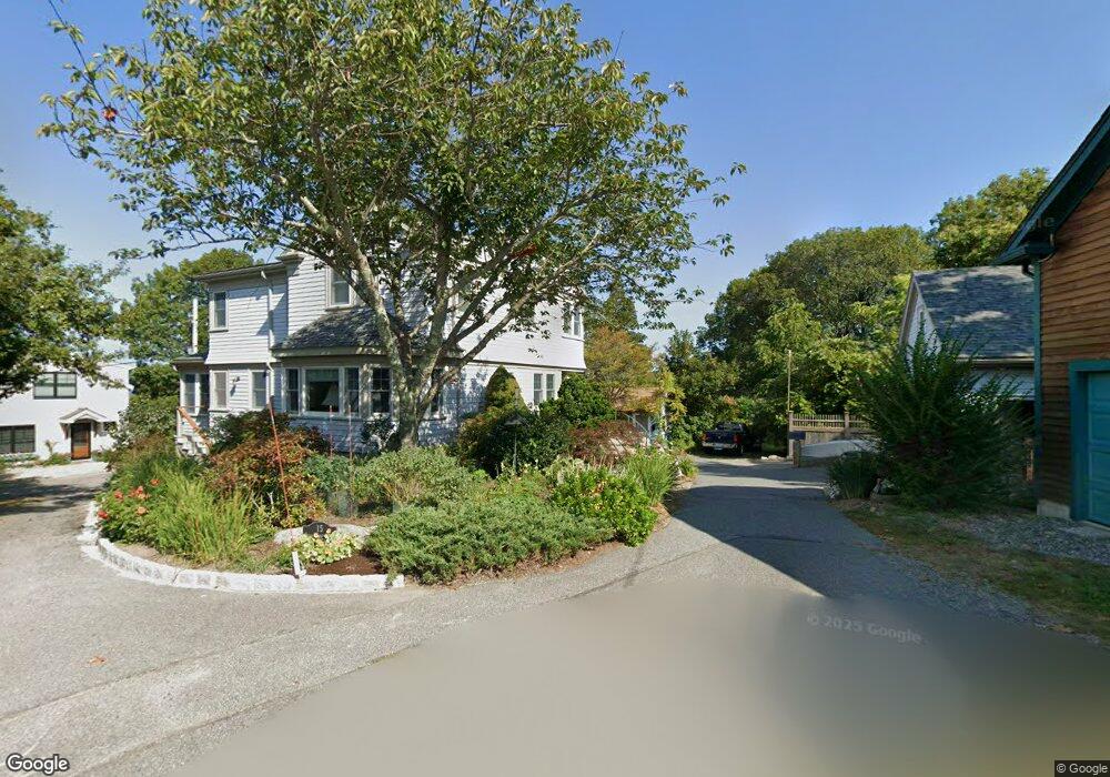
17 Riggs Point Rd Gloucester, MA 01930
Estimated Value: $502,000 - $614,000
1
Bed
1
Bath
780
Sq Ft
$742/Sq Ft
Est. Value
About This Home
This home is located at 17 Riggs Point Rd, Gloucester, MA 01930 and is currently estimated at $578,697, approximately $741 per square foot. 17 Riggs Point Rd is a home located in Essex County with nearby schools including Plum Cove School, Ralph B O'maley Middle School, and Gloucester High School.
Ownership History
Date
Name
Owned For
Owner Type
Purchase Details
Closed on
Jun 10, 2003
Sold by
Ives Harwood S and Ives Kwan Li L
Bought by
Ives Benjamin P
Current Estimated Value
Home Financials for this Owner
Home Financials are based on the most recent Mortgage that was taken out on this home.
Original Mortgage
$125,000
Outstanding Balance
$54,015
Interest Rate
5.83%
Mortgage Type
Purchase Money Mortgage
Estimated Equity
$524,682
Purchase Details
Closed on
Mar 16, 1993
Sold by
Mccarthy Devt Rt
Bought by
Elwell Robert L and Elwell Nancy L
Home Financials for this Owner
Home Financials are based on the most recent Mortgage that was taken out on this home.
Original Mortgage
$125,400
Interest Rate
7.8%
Mortgage Type
Purchase Money Mortgage
Purchase Details
Closed on
Feb 19, 1993
Sold by
First Nb Of Ipswich
Bought by
Mccarthy Dev Rt One
Home Financials for this Owner
Home Financials are based on the most recent Mortgage that was taken out on this home.
Original Mortgage
$125,400
Interest Rate
7.8%
Mortgage Type
Purchase Money Mortgage
Create a Home Valuation Report for This Property
The Home Valuation Report is an in-depth analysis detailing your home's value as well as a comparison with similar homes in the area
Purchase History
| Date | Buyer | Sale Price | Title Company |
|---|---|---|---|
| Ives Benjamin P | $215,000 | -- | |
| Ives Benjamin P | $215,000 | -- | |
| Elwell Robert L | $132,000 | -- | |
| Mccarthy Dev Rt One | $56,000 | -- |
Source: Public Records
Mortgage History
| Date | Status | Borrower | Loan Amount |
|---|---|---|---|
| Open | Ives Benjamin P | $125,000 | |
| Previous Owner | Elwell Robert L | $125,400 | |
| Previous Owner | Mccarthy Dev Rt One | $27,915 |
Source: Public Records
Tax History
| Year | Tax Paid | Tax Assessment Tax Assessment Total Assessment is a certain percentage of the fair market value that is determined by local assessors to be the total taxable value of land and additions on the property. | Land | Improvement |
|---|---|---|---|---|
| 2025 | $4,893 | $503,400 | $445,700 | $57,700 |
| 2024 | $4,692 | $482,200 | $424,500 | $57,700 |
| 2023 | $4,572 | $431,700 | $379,100 | $52,600 |
| 2022 | $4,470 | $381,100 | $329,800 | $51,300 |
| 2021 | $3,564 | $286,500 | $237,800 | $48,700 |
| 2020 | $3,344 | $271,200 | $224,200 | $47,000 |
| 2019 | $3,395 | $267,500 | $224,200 | $43,300 |
| 2018 | $3,421 | $264,600 | $224,200 | $40,400 |
| 2017 | $3,325 | $252,100 | $213,400 | $38,700 |
| 2016 | $3,234 | $237,600 | $202,600 | $35,000 |
| 2015 | $3,243 | $237,600 | $202,600 | $35,000 |
Source: Public Records
Map
Nearby Homes
- 2 Breezy Point Rd
- 672 Washington St
- 3 Deacon Farm Ln
- 13 Honeysuckle Rd
- 31 Echo Ave
- 226 Atlantic St
- 178 Atlantic St
- 167 Atlantic St
- 136 Leonard St
- 4 Ciaramitaro Ct
- 13 Mystic Ave
- 8 Mystic Ave
- 3 Rockland St
- 6 Monroe Ct
- 98 Maplewood Ave
- 12 Arthur St
- 9 Cleveland Place
- 40 Sargent St
- 19 Trask St Unit 2
- 50 Warner St
- 15 Riggs Point Rd
- 20 Riggs Point Rd
- 19 Riggs Point Rd
- 28 Riggs Point Rd
- 24 Riggs Point Rd
- 24 Riggs Point Rd Unit WINTER
- 24 Riggs Point Road Winter
- 24 Riggs Point Road Winter Unit WINTER
- 21 Riggs Point Rd
- 22 Riggs Point Rd
- 18 Riggs Point Rd
- 26 Riggs Point Rd
- 11 Riggs Point Rd
- 16 Riggs Point Rd
- 12 Riggs Point Rd
- 90 Riggs Point Rd
- 14 Riggs Point Rd
- 10 Riggs Point Rd
- 620 Washington St
- 9 Riggs Point Rd
Your Personal Tour Guide
Ask me questions while you tour the home.