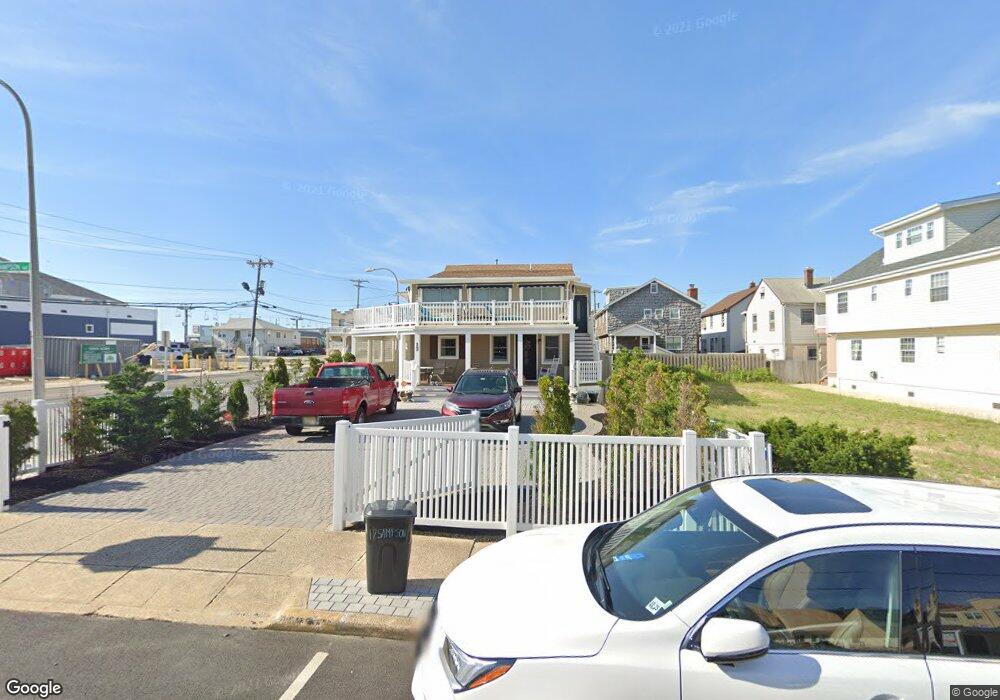
17 Sampson Ave Unit 1 & 2 Seaside Heights, NJ 08751
Estimated Value: $662,000 - $1,343,000
4
Beds
4
Baths
2,154
Sq Ft
$465/Sq Ft
Est. Value
About This Home
This home is located at 17 Sampson Ave Unit 1 & 2, Seaside Heights, NJ 08751 and is currently estimated at $1,002,067, approximately $465 per square foot. 17 Sampson Ave Unit 1 & 2 is a home located in Ocean County with nearby schools including Hugh J. Boyd Jr. Elementary School, Central Regional Middle School, and Central Regional High School.
Ownership History
Date
Name
Owned For
Owner Type
Purchase Details
Closed on
Dec 11, 2017
Sold by
Indahl Kenneth G and Indahl Ann Marie
Bought by
Killeen Ruth C
Current Estimated Value
Home Financials for this Owner
Home Financials are based on the most recent Mortgage that was taken out on this home.
Original Mortgage
$440,000
Outstanding Balance
$370,058
Interest Rate
3.9%
Mortgage Type
New Conventional
Estimated Equity
$632,009
Purchase Details
Closed on
Apr 5, 2017
Sold by
Indahl Ann Marie
Bought by
Indahl Kenneth G and Indahl Ann Marie
Purchase Details
Closed on
Mar 31, 2003
Purchase Details
Closed on
Nov 30, 1993
Sold by
Rinaldi Angelo
Bought by
Morgante Anthony and Morgante Ann
Home Financials for this Owner
Home Financials are based on the most recent Mortgage that was taken out on this home.
Original Mortgage
$100,000
Interest Rate
7.03%
Create a Home Valuation Report for This Property
The Home Valuation Report is an in-depth analysis detailing your home's value as well as a comparison with similar homes in the area
Home Values in the Area
Average Home Value in this Area
Purchase History
| Date | Buyer | Sale Price | Title Company |
|---|---|---|---|
| Killeen Ruth C | $550,000 | -- | |
| Indahl Kenneth G | -- | -- | |
| -- | -- | -- | |
| Morgante Anthony | $159,000 | -- |
Source: Public Records
Mortgage History
| Date | Status | Borrower | Loan Amount |
|---|---|---|---|
| Open | Killeen Ruth C | $440,000 | |
| Previous Owner | Morgante Anthony | $100,000 |
Source: Public Records
Tax History Compared to Growth
Tax History
| Year | Tax Paid | Tax Assessment Tax Assessment Total Assessment is a certain percentage of the fair market value that is determined by local assessors to be the total taxable value of land and additions on the property. | Land | Improvement |
|---|---|---|---|---|
| 2025 | $11,721 | $977,600 | $600,000 | $377,600 |
| 2024 | $10,878 | $413,600 | $180,000 | $233,600 |
| 2023 | $10,344 | $413,600 | $180,000 | $233,600 |
| 2022 | $10,344 | $413,600 | $180,000 | $233,600 |
| 2021 | $10,009 | $413,600 | $180,000 | $233,600 |
| 2020 | $8,469 | $348,800 | $180,000 | $168,800 |
| 2019 | $8,214 | $348,800 | $180,000 | $168,800 |
| 2018 | $7,998 | $348,800 | $180,000 | $168,800 |
| 2017 | $7,848 | $348,800 | $180,000 | $168,800 |
| 2016 | $7,715 | $348,800 | $180,000 | $168,800 |
| 2015 | $7,447 | $348,800 | $180,000 | $168,800 |
| 2014 | $6,819 | $348,800 | $180,000 | $168,800 |
Source: Public Records
Map
Nearby Homes
- 1501 Ocean Terrace Unit H
- 51 Hiering Ave Unit D-4
- 55 Sampson Ave
- 45 Sampson Ave Unit 11
- 1300 Ocean Terrace
- 500 Ocean Terrace Unit 6
- 500 Ocean Terrace Unit 9
- 500 Ocean Terrace Unit 1
- 51 Sampson Ave
- 36 Kearney Ave
- 61 Hiering Ave
- 52 Kearney Ave
- 28 Fremont Ave Unit 14
- 28 Fremont Ave Unit 8
- 28 Fremont Ave Unit 12
- 1515 Boulevard Unit 13
- 1601 Boulevard Unit B7
- 3 Holiday Rd
- 34 Hancock Ave
- 36 Hancock Ave
- 17 Sampson Ave
- 17 Sampson Ave Unit Lower
- 21 Sampson Ave
- 23 Sampson Ave
- 27 Sampson Ave
- 27 Sampson Ave Unit 1st floor
- 27 Sampson Ave Unit 2nd Floor
- 20 Carteret Ave
- 16 Carteret Ave
- 22 Carteret Ave
- 1501 Ocean Terrace Unit A
- 1501 Ocean Terrace
- 1501 Ocean Terrace Unit D
- 1501 Ocean Terrace Unit E
- 1501 Ocean Terrace Unit F
- 1501 Ocean Terrace Unit G
- 1501 Ocean Ave Unit E
- 1501 Ocean Ave Unit F
- 1501 Ocean Ave Unit B
- 1501 Ocean Ave Unit C