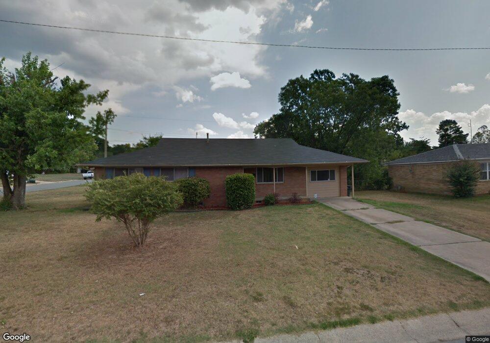
17 Serenity Dr Little Rock, AR 72205
West Markham NeighborhoodEstimated Value: $168,000 - $218,000
3
Beds
2
Baths
2,088
Sq Ft
$96/Sq Ft
Est. Value
About This Home
This home is located at 17 Serenity Dr, Little Rock, AR 72205 and is currently estimated at $200,186, approximately $95 per square foot. 17 Serenity Dr is a home located in Pulaski County with nearby schools including McDermott Elementary School, J.A. Fair K8 Preparatory School, and Henderson Middle School.
Ownership History
Date
Name
Owned For
Owner Type
Purchase Details
Closed on
Jul 7, 2011
Sold by
Thompson Jose and Odonnell Elizabeth
Bought by
Robinson Shamel S and Robinson Latwanda
Current Estimated Value
Home Financials for this Owner
Home Financials are based on the most recent Mortgage that was taken out on this home.
Original Mortgage
$6,000
Interest Rate
4.55%
Mortgage Type
Stand Alone Second
Purchase Details
Closed on
Feb 23, 2007
Sold by
Estes William K and Maxwell Debra Estes
Bought by
Thompson Jose and Odonnell Elizabeth
Home Financials for this Owner
Home Financials are based on the most recent Mortgage that was taken out on this home.
Original Mortgage
$22,000
Interest Rate
6.01%
Mortgage Type
Stand Alone Second
Create a Home Valuation Report for This Property
The Home Valuation Report is an in-depth analysis detailing your home's value as well as a comparison with similar homes in the area
Home Values in the Area
Average Home Value in this Area
Purchase History
| Date | Buyer | Sale Price | Title Company |
|---|---|---|---|
| Robinson Shamel S | $120,000 | West Little Rock Title Co | |
| Thompson Jose | $110,000 | Stewart Title Of Arkansas |
Source: Public Records
Mortgage History
| Date | Status | Borrower | Loan Amount |
|---|---|---|---|
| Closed | Robinson Shamel S | $6,000 | |
| Open | Robinson Shamel S | $116,860 | |
| Previous Owner | Thompson Jose | $22,000 | |
| Previous Owner | Thompson Jose | $88,000 |
Source: Public Records
Tax History Compared to Growth
Tax History
| Year | Tax Paid | Tax Assessment Tax Assessment Total Assessment is a certain percentage of the fair market value that is determined by local assessors to be the total taxable value of land and additions on the property. | Land | Improvement |
|---|---|---|---|---|
| 2025 | $2,233 | $31,902 | $5,800 | $26,102 |
| 2024 | $2,233 | $31,902 | $5,800 | $26,102 |
| 2023 | $2,233 | $31,902 | $5,800 | $26,102 |
| 2022 | $2,169 | $31,902 | $5,800 | $26,102 |
| 2021 | $1,986 | $28,170 | $3,050 | $25,120 |
| 2020 | $1,972 | $28,170 | $3,050 | $25,120 |
| 2019 | $1,972 | $28,170 | $3,050 | $25,120 |
| 2018 | $1,972 | $28,170 | $3,050 | $25,120 |
| 2017 | $1,972 | $28,170 | $3,050 | $25,120 |
| 2016 | $1,852 | $26,450 | $3,800 | $22,650 |
| 2015 | $1,854 | $26,450 | $3,800 | $22,650 |
| 2014 | $1,854 | $26,450 | $3,800 | $22,650 |
Source: Public Records
Map
Nearby Homes
- 15 Brooklawn Dr
- 423 Brookside Dr
- 4 Brookridge Cove
- 7 Brookfield Cove
- 9 Brookfield Cove
- 8806 Mayflower Rd
- 41 Brookridge Dr
- 814 Shea Dr
- 22 Nob Hill Cove
- 411 Burnside Dr
- 8815 Cloverhill Rd
- 8306 Louwanda Dr
- 22 Nob View Cir
- 409 Sunnymeade Dr
- 3 Edgestone Dr
- 73 Reservoir Heights Dr
- 10 Reservoir Heights Dr
- 9320 Cloverhill Rd
- 9605 Brooks Ct
- 9516 Wiggins Place
- 17 Brookhaven Dr
- 15 Serenity Dr
- 11 Serenity Dr
- 20 Brookhaven Dr
- 15 Brookhaven Dr
- 4 Brooklawn Dr
- 18 Serenity Dr
- 18 Brookhaven Dr
- 16 Serenity Dr
- 20 Serenity Dr
- 9 Serenity Dr
- 14 Serenity Dr
- 22 Serenity Dr
- 16 Brookhaven Dr
- 25 Serenity Dr
- 2 Brooklawn Dr
- 12 Serenity Dr
- 24 Serenity Dr
- 7 Serenity Dr
- 12 Brooklawn Dr