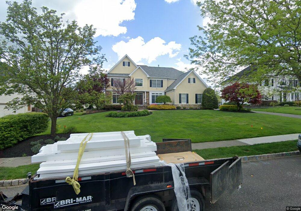
17 Sheffield Dr Moorestown, NJ 08057
Estimated Value: $1,293,514 - $1,593,000
Studio
--
Bath
4,194
Sq Ft
$335/Sq Ft
Est. Value
About This Home
This home is located at 17 Sheffield Dr, Moorestown, NJ 08057 and is currently estimated at $1,406,171, approximately $335 per square foot. 17 Sheffield Dr is a home located in Burlington County with nearby schools including South Valley Elementary School, Moorestown Upper Elementary School, and William Allen Middle School.
Ownership History
Date
Name
Owned For
Owner Type
Purchase Details
Closed on
Jul 18, 2001
Sold by
Orleans Corp
Bought by
Schimenti Robert J and Schimenti Joanne
Current Estimated Value
Create a Home Valuation Report for This Property
The Home Valuation Report is an in-depth analysis detailing your home's value as well as a comparison with similar homes in the area
Home Values in the Area
Average Home Value in this Area
Purchase History
| Date | Buyer | Sale Price | Title Company |
|---|---|---|---|
| Schimenti Robert J | $577,536 | Settlers Title Agency Lp | |
| -- | $577,500 | -- |
Source: Public Records
Tax History
| Year | Tax Paid | Tax Assessment Tax Assessment Total Assessment is a certain percentage of the fair market value that is determined by local assessors to be the total taxable value of land and additions on the property. | Land | Improvement |
|---|---|---|---|---|
| 2025 | $20,923 | $737,500 | $189,800 | $547,700 |
| 2024 | $20,289 | $737,500 | $189,800 | $547,700 |
| 2023 | $20,289 | $737,500 | $189,800 | $547,700 |
| 2022 | $20,082 | $737,500 | $189,800 | $547,700 |
| 2021 | $19,817 | $737,500 | $189,800 | $547,700 |
| 2020 | $19,691 | $737,500 | $189,800 | $547,700 |
| 2019 | $19,345 | $737,500 | $189,800 | $547,700 |
| 2018 | $18,821 | $737,500 | $189,800 | $547,700 |
| 2017 | $18,983 | $737,500 | $189,800 | $547,700 |
| 2016 | $18,917 | $737,500 | $189,800 | $547,700 |
| 2015 | $18,688 | $737,500 | $189,800 | $547,700 |
| 2014 | $17,744 | $737,500 | $189,800 | $547,700 |
Source: Public Records
Map
Nearby Homes
- 635 E Main St Unit 14
- 635 E Main St Unit 7
- 437 Windrow Clusters Dr
- 9 Deerfield Terrace
- 49 Brooks Rd
- 451 E 2nd St
- 526 E Main St
- 408 N Stanwick Rd
- 337 E 2nd St
- 396 E Linden St
- 744 Signal Light Rd
- 628 Windsock Way
- 40 Palmer Dr Unit 110
- 308 Elm St
- 15 Hogan Way
- 205 E Central Ave
- 140 E Central Ave
- 863 Golf View Rd
- 625 Tournament Dr
- 740 Garwood Rd
- 15 Sheffield Dr
- 19 Sheffield Dr
- 24 Castleton Ln
- 13 Sheffield Dr
- 26 Castleton Ln
- 21 Sheffield Dr
- 24 Sheffield Dr
- 22 Sheffield Dr
- 26 Sheffield Dr
- 20 Castleton Ln
- 20 Sheffield Dr
- 28 Castleton Ln
- 4 Dorchester Ln
- 2 Dorchester Ln
- 23 Sheffield Dr
- 6 Dorchester Ln
- 18 Sheffield Dr
- 28 Sheffield Dr
- 8 Dorchester Ln
Your Personal Tour Guide
Ask me questions while you tour the home.