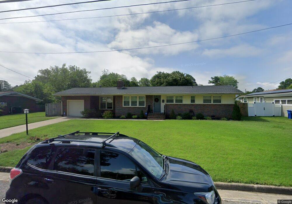
17 Shore Park Dr Newport News, VA 23602
Sanford NeighborhoodEstimated Value: $323,000 - $345,000
3
Beds
2
Baths
1,422
Sq Ft
$234/Sq Ft
Est. Value
About This Home
This home is located at 17 Shore Park Dr, Newport News, VA 23602 and is currently estimated at $332,291, approximately $233 per square foot. 17 Shore Park Dr is a home located in Newport News City with nearby schools including T. Ryland Sanford Elementary School, Mary Passage Middle School, and Denbigh High School.
Ownership History
Date
Name
Owned For
Owner Type
Purchase Details
Closed on
Jul 23, 2020
Sold by
Pas It On Capital Llc
Bought by
Broussard Benjamin and Broussard Kelsey
Current Estimated Value
Home Financials for this Owner
Home Financials are based on the most recent Mortgage that was taken out on this home.
Original Mortgage
$248,077
Outstanding Balance
$219,978
Interest Rate
3.1%
Mortgage Type
VA
Estimated Equity
$112,313
Purchase Details
Closed on
Feb 13, 2020
Sold by
The Estate Of Myrtle W Lowry
Bought by
Pass It On Capital Llc
Create a Home Valuation Report for This Property
The Home Valuation Report is an in-depth analysis detailing your home's value as well as a comparison with similar homes in the area
Home Values in the Area
Average Home Value in this Area
Purchase History
| Date | Buyer | Sale Price | Title Company |
|---|---|---|---|
| Broussard Benjamin | $242,500 | Attorney | |
| Pass It On Capital Llc | $112,000 | Attorney |
Source: Public Records
Mortgage History
| Date | Status | Borrower | Loan Amount |
|---|---|---|---|
| Open | Broussard Benjamin | $248,077 |
Source: Public Records
Tax History Compared to Growth
Tax History
| Year | Tax Paid | Tax Assessment Tax Assessment Total Assessment is a certain percentage of the fair market value that is determined by local assessors to be the total taxable value of land and additions on the property. | Land | Improvement |
|---|---|---|---|---|
| 2024 | $3,802 | $322,200 | $77,000 | $245,200 |
| 2023 | $3,734 | $304,000 | $77,000 | $227,000 |
| 2022 | $3,511 | $280,300 | $77,000 | $203,300 |
| 2021 | $3,082 | $240,600 | $70,000 | $170,600 |
| 2020 | $2,874 | $223,500 | $70,000 | $153,500 |
| 2019 | $2,381 | $183,500 | $70,000 | $113,500 |
| 2018 | $2,338 | $180,200 | $70,000 | $110,200 |
| 2017 | $2,338 | $180,200 | $70,000 | $110,200 |
| 2016 | $2,294 | $177,000 | $70,000 | $107,000 |
| 2015 | $2,288 | $177,000 | $70,000 | $107,000 |
| 2014 | $2,057 | $177,000 | $70,000 | $107,000 |
Source: Public Records
Map
Nearby Homes
- 421 Lanyard Rd
- 419 Lanyard Rd
- 32 Jolama Dr
- 517 Quarterfield Rd
- 525 Helm Dr
- 623 Haystack Landing Rd
- 477 Windemere Rd
- 783 Childress Dr
- 117 Virginia Dr
- 203 Tabbs Ln
- 111 Hertzler Rd
- 474 Dunmore Dr
- 721 Mac Neil Dr
- 214 Denbigh Blvd
- 19 Evelyn Dr
- 461 Dunmore Dr
- 131 Denbigh Blvd
- 803 Ashley Place
- 140 Gingerwood Ct
- 299 Windemere Rd
- 19 Shore Park Dr
- 15 Shore Park Dr
- 117 Binnacle Dr
- 119 Binnacle Dr
- 21 Shore Park Dr
- 115 Binnacle Dr
- 2 Laurel Wood Rd
- 133 Kittywake Dr
- 18 Shore Park Dr
- 113 Binnacle Dr
- 23 Shore Park Dr
- 121 Binnacle Dr
- 20 Shore Park Dr
- 4 Laurel Wood Rd
- 131 Kittywake Dr
- 12 Shore Park Dr
- 13 Shore Park Dr
- 22 Shore Park Dr
- 111 Binnacle Dr
- 25 Shore Park Dr