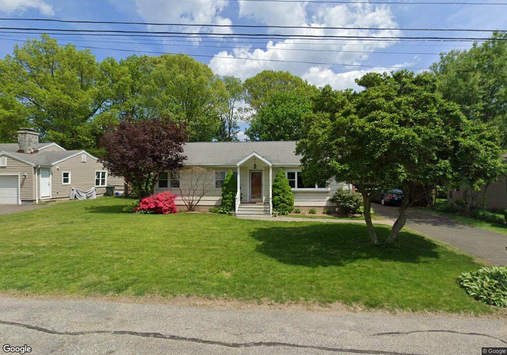
17 Smith Dr Trumbull, CT 06611
West Trumbull NeighborhoodEstimated Value: $526,000 - $561,976
3
Beds
2
Baths
1,454
Sq Ft
$374/Sq Ft
Est. Value
About This Home
This home is located at 17 Smith Dr, Trumbull, CT 06611 and is currently estimated at $543,744, approximately $373 per square foot. 17 Smith Dr is a home located in Fairfield County with nearby schools including Jane Ryan School, Madison Middle School, and Trumbull High School.
Ownership History
Date
Name
Owned For
Owner Type
Purchase Details
Closed on
Jul 1, 2021
Sold by
Grant Stacey N
Bought by
Grant Timothy F
Current Estimated Value
Home Financials for this Owner
Home Financials are based on the most recent Mortgage that was taken out on this home.
Original Mortgage
$263,000
Outstanding Balance
$238,995
Interest Rate
3%
Mortgage Type
Stand Alone Refi Refinance Of Original Loan
Estimated Equity
$304,749
Purchase Details
Closed on
Mar 17, 2005
Sold by
Gerard William and Gerard Sally
Bought by
Grant Timothy F and Grant Stacey N
Purchase Details
Closed on
Jun 3, 2004
Sold by
Schwartz George and Schwartz Sylvia
Bought by
Gerard William and Gerard Sally
Create a Home Valuation Report for This Property
The Home Valuation Report is an in-depth analysis detailing your home's value as well as a comparison with similar homes in the area
Home Values in the Area
Average Home Value in this Area
Purchase History
| Date | Buyer | Sale Price | Title Company |
|---|---|---|---|
| Grant Timothy F | -- | None Available | |
| Grant Timothy F | -- | None Available | |
| Grant Timothy F | $350,000 | -- | |
| Gerard William | $200,000 | -- | |
| Grant Timothy F | $350,000 | -- | |
| Gerard William | $200,000 | -- |
Source: Public Records
Mortgage History
| Date | Status | Borrower | Loan Amount |
|---|---|---|---|
| Open | Grant Timothy F | $263,000 | |
| Closed | Grant Timothy F | $263,000 | |
| Previous Owner | Gerard William | $316,823 | |
| Previous Owner | Gerard William | $313,084 | |
| Previous Owner | Gerard William | $290,000 |
Source: Public Records
Tax History Compared to Growth
Tax History
| Year | Tax Paid | Tax Assessment Tax Assessment Total Assessment is a certain percentage of the fair market value that is determined by local assessors to be the total taxable value of land and additions on the property. | Land | Improvement |
|---|---|---|---|---|
| 2025 | $8,493 | $231,140 | $142,310 | $88,830 |
| 2024 | $8,253 | $231,140 | $142,310 | $88,830 |
| 2023 | $8,122 | $231,140 | $142,310 | $88,830 |
| 2022 | $7,991 | $231,140 | $142,310 | $88,830 |
| 2021 | $6,916 | $190,190 | $118,580 | $71,610 |
| 2020 | $6,783 | $190,190 | $118,580 | $71,610 |
| 2018 | $6,631 | $190,190 | $118,580 | $71,610 |
| 2017 | $6,508 | $190,190 | $118,580 | $71,610 |
| 2016 | $6,341 | $190,190 | $118,580 | $71,610 |
| 2015 | $6,396 | $191,100 | $118,600 | $72,500 |
| 2014 | $6,260 | $191,100 | $118,600 | $72,500 |
Source: Public Records
Map
Nearby Homes
- 10 Aragon Dr
- 40 Rose Terrace
- 26 Grove St
- 75 Middlebrooks Ave
- 4487 Madison Ave
- 21 Histon Rd
- 4 Cider Mill Ln
- 88 Chestnut Hill Rd
- lot 194 Prospect Ave
- Lot 31 Valley View Rd
- 0 Main St
- 36 Craig Ln
- 83 Buck Hill Rd
- 4725 Madison Ave
- 18 Ridgebury Dr
- 45 Frenchtown Rd
- 546 Church Hill Rd
- 66 Loftus Cir
- 132 Merrimac Dr
- 81 Lance Cir