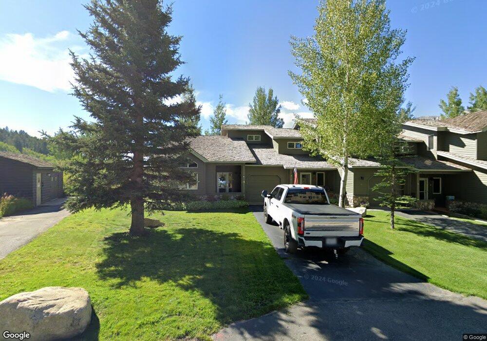
17 St Andrews Cir Crested Butte, CO 81224
Estimated Value: $1,253,000 - $1,299,353
3
Beds
3
Baths
1,458
Sq Ft
$875/Sq Ft
Est. Value
About This Home
This home is located at 17 St Andrews Cir, Crested Butte, CO 81224 and is currently estimated at $1,275,088, approximately $874 per square foot. 17 St Andrews Cir is a home located in Gunnison County with nearby schools including Gunnison Elementary School, Crested Butte Community School, and Gunnison Middle School.
Ownership History
Date
Name
Owned For
Owner Type
Purchase Details
Closed on
Dec 24, 2008
Sold by
Kull Sally Stark
Bought by
The Butte Llc
Current Estimated Value
Purchase Details
Closed on
May 15, 2002
Sold by
Estate Of Frederick Henry Kull Ii
Bought by
Kull Sally Stark
Purchase Details
Closed on
Dec 8, 1999
Sold by
Golf Villas Inc
Bought by
Kull Frederick Henry
Create a Home Valuation Report for This Property
The Home Valuation Report is an in-depth analysis detailing your home's value as well as a comparison with similar homes in the area
Home Values in the Area
Average Home Value in this Area
Purchase History
| Date | Buyer | Sale Price | Title Company |
|---|---|---|---|
| The Butte Llc | -- | None Available | |
| Kull Sally Stark | -- | -- | |
| Kull Frederick Henry | $306,000 | -- |
Source: Public Records
Tax History Compared to Growth
Tax History
| Year | Tax Paid | Tax Assessment Tax Assessment Total Assessment is a certain percentage of the fair market value that is determined by local assessors to be the total taxable value of land and additions on the property. | Land | Improvement |
|---|---|---|---|---|
| 2024 | $5,567 | $76,640 | $0 | $76,640 |
| 2023 | $5,567 | $72,960 | $0 | $72,960 |
| 2022 | $3,825 | $42,840 | $0 | $42,840 |
| 2021 | $3,521 | $44,070 | $0 | $44,070 |
| 2020 | $3,108 | $36,920 | $0 | $36,920 |
| 2019 | $3,065 | $36,920 | $0 | $36,920 |
| 2018 | $2,516 | $27,970 | $0 | $27,970 |
| 2017 | $2,533 | $27,970 | $0 | $27,970 |
| 2016 | $3,034 | $34,900 | $0 | $34,900 |
| 2015 | -- | $34,900 | $0 | $34,900 |
| 2014 | -- | $21,230 | $0 | $21,230 |
Source: Public Records
Map
Nearby Homes
- 412 Ridge Rd
- 315 Par Ln
- 350 Country Club Dr Unit 217A
- 350 Country Club Dr Unit 218A
- 350 Country Club Dr Unit 402A
- 434 Country Club Dr
- 0 Tbd Saddle Ridge Rd
- 262 Larkspur Loop
- 402 Eagle Ln
- 365 Larkspur Loop
- 1665 Skyland Dr
- 115 Larkspur Loop
- 618 Country Club Dr
- 166 & 168 Coyote Cir
- 42 Lexie Ct
- 491 Slate River Dr
- 168 W Silver Sage Dr
- 77 S Avion Dr
- 44 County Road 738a Brush Creek Rd
- 64 Vista Ct
- 19 St Andrews Cir
- 18 St Andrews Cir
- 19 St Andrews Cir Unit 19 Golf Villas
- 18 Saint Andrews Cir Unit 18
- 12 St Andrews Cir
- 7 Saint An Circle
- 0 Circle Unit 11204
- 0 St Andrew's Cir
- 0 St Andrews Cr Unit 8 Golf Villas
- 6 St Andrews Cir
- 9 St Andrews Cir
- 7 St Andrews Cir
- 10 St Andrews Cir
- 8 St Andrews Cir
- 11 St Andrews Cir Unit 11 Golf Villas
- 8 St Andrews Cir Unit 8 Golf Villas
- 24 St Andrews Cir
- 28 St Andrews Cir
- 27 St Andrews Cir
- 25 St Andrews Cir