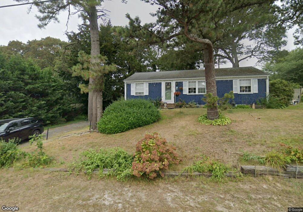
17 Uncle Ephraims Rd South Yarmouth, MA 02664
Estimated Value: $487,000 - $518,000
2
Beds
1
Bath
1,001
Sq Ft
$501/Sq Ft
Est. Value
About This Home
This home is located at 17 Uncle Ephraims Rd, South Yarmouth, MA 02664 and is currently estimated at $501,005, approximately $500 per square foot. 17 Uncle Ephraims Rd is a home located in Barnstable County with nearby schools including Dennis-Yarmouth Regional High School and St. Pius X. School.
Ownership History
Date
Name
Owned For
Owner Type
Purchase Details
Closed on
Aug 25, 2024
Sold by
Anderson Pamela M
Bought by
Pamela M Anderson Ret and Anderson
Current Estimated Value
Purchase Details
Closed on
Sep 28, 2004
Sold by
Laing David M and Laing Wendy M
Bought by
Anderson Pamela M
Home Financials for this Owner
Home Financials are based on the most recent Mortgage that was taken out on this home.
Original Mortgage
$237,500
Interest Rate
5.89%
Mortgage Type
Purchase Money Mortgage
Purchase Details
Closed on
Oct 9, 1998
Sold by
Kievit Elsa A and Tierney Anna Marie
Bought by
Laing David M and Laing Wendy M
Home Financials for this Owner
Home Financials are based on the most recent Mortgage that was taken out on this home.
Original Mortgage
$65,000
Interest Rate
6.92%
Mortgage Type
Purchase Money Mortgage
Create a Home Valuation Report for This Property
The Home Valuation Report is an in-depth analysis detailing your home's value as well as a comparison with similar homes in the area
Home Values in the Area
Average Home Value in this Area
Purchase History
| Date | Buyer | Sale Price | Title Company |
|---|---|---|---|
| Pamela M Anderson Ret | -- | None Available | |
| Pamela M Anderson Ret | -- | None Available | |
| Anderson Pamela M | $250,000 | -- | |
| Laing David M | $72,300 | -- | |
| Anderson Pamela M | $250,000 | -- | |
| Laing David M | $72,300 | -- |
Source: Public Records
Mortgage History
| Date | Status | Borrower | Loan Amount |
|---|---|---|---|
| Previous Owner | Anderson Pamela M | $237,500 | |
| Previous Owner | Laing David M | $130,000 | |
| Previous Owner | Laing David M | $65,000 |
Source: Public Records
Tax History Compared to Growth
Tax History
| Year | Tax Paid | Tax Assessment Tax Assessment Total Assessment is a certain percentage of the fair market value that is determined by local assessors to be the total taxable value of land and additions on the property. | Land | Improvement |
|---|---|---|---|---|
| 2025 | $2,724 | $384,800 | $163,300 | $221,500 |
| 2024 | $2,520 | $341,500 | $138,100 | $203,400 |
| 2023 | $2,472 | $304,800 | $119,500 | $185,300 |
| 2022 | $2,350 | $256,000 | $108,700 | $147,300 |
| 2021 | $2,231 | $233,400 | $108,700 | $124,700 |
| 2020 | $2,198 | $219,800 | $108,700 | $111,100 |
| 2019 | $2,056 | $203,600 | $108,700 | $94,900 |
| 2018 | $1,929 | $187,500 | $92,600 | $94,900 |
| 2017 | $1,839 | $183,500 | $88,600 | $94,900 |
| 2016 | $1,750 | $175,400 | $80,500 | $94,900 |
| 2015 | $1,685 | $167,800 | $80,500 | $87,300 |
Source: Public Records
Map
Nearby Homes
- 61 Station Ave
- 15 Sharon Rd
- 22 Powhatan Rd
- 7 Sunset Pines Rd
- 308 Old Main St
- 116 N Main St
- 45 Seth Ln
- 29 Bass River Rd
- 251 Old Main St
- 18 Turner Ln
- 4 Raymond Ave
- 181 Pleasant St
- 141 Main St Unit 4
- 141 Main St Unit 23
- 9 Victory Ln
- 147 Captain Bacon Rd
- 209 Main St Unit 3
- 209 Main St Unit 6
- 209 Main St Unit 1
- 209 Main St Unit 2
- 11 Uncle Ephraims Rd
- 11 Uncle Ephriams Rd
- 16 Uncle Ephraims Rd
- 16 Uncle Ephriams Rd
- 12 Uncle Ephraims Rd
- 12 Uncle Ephraims Rd
- 7 Uncle Ephraims Rd
- 7 Uncle Ephrams Rd
- 7 Uncle Ephriams Rd
- 8 Uncle Ephraims Rd
- 8 Uncle Ephraims Rd
- 45 Station Ave
- 268 Wood Rd
- 9 Marys Way
- 262 Wood Rd
- 274 Wood Rd
- 17 Uncle Ephraim
- 51 Station Ave
- 57 Station Ave
- 10 Pine Grove Rd