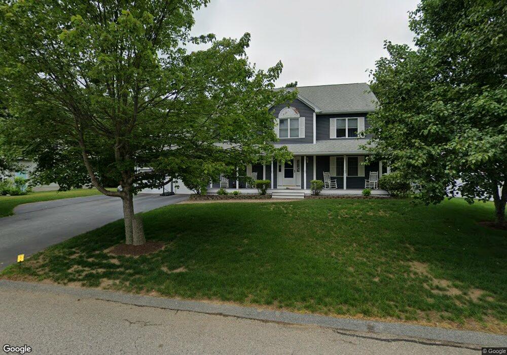
17 Woodridge Rd Millbury, MA 01527
Estimated Value: $720,648 - $802,000
4
Beds
3
Baths
2,318
Sq Ft
$328/Sq Ft
Est. Value
About This Home
This home is located at 17 Woodridge Rd, Millbury, MA 01527 and is currently estimated at $760,912, approximately $328 per square foot. 17 Woodridge Rd is a home located in Worcester County with nearby schools including Elmwood Street Elementary School, Raymond E. Shaw Elementary School, and Millbury Junior/Senior High School.
Ownership History
Date
Name
Owned For
Owner Type
Purchase Details
Closed on
Aug 30, 2001
Sold by
Tomkiewicz Thomas J
Bought by
Diamond David M and Diamond Tatiana R
Current Estimated Value
Home Financials for this Owner
Home Financials are based on the most recent Mortgage that was taken out on this home.
Original Mortgage
$275,000
Interest Rate
7.06%
Mortgage Type
Purchase Money Mortgage
Create a Home Valuation Report for This Property
The Home Valuation Report is an in-depth analysis detailing your home's value as well as a comparison with similar homes in the area
Home Values in the Area
Average Home Value in this Area
Purchase History
| Date | Buyer | Sale Price | Title Company |
|---|---|---|---|
| Diamond David M | $347,549 | -- | |
| Diamond David M | $347,549 | -- |
Source: Public Records
Mortgage History
| Date | Status | Borrower | Loan Amount |
|---|---|---|---|
| Open | Diamond David M | $275,000 | |
| Closed | Diamond David M | $275,000 | |
| Previous Owner | Diamond David M | $60,000 |
Source: Public Records
Tax History Compared to Growth
Tax History
| Year | Tax Paid | Tax Assessment Tax Assessment Total Assessment is a certain percentage of the fair market value that is determined by local assessors to be the total taxable value of land and additions on the property. | Land | Improvement |
|---|---|---|---|---|
| 2025 | $8,484 | $633,600 | $138,600 | $495,000 |
| 2024 | $7,787 | $588,600 | $128,400 | $460,200 |
| 2023 | $7,095 | $491,000 | $90,100 | $400,900 |
| 2022 | $6,350 | $423,300 | $86,500 | $336,800 |
| 2021 | $6,263 | $405,900 | $86,500 | $319,400 |
| 2020 | $6,132 | $400,000 | $86,500 | $313,500 |
| 2019 | $5,979 | $377,200 | $75,300 | $301,900 |
| 2018 | $6,137 | $375,600 | $88,400 | $287,200 |
| 2017 | $5,704 | $347,200 | $88,400 | $258,800 |
| 2016 | $5,751 | $349,400 | $88,400 | $261,000 |
| 2015 | $5,642 | $342,800 | $94,000 | $248,800 |
| 2014 | $5,050 | $295,300 | $83,500 | $211,800 |
Source: Public Records
Map
Nearby Homes
- 20 Woodridge Rd
- 11 Lexington Rd Unit 11
- Lot 1 Cooper Rd
- 73 Potter Hill Rd
- 19 Cortland Way
- 123 Riverlin St
- 64 Millbury Ave
- 75 Potter Hill Rd
- 81 Ariel Cir
- 156 Brigham Hill Rd
- 16 Jackie Dr
- 5 Edward Dr
- 8 Danielle Dr
- 28 Lincoln Ln
- 255 Riverlin St
- 46 John Dr Unit 46
- 5 Lincoln Ln Unit 5
- 14 Howe Ln
- 18 Barbara Jean St
- 17 Atwood Ave
- 15 Woodridge Rd
- 19 Woodridge Rd
- 21 Woodridge Rd
- 18 Woodridge Rd
- 16 Woodridge Rd
- 22 Woodridge Rd
- 23 Woodridge Rd
- 24 Woodridge Rd
- 28 Braney Rd
- 3 Turning Leaf Ln
- 50 Lexington Rd
- 49 Lexington Rd
- 48 Lexington Rd
- 47 Lexington Rd
- 50 Lexington Rd Unit 48 Lex
- 49 Lexington Rd
- 52 Lexington Rd
- 51 Lexington Rd
- 5 Turning Leaf Ln
- 24 Coldbrook Rd