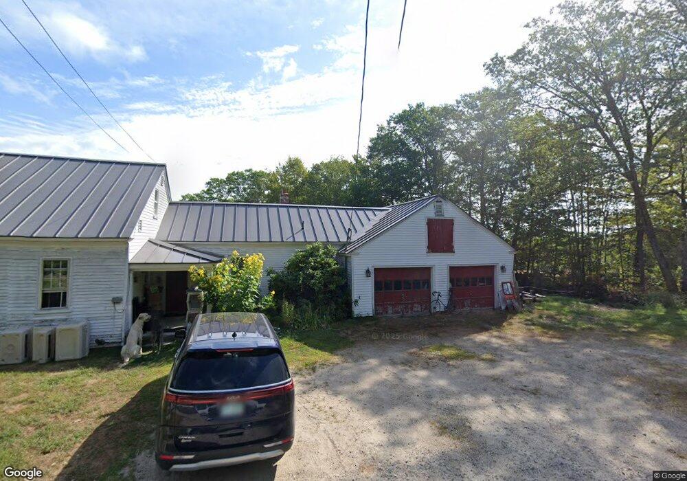
170 Browns Ridge Rd Ossipee, NH 03864
Estimated Value: $318,000 - $579,000
3
Beds
2
Baths
2,598
Sq Ft
$180/Sq Ft
Est. Value
About This Home
This home is located at 170 Browns Ridge Rd, Ossipee, NH 03864 and is currently estimated at $468,007, approximately $180 per square foot. 170 Browns Ridge Rd is a home located in Carroll County with nearby schools including Ossipee Central School, Kingswood Regional Middle School, and Kingswood Regional High School.
Ownership History
Date
Name
Owned For
Owner Type
Purchase Details
Closed on
Oct 14, 2003
Sold by
Garrett Judith A
Bought by
Lang Cheryl F and Lang Gordon M
Current Estimated Value
Home Financials for this Owner
Home Financials are based on the most recent Mortgage that was taken out on this home.
Original Mortgage
$113,000
Outstanding Balance
$53,238
Interest Rate
6.35%
Estimated Equity
$414,769
Create a Home Valuation Report for This Property
The Home Valuation Report is an in-depth analysis detailing your home's value as well as a comparison with similar homes in the area
Home Values in the Area
Average Home Value in this Area
Purchase History
| Date | Buyer | Sale Price | Title Company |
|---|---|---|---|
| Lang Cheryl F | $241,000 | -- |
Source: Public Records
Mortgage History
| Date | Status | Borrower | Loan Amount |
|---|---|---|---|
| Open | Lang Cheryl F | $113,000 |
Source: Public Records
Tax History
| Year | Tax Paid | Tax Assessment Tax Assessment Total Assessment is a certain percentage of the fair market value that is determined by local assessors to be the total taxable value of land and additions on the property. | Land | Improvement |
|---|---|---|---|---|
| 2024 | $4,356 | $375,500 | $160,800 | $214,700 |
| 2023 | $3,946 | $380,500 | $165,800 | $214,700 |
| 2022 | $4,121 | $224,200 | $58,800 | $165,400 |
| 2021 | $4,284 | $233,700 | $58,800 | $174,900 |
| 2020 | $3,985 | $233,700 | $58,800 | $174,900 |
| 2019 | $3,999 | $233,700 | $58,800 | $174,900 |
| 2018 | $4,312 | $207,300 | $43,500 | $163,800 |
| 2016 | $4,350 | $225,400 | $43,500 | $181,900 |
| 2015 | $4,132 | $225,400 | $43,500 | $181,900 |
| 2014 | $4,801 | $266,400 | $64,500 | $201,900 |
| 2013 | $4,671 | $268,600 | $64,500 | $204,100 |
Source: Public Records
Map
Nearby Homes
- Map 25-6 Upper Trask Mountain Rd
- 4 Brookwood Dr
- 45 Old Granite Rd
- 11 Wellington Ct
- 6 Wellington Ct
- 954 Route 16
- 829 Route 16
- 35 Margarets Way
- 0 Village Corner Rd Unit 15
- Map 86 L 5 Haines Hill Rd
- 16 Pollys Crossing Rd
- 45 Effingham Rd
- 1060 Route 16
- 5 John Terrace
- 00 N Wakefield Rd Unit 4
- 190 Circuit Rd
- 19 Cotton Mountain Rd
- 65 Archers Pond Rd
- Map 102 L 4 Center St
- 42 College Rd
- 180 Browns Ridge Rd
- 160 Browns Ridge Rd
- 215 Browns Ridge Rd
- 0 Upper Trask Mountain Rd
- 00 Upper Trask Mountain Rd
- 155 Browns Ridge Rd
- 210 Browns Ridge Rd
- 135 Browns Ridge Rd
- 238 Trask Mountain Rd
- 220 Browns Ridge Rd
- 241 Browns Ridge Rd
- 125 Browns Ridge Rd
- 2 Northfield Dr
- 245 Browns Ridge Rd
- 230 Browns Ridge Rd
- 110 Browns Ridge Rd
- 275 Browns Ridge Rd
- 5 Youngs Rd
- 90 Browns Ridge Rd
- 383 Browns Ridge Rd
Your Personal Tour Guide
Ask me questions while you tour the home.