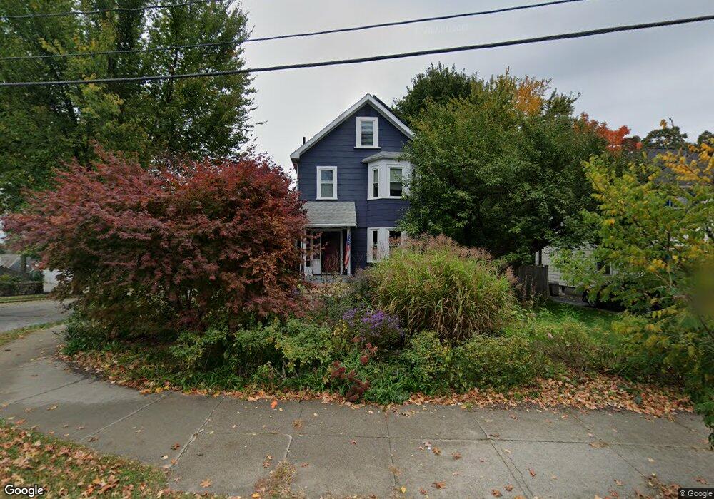
170 Cherry St West Newton, MA 02465
West Newton NeighborhoodEstimated Value: $1,147,000 - $1,332,059
4
Beds
2
Baths
2,184
Sq Ft
$575/Sq Ft
Est. Value
About This Home
This home is located at 170 Cherry St, West Newton, MA 02465 and is currently estimated at $1,256,015, approximately $575 per square foot. 170 Cherry St is a home located in Middlesex County with nearby schools including Franklin Elementary School, F.A. Day Middle School, and Newton North High School.
Ownership History
Date
Name
Owned For
Owner Type
Purchase Details
Closed on
Jun 23, 2006
Sold by
Langkopf Deborah
Bought by
Moore Eric R and Wolfe Julia
Current Estimated Value
Purchase Details
Closed on
Jan 22, 1999
Sold by
Langkopf Andrew and Langkopf Deborah
Bought by
Langdkopf Deborah
Purchase Details
Closed on
Jan 21, 1987
Sold by
Sprasansky Dorothy
Bought by
Langkopf Andrew
Create a Home Valuation Report for This Property
The Home Valuation Report is an in-depth analysis detailing your home's value as well as a comparison with similar homes in the area
Home Values in the Area
Average Home Value in this Area
Purchase History
| Date | Buyer | Sale Price | Title Company |
|---|---|---|---|
| Moore Eric R | $570,000 | -- | |
| Langdkopf Deborah | $27,000 | -- | |
| Langkopf Andrew | $187,000 | -- |
Source: Public Records
Mortgage History
| Date | Status | Borrower | Loan Amount |
|---|---|---|---|
| Open | Langkopf Andrew | $392,000 | |
| Closed | Langkopf Andrew | $135,000 |
Source: Public Records
Tax History Compared to Growth
Tax History
| Year | Tax Paid | Tax Assessment Tax Assessment Total Assessment is a certain percentage of the fair market value that is determined by local assessors to be the total taxable value of land and additions on the property. | Land | Improvement |
|---|---|---|---|---|
| 2025 | $9,661 | $985,800 | $767,600 | $218,200 |
| 2024 | $9,341 | $957,100 | $745,200 | $211,900 |
| 2023 | $8,868 | $871,100 | $569,100 | $302,000 |
| 2022 | $8,485 | $806,600 | $526,900 | $279,700 |
| 2021 | $8,187 | $760,900 | $497,100 | $263,800 |
| 2020 | $7,944 | $760,900 | $497,100 | $263,800 |
| 2019 | $7,719 | $738,700 | $482,600 | $256,100 |
| 2018 | $7,357 | $679,900 | $438,000 | $241,900 |
| 2017 | $7,132 | $641,400 | $413,200 | $228,200 |
| 2016 | $6,821 | $599,400 | $386,200 | $213,200 |
| 2015 | $6,504 | $560,200 | $360,900 | $199,300 |
Source: Public Records
Map
Nearby Homes
- 75 Cherry St
- 41 Kilburn Rd
- 287 Cherry St Unit 2
- 76 Taft Ave Unit 1
- 76 Taft Ave
- 76 Taft Ave Unit 2
- 76 Harding St
- 56 Dearborn St
- 44 Westland Ave
- 14 Cottage Place Unit 14
- 106 River St Unit 18
- 106 River St Unit 2
- 106 River St Unit 14
- 2 Elm St Unit 6
- 2 Elm St Unit 8
- 24 Tolman St Unit A
- 371 Cherry St
- 162 Myrtle St Unit 1
- 265-267 River St Unit 267
- 265-267 River St Unit 265
- 176 Cherry St
- 87 Pleasant St Unit 89
- 83 Pleasant St
- 180-182 Cherry St
- 180 Cherry St Unit 182
- 123 Fordham Rd
- 154 Cherry St
- 163 Cherry St
- 186 Cherry St
- 167 Cherry St
- 171 Cherry St
- 66 Pleasant St
- 177 Cherry St
- 22 Cappy Cir
- 115 Fordham Rd
- 124 Fordham Rd
- 157 Cherry St
- 150 Cherry St
- 18 Cappy Cir
- 183 Cherry St