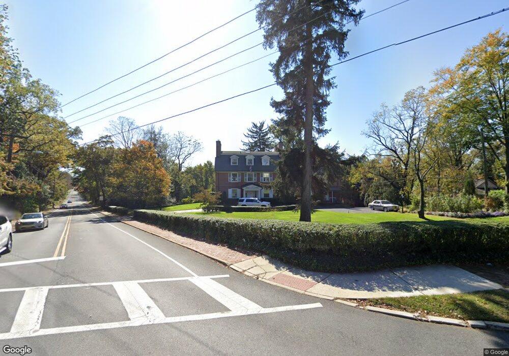
170 E Main St Moorestown, NJ 08057
Estimated Value: $1,341,000 - $1,452,969
Studio
--
Bath
5,169
Sq Ft
$272/Sq Ft
Est. Value
About This Home
This home is located at 170 E Main St, Moorestown, NJ 08057 and is currently estimated at $1,405,323, approximately $271 per square foot. 170 E Main St is a home located in Burlington County with nearby schools including Mary E. Roberts Elementary School, Moorestown Upper Elementary School, and William Allen Middle School.
Ownership History
Date
Name
Owned For
Owner Type
Purchase Details
Closed on
Jun 30, 1988
Bought by
Giordano Dorothy J
Current Estimated Value
Create a Home Valuation Report for This Property
The Home Valuation Report is an in-depth analysis detailing your home's value as well as a comparison with similar homes in the area
Home Values in the Area
Average Home Value in this Area
Purchase History
| Date | Buyer | Sale Price | Title Company |
|---|---|---|---|
| Giordano Dorothy J | -- | -- |
Source: Public Records
Tax History
| Year | Tax Paid | Tax Assessment Tax Assessment Total Assessment is a certain percentage of the fair market value that is determined by local assessors to be the total taxable value of land and additions on the property. | Land | Improvement |
|---|---|---|---|---|
| 2025 | $24,021 | $846,700 | $245,500 | $601,200 |
| 2024 | $23,293 | $846,700 | $245,500 | $601,200 |
| 2023 | $23,293 | $846,700 | $245,500 | $601,200 |
| 2022 | $23,056 | $846,700 | $245,500 | $601,200 |
| 2021 | $22,751 | $846,700 | $245,500 | $601,200 |
| 2020 | $22,607 | $846,700 | $245,500 | $601,200 |
| 2019 | $22,209 | $846,700 | $245,500 | $601,200 |
| 2018 | $21,608 | $846,700 | $245,500 | $601,200 |
| 2017 | $21,794 | $846,700 | $245,500 | $601,200 |
| 2016 | $21,718 | $846,700 | $245,500 | $601,200 |
| 2015 | $21,455 | $846,700 | $245,500 | $601,200 |
| 2014 | $20,372 | $846,700 | $245,500 | $601,200 |
Source: Public Records
Map
Nearby Homes
- 104 Mount Laurel Rd
- 127 Schooley St
- 133 Plum St Unit 6
- 308 Elm St
- 80 E 3rd St
- 66 E 3rd St
- 325 E 2nd St
- 337 E 2nd St
- 205 E Central Ave
- 228 Mill St
- 408 N Stanwick Rd
- 129 S Church St
- 451 E 2nd St
- 8 S Close Unit 8
- 526 E Main St
- 22 E Close Unit 22
- 15 W Close Unit 15
- 120 Canterbury Rd
- 35 Sisters Farmstead Dr
- 437 Windrow Clusters Dr
- 166 E Main St
- 164 E Main St
- 200 E Main St
- 210 E Main St
- 154 E Main St
- 201 E Main St
- 205 Laurence Dr
- 109 Mount Laurel Rd
- 203 E Main St
- 213 Laurence Ct
- 113 Mount Laurel Rd
- 146 E Main St
- 146 E Main St Unit 1
- 146 E Main St Unit UPPER
- 220 E Main St
- 215 E Main St
- 118 Chestnut St
- 115 Chestnut St
- 219 E Main St
- 140 E Main St
Your Personal Tour Guide
Ask me questions while you tour the home.