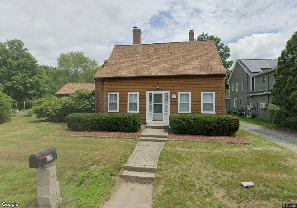
170 East St Foxboro, MA 02035
Estimated Value: $475,000 - $655,286
3
Beds
2
Baths
1,684
Sq Ft
$338/Sq Ft
Est. Value
About This Home
This home is located at 170 East St, Foxboro, MA 02035 and is currently estimated at $569,572, approximately $338 per square foot. 170 East St is a home located in Norfolk County with nearby schools including Foxborough High School, St Mary's Catholic School, and Hands-On-Montessori School.
Ownership History
Date
Name
Owned For
Owner Type
Purchase Details
Closed on
May 24, 2011
Sold by
170 East Street Rt
Bought by
Putnam Kevin L and Putnam Stephanie W
Current Estimated Value
Home Financials for this Owner
Home Financials are based on the most recent Mortgage that was taken out on this home.
Original Mortgage
$190,000
Outstanding Balance
$132,041
Interest Rate
4.88%
Mortgage Type
Purchase Money Mortgage
Estimated Equity
$437,531
Create a Home Valuation Report for This Property
The Home Valuation Report is an in-depth analysis detailing your home's value as well as a comparison with similar homes in the area
Home Values in the Area
Average Home Value in this Area
Purchase History
| Date | Buyer | Sale Price | Title Company |
|---|---|---|---|
| Putnam Kevin L | $200,000 | -- |
Source: Public Records
Mortgage History
| Date | Status | Borrower | Loan Amount |
|---|---|---|---|
| Open | Putnam Kevin L | $190,000 |
Source: Public Records
Tax History Compared to Growth
Tax History
| Year | Tax Paid | Tax Assessment Tax Assessment Total Assessment is a certain percentage of the fair market value that is determined by local assessors to be the total taxable value of land and additions on the property. | Land | Improvement |
|---|---|---|---|---|
| 2025 | $7,171 | $542,400 | $262,500 | $279,900 |
| 2024 | $7,114 | $526,600 | $278,400 | $248,200 |
| 2023 | $6,932 | $487,800 | $266,400 | $221,400 |
| 2022 | $6,556 | $451,500 | $241,500 | $210,000 |
| 2021 | $6,058 | $411,000 | $230,600 | $180,400 |
| 2020 | $5,880 | $403,600 | $230,600 | $173,000 |
| 2019 | $5,765 | $392,200 | $231,100 | $161,100 |
| 2018 | $5,521 | $378,900 | $220,800 | $158,100 |
| 2017 | $5,381 | $357,800 | $217,500 | $140,300 |
| 2016 | $5,307 | $358,100 | $210,400 | $147,700 |
| 2015 | $4,718 | $310,600 | $162,900 | $147,700 |
| 2014 | $4,656 | $310,600 | $162,900 | $147,700 |
Source: Public Records
Map
Nearby Homes
- 1 Revere Dr
- 7 Revere Dr
- 12 Community Way
- 35 Independence Dr Unit 35
- 261 East St
- 9 Independence Dr Unit 9
- 67 Morse St
- 132 Cannon Forge Dr
- 5 Lauren Ln
- 170 Cannon Forge Dr
- 2 Red Fox Run
- 25 Winter St
- 55-57 Pine Needle Ln
- 89 Oak St
- 260 Massapoag Ave
- 619 N Main St
- 3 Wampanoag Rd
- 3 Cushing Ln
- Lot One Old Wolomolopoag St
- Lot Two Old Wolomolopoag St