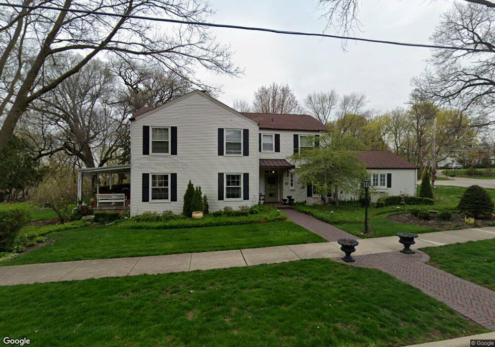
170 River Bluff Rd Elgin, IL 60120
Northeast Elgin NeighborhoodEstimated Value: $443,000 - $479,051
4
Beds
3
Baths
2,566
Sq Ft
$181/Sq Ft
Est. Value
About This Home
This home is located at 170 River Bluff Rd, Elgin, IL 60120 and is currently estimated at $465,263, approximately $181 per square foot. 170 River Bluff Rd is a home located in Kane County with nearby schools including McKinley Elementary School, Larsen Middle School, and Elgin High School.
Ownership History
Date
Name
Owned For
Owner Type
Purchase Details
Closed on
Sep 20, 2004
Sold by
King Thomas J and King Shirley K
Bought by
Omalley John and Omalley Elizabeth
Current Estimated Value
Home Financials for this Owner
Home Financials are based on the most recent Mortgage that was taken out on this home.
Original Mortgage
$228,000
Outstanding Balance
$113,333
Interest Rate
5.93%
Mortgage Type
Purchase Money Mortgage
Estimated Equity
$351,930
Create a Home Valuation Report for This Property
The Home Valuation Report is an in-depth analysis detailing your home's value as well as a comparison with similar homes in the area
Home Values in the Area
Average Home Value in this Area
Purchase History
| Date | Buyer | Sale Price | Title Company |
|---|---|---|---|
| Omalley John | $285,000 | Chicago Title Insurance Comp |
Source: Public Records
Mortgage History
| Date | Status | Borrower | Loan Amount |
|---|---|---|---|
| Open | Omalley John | $228,000 | |
| Closed | Omalley John | $28,500 |
Source: Public Records
Tax History
| Year | Tax Paid | Tax Assessment Tax Assessment Total Assessment is a certain percentage of the fair market value that is determined by local assessors to be the total taxable value of land and additions on the property. | Land | Improvement |
|---|---|---|---|---|
| 2024 | $11,187 | $147,783 | $29,787 | $117,996 |
| 2023 | $10,699 | $133,510 | $26,910 | $106,600 |
| 2022 | $10,036 | $121,738 | $24,537 | $97,201 |
| 2021 | $9,619 | $113,816 | $22,940 | $90,876 |
| 2020 | $9,363 | $108,655 | $21,900 | $86,755 |
| 2019 | $9,106 | $103,501 | $20,861 | $82,640 |
| 2018 | $8,789 | $94,900 | $19,652 | $75,248 |
| 2017 | $8,610 | $89,714 | $18,578 | $71,136 |
| 2016 | $8,237 | $83,230 | $17,235 | $65,995 |
| 2015 | $8,599 | $76,287 | $15,797 | $60,490 |
| 2014 | $8,599 | $75,345 | $15,602 | $59,743 |
| 2013 | $8,599 | $77,333 | $16,014 | $61,319 |
Source: Public Records
Map
Nearby Homes
- 841 Douglas Ave
- 851 N Grove Ave
- 920 Augusta Ave
- 1045 Richard Rd Unit 207
- 1052 Bayside Rd Unit 213
- 1074 Lakeview Rd Unit 258
- 221 Little Peninsula Rd Unit 313
- 1101 Richard Rd
- 1124 Lake Terrace Rd Unit 159
- 1131 Lakeview Rd Unit 194
- 1143 Bayside Rd Unit 149
- 1143 Lake Terrace Rd Unit 171
- 1116 Candlewood Rd Unit 356
- 1149 Bayside Rd Unit 148
- 1367 Wauchope Dr
- 244 Northshore Rd Unit 76
- 603 Douglas Ave
- 240 Parkwood Rd Unit 41
- 173 Northshore Rd
- 1167 Candida Rd Unit 532
- 1100 N Spring St
- 1050 N Spring St
- 164 River Bluff Rd
- 1028 N Spring St
- 1045 N Spring St
- 1025 Douglas Ave
- 1031 N Spring St
- 150 River Bluff Rd
- 1020 N Spring St
- 1027 N Spring St
- 1015 Douglas Ave
- 200 River Bluff Rd
- 3621/2 River Bluff Rd
- 1014 N Spring St
- 1023 N Spring St
- 1044 Center St
- 1038 Center St
- 1030 Center St
- 1015 N Spring St
- 1028 Douglas Ave
Your Personal Tour Guide
Ask me questions while you tour the home.