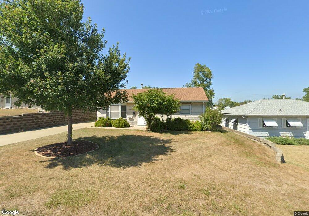
1700 12th Ave SW Cedar Rapids, IA 52404
Cleveland Area NeighborhoodEstimated Value: $136,000 - $150,000
3
Beds
1
Bath
864
Sq Ft
$166/Sq Ft
Est. Value
About This Home
This home is located at 1700 12th Ave SW, Cedar Rapids, IA 52404 and is currently estimated at $143,000, approximately $165 per square foot. 1700 12th Ave SW is a home located in Linn County with nearby schools including Junction City Elementary School, Cleveland Elementary School, and Kentucky Tech - Ashland Reg Tech Center.
Ownership History
Date
Name
Owned For
Owner Type
Purchase Details
Closed on
Aug 24, 2023
Sold by
Darling Michael S
Bought by
Darling Michael S and Darling Sean Michael
Current Estimated Value
Create a Home Valuation Report for This Property
The Home Valuation Report is an in-depth analysis detailing your home's value as well as a comparison with similar homes in the area
Home Values in the Area
Average Home Value in this Area
Purchase History
| Date | Buyer | Sale Price | Title Company |
|---|---|---|---|
| Darling Michael S | -- | None Listed On Document | |
| Darling Michael S | -- | None Listed On Document |
Source: Public Records
Tax History Compared to Growth
Tax History
| Year | Tax Paid | Tax Assessment Tax Assessment Total Assessment is a certain percentage of the fair market value that is determined by local assessors to be the total taxable value of land and additions on the property. | Land | Improvement |
|---|---|---|---|---|
| 2025 | $1,666 | $130,100 | $29,600 | $100,500 |
| 2024 | $1,944 | $122,200 | $27,000 | $95,200 |
| 2023 | $1,944 | $120,200 | $27,000 | $93,200 |
| 2022 | $1,806 | $104,400 | $22,900 | $81,500 |
| 2021 | $1,860 | $99,600 | $22,900 | $76,700 |
| 2020 | $1,860 | $96,200 | $21,600 | $74,600 |
| 2019 | $1,654 | $88,500 | $21,600 | $66,900 |
| 2018 | $1,602 | $88,500 | $21,600 | $66,900 |
| 2017 | $1,656 | $87,800 | $21,600 | $66,200 |
| 2016 | $1,751 | $85,700 | $21,600 | $64,100 |
| 2015 | $1,743 | $85,275 | $21,560 | $63,715 |
| 2014 | $1,558 | $87,957 | $21,560 | $66,397 |
| 2013 | $1,576 | $87,957 | $21,560 | $66,397 |
Source: Public Records
Map
Nearby Homes
- 1206 18th St SW
- 1807 9th Ave SW
- 1812 Holly Meadow Ave SW
- 1818 Holly Meadow Ave SW
- 1806 Holly Meadow Ave SW
- 1824 Holly Meadow Ave SW
- 1253 20th St SW
- 1801 Shady Grove Rd SW
- 1913 Holly Meadow Ave SW
- 1832 8th Ave SW
- 1960 Rockford Rd SW Unit 45
- 1400 7th Ave SW
- 1602 1st Ave NW
- 2025 18th St SW
- 1121 15th Ave SW
- 2178 Chandler St SW
- 1227 19th Ave SW
- Remington - Cedar Rapids Plan at Whispering Pines
- Copeland Plan at Whispering Pines
- Meadowbrook - Cedar Rapids Plan at Stags Leap Estates
- 1702 12th Ave SW
- 1610 12th Ave SW
- 1704 12th Ave SW
- 1608 12th Ave SW
- 1703 11th Ave SW
- 1705 11th Ave SW
- 1701 11th Ave SW
- 1606 12th Ave SW
- 1706 12th Ave SW
- 1707 11th Ave SW
- 1611 11th Ave SW
- 1703 12th Ave SW
- 1701 12th Ave SW
- 1705 12th Ave SW
- 1609 12th Ave SW
- 1607 12th Ave SW
- 1709 11th Ave SW
- 1604 12th Ave SW
- 1708 12th Ave SW
- 1707 12th Ave SW