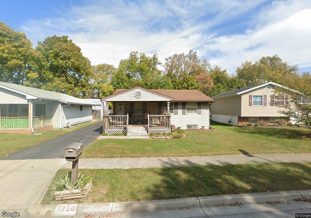
1700 Creekside Dr Columbus, OH 43223
Riverbend NeighborhoodEstimated Value: $200,000 - $236,000
3
Beds
1
Bath
896
Sq Ft
$246/Sq Ft
Est. Value
About This Home
This home is located at 1700 Creekside Dr, Columbus, OH 43223 and is currently estimated at $220,787, approximately $246 per square foot. 1700 Creekside Dr is a home located in Franklin County with nearby schools including James A Harmon Elementary School, Franklin Woods Intermediate School, and Finland Middle School.
Ownership History
Date
Name
Owned For
Owner Type
Purchase Details
Closed on
Jul 29, 2024
Sold by
Grant Rick A and Grant Margaret A
Bought by
Grant Margaret A
Current Estimated Value
Purchase Details
Closed on
Mar 11, 2000
Sold by
Grant Rick A
Bought by
Grant Rick A and Grant Margaret A
Home Financials for this Owner
Home Financials are based on the most recent Mortgage that was taken out on this home.
Original Mortgage
$80,100
Interest Rate
8.3%
Mortgage Type
Balloon
Purchase Details
Closed on
Jan 26, 1999
Sold by
Gutherie James E and Gutherie Nedra E
Bought by
Grant Rick A
Purchase Details
Closed on
May 9, 1989
Bought by
Gutherie James E
Purchase Details
Closed on
Aug 1, 1973
Create a Home Valuation Report for This Property
The Home Valuation Report is an in-depth analysis detailing your home's value as well as a comparison with similar homes in the area
Home Values in the Area
Average Home Value in this Area
Purchase History
| Date | Buyer | Sale Price | Title Company |
|---|---|---|---|
| Grant Margaret A | -- | None Listed On Document | |
| Grant Rick A | -- | Midwest Title Agency | |
| Grant Rick A | $80,000 | -- | |
| Gutherie James E | $58,900 | -- | |
| -- | $27,000 | -- |
Source: Public Records
Mortgage History
| Date | Status | Borrower | Loan Amount |
|---|---|---|---|
| Previous Owner | Grant Rick A | $80,100 |
Source: Public Records
Tax History Compared to Growth
Tax History
| Year | Tax Paid | Tax Assessment Tax Assessment Total Assessment is a certain percentage of the fair market value that is determined by local assessors to be the total taxable value of land and additions on the property. | Land | Improvement |
|---|---|---|---|---|
| 2024 | $2,384 | $65,390 | $19,010 | $46,380 |
| 2023 | $2,342 | $65,380 | $19,005 | $46,375 |
| 2022 | $1,804 | $36,970 | $9,910 | $27,060 |
| 2021 | $1,841 | $36,970 | $9,910 | $27,060 |
| 2020 | $1,830 | $36,970 | $9,910 | $27,060 |
| 2019 | $1,689 | $30,100 | $8,260 | $21,840 |
| 2018 | $1,581 | $30,100 | $8,260 | $21,840 |
| 2017 | $1,577 | $30,100 | $8,260 | $21,840 |
| 2016 | $1,480 | $24,470 | $4,800 | $19,670 |
| 2015 | $1,480 | $24,470 | $4,800 | $19,670 |
| 2014 | $1,482 | $24,470 | $4,800 | $19,670 |
| 2013 | $816 | $27,160 | $5,320 | $21,840 |
Source: Public Records
Map
Nearby Homes
- 2800 Alkire Rd
- 1520 Fall Brook Rd
- 0 Glencreek Rd
- 2894 Creith Ct
- 3326 Bluhm Ct
- 2195 Big Run Ave
- 2930 Alkire Rd
- 2937 Rundell Dr
- 2856 Chesfield Dr
- 2255 Harrisburg Pike
- 1465 Tall Meadows Dr
- 1657 Ripplebrook Rd
- 3206 Andy Terrace
- 2103 Keller Place W
- 2929 Briggs Rd
- 3488 Rocky Rd
- 1168 Racine Ave
- 1181 Onslow Dr
- 0 S Central Ave
- 1226 Pinnacle Dr
- 1696 Creekside Dr
- 1704 Creekside Dr
- 1692 Creekside Dr
- 1708 Creekside Dr
- 1688 Creekside Dr
- 1714 Creekside Dr
- 1705 Creekside Dr Unit ROCK
- 1705 Creekside Dr
- 1709 Creekside Dr
- 1684 Creekside Dr
- 1701 Creekside Dr
- 1715 Creekside Dr
- 1720 Creekside Dr
- 1697 Creekside Dr
- 1719 Creekside Dr Unit ROCK
- 1719 Creekside Dr
- 1693 Creekside Dr
- 1725 Creekside Dr
- 1689 Creekside Dr