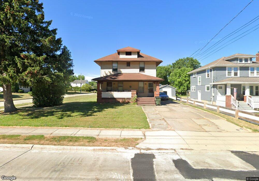
1700 E 290th St Wickliffe, OH 44092
Estimated Value: $209,000 - $224,000
4
Beds
2
Baths
971
Sq Ft
$224/Sq Ft
Est. Value
About This Home
This home is located at 1700 E 290th St, Wickliffe, OH 44092 and is currently estimated at $217,564, approximately $224 per square foot. 1700 E 290th St is a home located in Lake County with nearby schools including Wickliffe Elementary School, Wickliffe Middle School, and Wickliffe High School.
Ownership History
Date
Name
Owned For
Owner Type
Purchase Details
Closed on
Apr 4, 2010
Sold by
Lane Joseph M and Lane Nancy J
Bought by
Lane Nancy J
Current Estimated Value
Purchase Details
Closed on
Apr 26, 2001
Sold by
Lane Nancy J
Bought by
Lane Nancy J and Lane Joseph M
Purchase Details
Closed on
May 2, 1994
Bought by
Lane Joseph M
Create a Home Valuation Report for This Property
The Home Valuation Report is an in-depth analysis detailing your home's value as well as a comparison with similar homes in the area
Home Values in the Area
Average Home Value in this Area
Purchase History
| Date | Buyer | Sale Price | Title Company |
|---|---|---|---|
| Lane Nancy J | -- | Enterprise Title Agency Inc | |
| Lane Nancy J | -- | Enterprise Title Agency Inc | |
| Lane Joseph M | $95,500 | -- |
Source: Public Records
Tax History
| Year | Tax Paid | Tax Assessment Tax Assessment Total Assessment is a certain percentage of the fair market value that is determined by local assessors to be the total taxable value of land and additions on the property. | Land | Improvement |
|---|---|---|---|---|
| 2025 | -- | $70,740 | $17,210 | $53,530 |
| 2024 | -- | $70,740 | $17,210 | $53,530 |
| 2023 | -- | $51,440 | $14,570 | $36,870 |
| 2022 | $3,073 | $51,440 | $14,570 | $36,870 |
| 2021 | $3,084 | $51,440 | $14,570 | $36,870 |
| 2020 | $2,843 | $42,170 | $11,950 | $30,220 |
| 2019 | $2,842 | $42,170 | $11,950 | $30,220 |
| 2018 | $3,079 | $36,030 | $13,710 | $22,320 |
| 2017 | $2,537 | $36,030 | $13,710 | $22,320 |
| 2016 | $2,586 | $36,030 | $13,710 | $22,320 |
| 2015 | $2,541 | $36,030 | $13,710 | $22,320 |
| 2014 | $2,246 | $36,030 | $13,710 | $22,320 |
| 2013 | $2,245 | $36,030 | $13,710 | $22,320 |
Source: Public Records
Map
Nearby Homes
- 28900 Euclid Ave
- 28756 Hazel Ave
- 1354 Craneing Rd
- 0 Green Ridge Dr
- 1525 Old School Way
- 29315 Nehls Park Dr
- 2715 Cabin Dr
- 1526 E 298th St
- 1540 E 298th St
- 27701 Mills Ave Unit 2G
- 1670 Hillandale Dr
- 29136 Norman Ave
- 815 E 272nd St
- 730 Hemlock Dr
- 670 Hemlock Dr
- 953 Bryn Mawr Ave
- 597 Hemlock Dr
- 591 Hemlock Dr
- 29566 Shaker Dr
- 1719 E 300th St
- 1534 E 290th St
- 1530 E 290th St
- 1710 E 290th St
- 28933 Alton Rd
- 28938 Alton Rd
- 1714 E 290th St
- 28923 Alton Rd
- 28934 Alton Rd
- 1720 E 290th St
- 1701 E 290th St
- 1707 E 290th St
- 1523 E 290th St
- 1527 E 290th St
- 28915 Alton Rd
- 28928 Alton Rd
- 1713 E 290th St
- 1724 E 290th St
- 28940 Euclid Ave Unit 2
- 28940 Euclid Ave
- 28905 Alton Rd
Your Personal Tour Guide
Ask me questions while you tour the home.