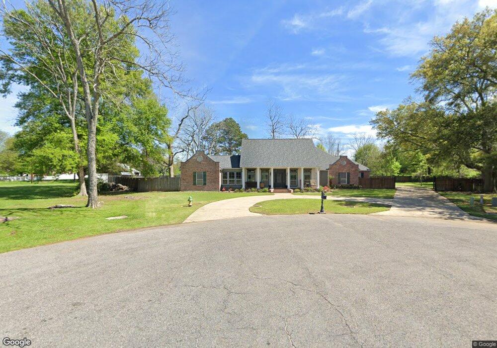
1700 Lansdown Ave Port Allen, LA 70767
West Baton Rouge Parish NeighborhoodEstimated Value: $456,740 - $519,000
--
Bed
--
Bath
2,829
Sq Ft
$169/Sq Ft
Est. Value
About This Home
This home is located at 1700 Lansdown Ave, Port Allen, LA 70767 and is currently estimated at $477,185, approximately $168 per square foot. 1700 Lansdown Ave is a home located in West Baton Rouge Parish with nearby schools including Brusly Elementary School, Lukeville Upper Elementary School, and Brusly Middle School.
Ownership History
Date
Name
Owned For
Owner Type
Purchase Details
Closed on
Dec 22, 2021
Sold by
Engerradupuy Rita S and Dupuy Gregg A
Bought by
Marino Kyle T and Marino Madelyn R
Current Estimated Value
Home Financials for this Owner
Home Financials are based on the most recent Mortgage that was taken out on this home.
Original Mortgage
$383,325
Outstanding Balance
$299,704
Interest Rate
2.34%
Estimated Equity
$177,481
Create a Home Valuation Report for This Property
The Home Valuation Report is an in-depth analysis detailing your home's value as well as a comparison with similar homes in the area
Home Values in the Area
Average Home Value in this Area
Purchase History
| Date | Buyer | Sale Price | Title Company |
|---|---|---|---|
| Marino Kyle T | $403,500 | None Available |
Source: Public Records
Mortgage History
| Date | Status | Borrower | Loan Amount |
|---|---|---|---|
| Open | Marino Kyle T | $383,325 |
Source: Public Records
Tax History Compared to Growth
Tax History
| Year | Tax Paid | Tax Assessment Tax Assessment Total Assessment is a certain percentage of the fair market value that is determined by local assessors to be the total taxable value of land and additions on the property. | Land | Improvement |
|---|---|---|---|---|
| 2024 | $2,651 | $34,870 | $8,550 | $26,320 |
| 2023 | $2,747 | $33,950 | $6,500 | $27,450 |
| 2022 | $3,561 | $33,950 | $6,500 | $27,450 |
| 2021 | $3,641 | $33,950 | $6,500 | $27,450 |
| 2020 | $3,310 | $30,560 | $5,850 | $24,710 |
| 2019 | $2,819 | $24,990 | $5,430 | $19,560 |
| 2018 | $2,871 | $24,990 | $5,430 | $19,560 |
| 2017 | $2,651 | $24,990 | $5,430 | $19,560 |
| 2015 | $2,102 | $24,480 | $4,920 | $19,560 |
| 2014 | $2,068 | $24,480 | $4,920 | $19,560 |
| 2013 | $2,068 | $24,480 | $4,920 | $19,560 |
Source: Public Records
Map
Nearby Homes
- 1959 Fairview Ave
- 1394 Rue Riviere
- 4747 Evergreen Dr
- 2218 Silverstone Ave
- 2217 Silverstone Ave
- 1152 Freeman Ln
- 2742 Emily Dr
- 2488 Oak Alley Dr
- 4000 Lake Beau Pre Blvd Unit 110
- 4000 Lake Beau Pre Blvd Unit 198
- 5565 Ducros Dr
- 3926 Northshore Ave
- 5024 Myrtle Trail Dr
- 3822 Southpass Ave
- 3839 Southpass Ave
- 5129 Amberlyn Dr
- 6455 Louisiana 1
- 6312 Louisiana 1
- 526 Gwin St
- 3531 Riverway Dr
- 1700 Lansdowne Dr
- 1700 Landsdown Dr
- 1707 Lansdown Ave
- 1710 Lansdown Ave
- 4530 S River Rd
- 1710 Lansdowne Dr
- 4464 S River Rd
- 4549 S River Rd
- 1723 Lansdown Ave
- 1730 Lansdown Ave
- 1721 Fairview Dr
- 1721 Fairview Ave
- 1705 Fairview Ave
- 1743 Fairview Ave
- 1635 Fairview Ave
- 1757 Fairview Ave
- 1743 Lansdown Ave
- 1743 Lansdowne Dr
- 1750 Lansdown Ave
- 1769 Fairview Ave