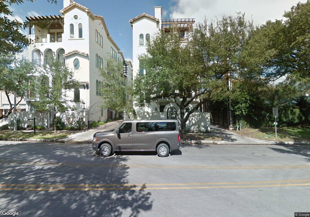
1700 Sunset Blvd Unit D Houston, TX 77005
University Place NeighborhoodEstimated Value: $1,334,959 - $1,525,000
3
Beds
4
Baths
3,976
Sq Ft
$360/Sq Ft
Est. Value
About This Home
This home is located at 1700 Sunset Blvd Unit D, Houston, TX 77005 and is currently estimated at $1,431,490, approximately $360 per square foot. 1700 Sunset Blvd Unit D is a home located in Harris County with nearby schools including Poe Elementary School, Lanier Middle School, and Lamar High School.
Ownership History
Date
Name
Owned For
Owner Type
Purchase Details
Closed on
Sep 17, 2021
Sold by
Daniels-Koun Randolph
Bought by
Daniels-Kolin Randolph and Preston Ashley
Current Estimated Value
Home Financials for this Owner
Home Financials are based on the most recent Mortgage that was taken out on this home.
Original Mortgage
$548,250
Outstanding Balance
$418,482
Interest Rate
2.1%
Mortgage Type
New Conventional
Estimated Equity
$1,013,008
Purchase Details
Closed on
Dec 26, 2013
Sold by
5177 Builders Ltd
Bought by
Daniels Kolin Randolph
Home Financials for this Owner
Home Financials are based on the most recent Mortgage that was taken out on this home.
Original Mortgage
$743,920
Interest Rate
4.36%
Mortgage Type
New Conventional
Create a Home Valuation Report for This Property
The Home Valuation Report is an in-depth analysis detailing your home's value as well as a comparison with similar homes in the area
Home Values in the Area
Average Home Value in this Area
Purchase History
| Date | Buyer | Sale Price | Title Company |
|---|---|---|---|
| Daniels-Kolin Randolph | -- | None Listed On Document | |
| Daniels Kolin Randolph | -- | None Available |
Source: Public Records
Mortgage History
| Date | Status | Borrower | Loan Amount |
|---|---|---|---|
| Open | Daniels-Kolin Randolph | $548,250 | |
| Previous Owner | Daniels Kolin Randolph | $743,920 |
Source: Public Records
Tax History Compared to Growth
Tax History
| Year | Tax Paid | Tax Assessment Tax Assessment Total Assessment is a certain percentage of the fair market value that is determined by local assessors to be the total taxable value of land and additions on the property. | Land | Improvement |
|---|---|---|---|---|
| 2025 | $12,709 | $1,051,439 | $274,287 | $777,152 |
| 2024 | $12,709 | $1,120,716 | $274,287 | $846,429 |
| 2023 | $12,709 | $974,110 | $274,287 | $699,823 |
| 2022 | $21,449 | $974,110 | $274,287 | $699,823 |
| 2021 | $24,283 | $1,041,882 | $274,287 | $767,595 |
| 2020 | $23,239 | $959,674 | $274,287 | $685,387 |
| 2019 | $25,512 | $1,008,194 | $274,287 | $733,907 |
| 2018 | $19,866 | $991,361 | $274,287 | $717,074 |
| 2017 | $27,010 | $1,068,177 | $274,287 | $793,890 |
| 2016 | $27,010 | $1,068,177 | $274,287 | $793,890 |
| 2015 | $18,892 | $1,068,177 | $274,287 | $793,890 |
| 2014 | $18,892 | $922,592 | $274,287 | $648,305 |
Source: Public Records
Map
Nearby Homes
- 1700 Sunset Blvd Unit E
- 1723 Albans Rd
- 1723 Sunset Blvd
- 1801 Sunset Blvd
- 1804 Bolsover St
- 5309 Cherokee St
- 1832 Albans Rd
- 5319 Mandell St
- 1928 Dunstan Rd
- 1723 Milford St
- 2019 Bissonnet St
- 1741 Banks St
- 1531 Milford St
- 1656 Banks St
- 2042 Bissonnet St
- 1819 Banks St
- 2114 Wroxton Rd
- 2121 Quenby St
- 2039 South Blvd
- 2122 Wroxton Rd
- 1700 Sunset Blvd Unit H
- 1700 Sunset Blvd Unit F
- 1700 Sunset Blvd Unit B
- 1700 Sunset Blvd Unit G
- 1700 Sunset Blvd Unit C
- 1700 Sunset Blvd Unit A
- 1700 Sunset Blvd
- 1700A Sunset Blvd
- 1700G Sunset Blvd
- 1700E Sunset Blvd
- 1700 Sunset Blvd
- 1708 Sunset Blvd
- 1700 Sunset Bl
- 5334 Cherokee St
- 1710 Sunset Blvd
- 1710 Sunset Blvd Unit A
- 1714 Sunset Blvd
- 1716 Sunset Blvd
- 1711 Albans Rd
- 1703 Albans Rd Unit 4