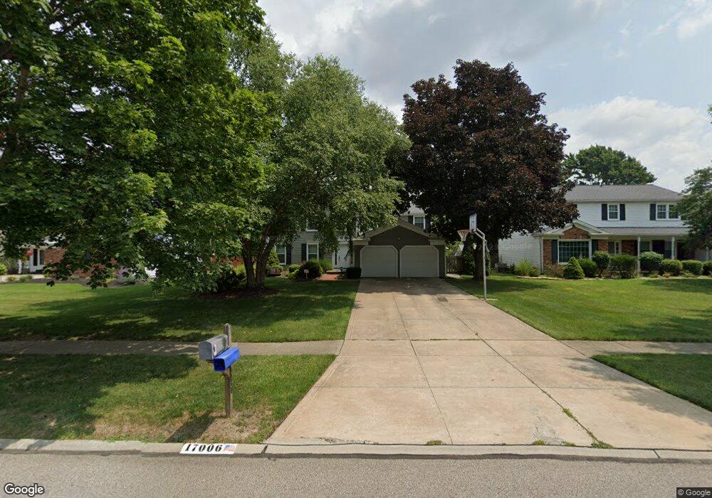
17006 Deer Path Dr Strongsville, OH 44136
Estimated Value: $372,059 - $407,000
4
Beds
3
Baths
2,004
Sq Ft
$195/Sq Ft
Est. Value
About This Home
This home is located at 17006 Deer Path Dr, Strongsville, OH 44136 and is currently estimated at $391,265, approximately $195 per square foot. 17006 Deer Path Dr is a home located in Cuyahoga County with nearby schools including Strongsville High School and Sts Joseph & John Interparochial School.
Ownership History
Date
Name
Owned For
Owner Type
Purchase Details
Closed on
Sep 7, 2004
Sold by
Synk Kevin C and Synk Andrea M
Bought by
Naso Carl W and Naso Tina L
Current Estimated Value
Home Financials for this Owner
Home Financials are based on the most recent Mortgage that was taken out on this home.
Original Mortgage
$192,100
Outstanding Balance
$97,007
Interest Rate
6.17%
Mortgage Type
Purchase Money Mortgage
Estimated Equity
$294,258
Purchase Details
Closed on
Aug 18, 1989
Sold by
Catani Thomas P and Catani Elizabeth
Bought by
Synk Kevin C
Purchase Details
Closed on
Apr 13, 1987
Sold by
Toy Glenn A
Bought by
Catani Thomas P and Catani Elizabeth
Purchase Details
Closed on
Aug 4, 1976
Bought by
Toy Glenn A
Purchase Details
Closed on
Jan 1, 1975
Bought by
J D Land Co
Create a Home Valuation Report for This Property
The Home Valuation Report is an in-depth analysis detailing your home's value as well as a comparison with similar homes in the area
Home Values in the Area
Average Home Value in this Area
Purchase History
| Date | Buyer | Sale Price | Title Company |
|---|---|---|---|
| Naso Carl W | $226,000 | -- | |
| Synk Kevin C | $132,000 | -- | |
| Catani Thomas P | $106,000 | -- | |
| Toy Glenn A | $59,300 | -- | |
| J D Land Co | -- | -- |
Source: Public Records
Mortgage History
| Date | Status | Borrower | Loan Amount |
|---|---|---|---|
| Open | Naso Carl W | $192,100 |
Source: Public Records
Tax History Compared to Growth
Tax History
| Year | Tax Paid | Tax Assessment Tax Assessment Total Assessment is a certain percentage of the fair market value that is determined by local assessors to be the total taxable value of land and additions on the property. | Land | Improvement |
|---|---|---|---|---|
| 2024 | $5,336 | $113,645 | $22,015 | $91,630 |
| 2023 | $5,554 | $88,700 | $18,590 | $70,110 |
| 2022 | $5,514 | $88,690 | $18,590 | $70,110 |
| 2021 | $5,470 | $88,690 | $18,590 | $70,110 |
| 2020 | $5,068 | $72,700 | $15,230 | $57,470 |
| 2019 | $4,919 | $207,700 | $43,500 | $164,200 |
| 2018 | $4,528 | $72,700 | $15,230 | $57,470 |
| 2017 | $4,676 | $70,490 | $12,250 | $58,240 |
| 2016 | $4,638 | $70,490 | $12,250 | $58,240 |
| 2015 | $4,669 | $70,490 | $12,250 | $58,240 |
| 2014 | $4,669 | $69,970 | $12,250 | $57,720 |
Source: Public Records
Map
Nearby Homes
- 17069 Partridge Dr
- 17024 Bear Creek Ln
- 18162 Fawn Cir
- 16650 Lanier Ave
- 17159 Turkey Meadow Ln
- 17682 Drake Rd
- 18294 Drake Rd
- 18630 Shurmer Rd
- 16450 Howe Rd
- 17934 Cambridge Oval
- 15639 Indianhead Ln
- 16486 S Red Rock Dr
- 19311 Bradford Ct
- 19297 Lauren Way
- 18411 Yorktown Oval
- 17259 Woodshire Dr
- 17130 Golden Star Dr
- 14826 Lenox Dr
- 14703 Lenox Dr Unit 103
- 19513 Lunn Rd
- 17010 Deer Path Dr
- 17002 Deer Path Dr
- 17000 Deer Path Dr
- 17014 Deer Path Dr
- 17015 Beaver Cir
- 17005 Beaver Cir
- 17021 Raccoon Trail
- 16998 Deer Path Dr
- 17021 Beaver Cir
- 17015 Deer Path Dr
- 17005 Deer Path Dr
- 17023 Raccoon Trail
- 16476 Hampton Chase
- 17026 Deer Path Dr
- 17027 Beaver Cir
- 16996 Deer Path Dr
- 17006 Beaver Cir
- 17003 Deer Path Dr
- 17021 Deer Path Dr
- 17027 Raccoon Trail