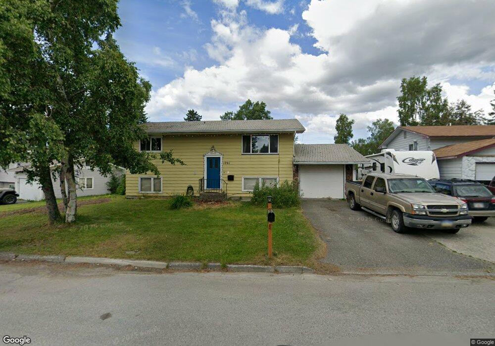
1701 Cache Dr Anchorage, AK 99507
Campbell Park NeighborhoodEstimated Value: $402,442 - $623,000
4
Beds
2
Baths
1,728
Sq Ft
$280/Sq Ft
Est. Value
About This Home
This home is located at 1701 Cache Dr, Anchorage, AK 99507 and is currently estimated at $483,111, approximately $279 per square foot. 1701 Cache Dr is a home located in Anchorage Municipality with nearby schools including Tudor Elementary School, Wendler Middle School, and Bettye Davis East Anchorage High School.
Ownership History
Date
Name
Owned For
Owner Type
Purchase Details
Closed on
Dec 11, 1998
Sold by
Horn Brent Lee and Horn Michele Ida
Bought by
Hays Robert K and Spartz-Hays Robin T
Current Estimated Value
Home Financials for this Owner
Home Financials are based on the most recent Mortgage that was taken out on this home.
Original Mortgage
$139,244
Outstanding Balance
$31,629
Interest Rate
6.78%
Mortgage Type
New Conventional
Estimated Equity
$451,482
Purchase Details
Closed on
May 31, 1993
Sold by
Byrns George Edgar and Byrns Kristine J
Bought by
Horn Brent Lee and Horn Michele Ida
Home Financials for this Owner
Home Financials are based on the most recent Mortgage that was taken out on this home.
Original Mortgage
$113,806
Interest Rate
7.5%
Mortgage Type
FHA
Create a Home Valuation Report for This Property
The Home Valuation Report is an in-depth analysis detailing your home's value as well as a comparison with similar homes in the area
Home Values in the Area
Average Home Value in this Area
Purchase History
| Date | Buyer | Sale Price | Title Company |
|---|---|---|---|
| Hays Robert K | -- | -- | |
| Horn Brent Lee | -- | -- |
Source: Public Records
Mortgage History
| Date | Status | Borrower | Loan Amount |
|---|---|---|---|
| Open | Hays Robert K | $139,244 | |
| Previous Owner | Horn Brent Lee | $113,806 |
Source: Public Records
Tax History
| Year | Tax Paid | Tax Assessment Tax Assessment Total Assessment is a certain percentage of the fair market value that is determined by local assessors to be the total taxable value of land and additions on the property. | Land | Improvement |
|---|---|---|---|---|
| 2025 | $4,590 | $369,200 | $88,500 | $280,700 |
| 2024 | $4,590 | $359,300 | $88,500 | $270,800 |
| 2023 | $5,599 | $328,800 | $88,500 | $240,300 |
| 2022 | $4,602 | $323,300 | $88,600 | $234,700 |
| 2021 | $5,002 | $277,600 | $88,600 | $189,000 |
| 2020 | $3,783 | $272,800 | $88,600 | $184,200 |
| 2019 | $3,542 | $266,500 | $88,600 | $177,900 |
| 2018 | $3,465 | $261,300 | $88,600 | $172,700 |
| 2017 | $3,809 | $263,200 | $88,600 | $174,600 |
| 2016 | $3,248 | $269,800 | $87,100 | $182,700 |
| 2015 | $3,248 | $262,800 | $87,100 | $175,700 |
| 2014 | $3,248 | $246,500 | $65,800 | $180,700 |
Source: Public Records
Map
Nearby Homes
- 1715 Bartlett Dr
- 5251 Little Tree St
- 2031 Campbell Place
- 1506 Cache Dr
- 5320 Larkspur St
- 2090 Dimond Dr
- 1643 Mountainman Loop Unit 32
- 1746 E 58th Cir
- L26 B2 Laurel Acres
- L25 B2 Laurel Acres
- L9A Laurel St
- 5409 Samoa St Unit 7C
- 2638 Lauren Creek Loop Unit 14
- 1642 E Dowling Rd
- 2800 E Dowling Rd
- 4511 Folker St Unit 2B
- 2830 Happy Ln Unit 6
- 4530 Wright St Unit 12
- 4510 Wright St Unit 17
- 4510 Wright St Unit 26
- 1711 Cache Dr
- 1615 Cache Dr
- 1717 Cache Dr
- 1706 Bartlett Dr
- 1720 Bartlett Dr
- 1646 Bartlett Dr
- 1732 Bartlett Dr
- 1806 Barlett
- 1605 Cache Dr
- 1727 Cache Dr
- 1720 Cache Dr
- 1734 Cache Dr
- 1705 Wickersham Dr
- 1727 Bartlett Dr
- 1631 Bartlett Dr
- 1726 Cache Dr
- 1735 Bartlett Dr
- 1621 Bartlett Dr
- 1805 Bartlett Dr
- 1815 Bartlett Dr
Your Personal Tour Guide
Ask me questions while you tour the home.