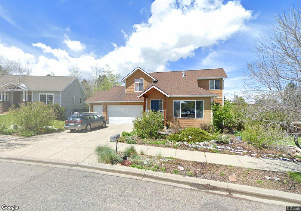
1701 Fir Crest Ct Bozeman, MT 59715
East Bozeman NeighborhoodEstimated Value: $870,000 - $951,554
4
Beds
4
Baths
1,368
Sq Ft
$666/Sq Ft
Est. Value
About This Home
This home is located at 1701 Fir Crest Ct, Bozeman, MT 59715 and is currently estimated at $911,639, approximately $666 per square foot. 1701 Fir Crest Ct is a home located in Gallatin County with nearby schools including Longfellow School, Sacajawea Middle School, and Bozeman High School.
Ownership History
Date
Name
Owned For
Owner Type
Purchase Details
Closed on
Oct 30, 2015
Sold by
Voegeli Sandra L and Voegeli Vincent J
Bought by
Hartshorn Anthony S and Bakker Victoria J
Current Estimated Value
Home Financials for this Owner
Home Financials are based on the most recent Mortgage that was taken out on this home.
Original Mortgage
$262,400
Outstanding Balance
$206,949
Interest Rate
3.87%
Mortgage Type
New Conventional
Estimated Equity
$704,690
Purchase Details
Closed on
May 30, 2007
Sold by
Galle Daniel J and Galle Kelly Lynn Bowen
Bought by
Voegeli Sandra L and Voegeli Vincent J
Home Financials for this Owner
Home Financials are based on the most recent Mortgage that was taken out on this home.
Original Mortgage
$256,000
Interest Rate
6.12%
Mortgage Type
Purchase Money Mortgage
Create a Home Valuation Report for This Property
The Home Valuation Report is an in-depth analysis detailing your home's value as well as a comparison with similar homes in the area
Home Values in the Area
Average Home Value in this Area
Purchase History
| Date | Buyer | Sale Price | Title Company |
|---|---|---|---|
| Hartshorn Anthony S | -- | Security Title Company | |
| Voegeli Sandra L | -- | Mte |
Source: Public Records
Mortgage History
| Date | Status | Borrower | Loan Amount |
|---|---|---|---|
| Open | Hartshorn Anthony S | $262,400 | |
| Previous Owner | Voegeli Sandra L | $256,000 |
Source: Public Records
Tax History Compared to Growth
Tax History
| Year | Tax Paid | Tax Assessment Tax Assessment Total Assessment is a certain percentage of the fair market value that is determined by local assessors to be the total taxable value of land and additions on the property. | Land | Improvement |
|---|---|---|---|---|
| 2025 | $3,676 | $778,300 | $0 | $0 |
| 2024 | $5,859 | $880,200 | $0 | $0 |
| 2023 | $5,661 | $880,200 | $0 | $0 |
| 2022 | $3,949 | $515,100 | $0 | $0 |
| 2021 | $4,358 | $515,100 | $0 | $0 |
| 2020 | $3,620 | $424,300 | $0 | $0 |
| 2019 | $3,703 | $424,300 | $0 | $0 |
| 2018 | $3,185 | $338,100 | $0 | $0 |
| 2017 | $3,152 | $338,100 | $0 | $0 |
| 2016 | $2,895 | $307,200 | $0 | $0 |
| 2015 | $2,898 | $307,200 | $0 | $0 |
| 2014 | $2,581 | $161,014 | $0 | $0 |
Source: Public Records
Map
Nearby Homes
- 1413 Cherry Dr
- 1103 S Pinecrest Dr
- 1207 S Spruce Dr
- 1121 Cherry Dr
- 1109 E Kagy Blvd
- 2934 Sourdough Rd
- 3045 Sourdough Rd
- 1816 S Rouse Ave
- 1816 S Rouse Ave Unit 1 & 2
- 3002 Candy Ln
- 1952 Little Cottage Ln
- TBD - Lot 18 Boreal Way
- 2020 S Rouse Ave Unit 7
- TBD Lot 33 Boreal Way
- 1659 S Black Ave
- 130 Cook Ct
- 8733 Huffman Ln
- 29 Hoffman Dr
- 125 Blossom Way
- 1919 Spring Creek Dr
- 1715 Fir Crest Ct
- 1731 Fir Crest Ct
- 1736 Fir Crest Ct
- 1751 Fir Crest Ct
- 1328 Holly Dr
- 1212 S Pinecrest Dr
- 1320 Holly Dr
- 1332 Holly Dr
- 1215 N Pinecrest Dr
- 1311 Holly Dr
- 1408 Ash Dr
- 1211 S Pinecrest Dr
- 1773 Fir Crest Ct
- 1336 Holly Dr
- 1770 Fir Crest Ct
- 1210 S Pinecrest Dr
- 1214 N Pinecrest Dr
- 1307 Holly Dr
- 1409 Ash Dr
- 1213 N Pinecrest Dr