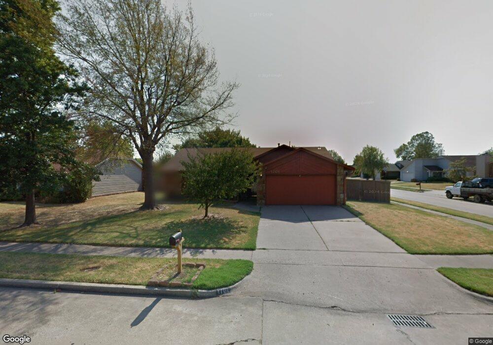
1701 N Butternut Ave Broken Arrow, OK 74012
Southbrook NeighborhoodEstimated Value: $209,167 - $220,000
3
Beds
2
Baths
1,504
Sq Ft
$143/Sq Ft
Est. Value
About This Home
This home is located at 1701 N Butternut Ave, Broken Arrow, OK 74012 and is currently estimated at $214,542, approximately $142 per square foot. 1701 N Butternut Ave is a home located in Tulsa County with nearby schools including McAuliffe Elementary School, Union 8th Grade Center, and Union 6th-7th Grade Center.
Ownership History
Date
Name
Owned For
Owner Type
Purchase Details
Closed on
Jul 30, 2025
Sold by
Vann Marva L and Davis Marva L
Bought by
Brown Cory and Brown Makayla
Current Estimated Value
Home Financials for this Owner
Home Financials are based on the most recent Mortgage that was taken out on this home.
Original Mortgage
$173,382
Outstanding Balance
$173,234
Interest Rate
6.81%
Mortgage Type
FHA
Estimated Equity
$41,308
Purchase Details
Closed on
Nov 21, 2000
Sold by
Kern Gary L and Kern Elizabeth P
Bought by
Vann Marva L
Purchase Details
Closed on
Jun 9, 1998
Sold by
Warriner Elizabeth Ann and Warriner Troy D
Bought by
Kern Gary L and Kern Elizabeth P
Purchase Details
Closed on
Jan 1, 1995
Create a Home Valuation Report for This Property
The Home Valuation Report is an in-depth analysis detailing your home's value as well as a comparison with similar homes in the area
Home Values in the Area
Average Home Value in this Area
Purchase History
| Date | Buyer | Sale Price | Title Company |
|---|---|---|---|
| Brown Cory | $213,000 | Allegiance Title & Escrow | |
| Vann Marva L | $90,000 | -- | |
| Kern Gary L | $78,000 | Guaranty Abstract Company | |
| -- | $71,500 | -- |
Source: Public Records
Mortgage History
| Date | Status | Borrower | Loan Amount |
|---|---|---|---|
| Open | Brown Cory | $173,382 |
Source: Public Records
Tax History Compared to Growth
Tax History
| Year | Tax Paid | Tax Assessment Tax Assessment Total Assessment is a certain percentage of the fair market value that is determined by local assessors to be the total taxable value of land and additions on the property. | Land | Improvement |
|---|---|---|---|---|
| 2025 | $2,039 | $15,531 | $2,331 | $13,200 |
| 2024 | $1,724 | $13,791 | $2,345 | $11,446 |
| 2023 | $1,724 | $14,360 | $2,534 | $11,826 |
| 2022 | $1,684 | $12,943 | $2,686 | $10,257 |
| 2021 | $1,637 | $12,537 | $2,601 | $9,936 |
| 2020 | $1,596 | $12,142 | $3,008 | $9,134 |
| 2019 | $1,550 | $11,814 | $2,927 | $8,887 |
| 2018 | $1,496 | $11,440 | $2,834 | $8,606 |
| 2017 | $1,468 | $12,077 | $2,992 | $9,085 |
| 2016 | $1,403 | $11,726 | $3,256 | $8,470 |
| 2015 | $1,404 | $11,726 | $3,256 | $8,470 |
| 2014 | $1,395 | $11,726 | $3,256 | $8,470 |
Source: Public Records
Map
Nearby Homes
- 1812 N Butternut Ave
- 4441 W Queens St
- 1908 N Cypress Ave
- 1429 N Yellowood Ave
- 11860 E 62nd Place
- 1216 N Cypress Ave
- 1312 N Willow Ave
- 6727 S 112th East Ave
- 2416 W Lansing Place
- 6526 S 111th East Ave
- 6529 S 110th Ave E
- 11329 E 61st St
- 911 N Butternut Ct
- 6407 S 109th East Ave
- 905 N Butternut Ave
- 1316 N Nyssa Ave
- 708 N Aster Ave
- 4501 W Hartford St
- 3413 W Norman St
- 3108 W Norman Cir
- 1705 N Butternut Ave
- 1702 N Aster Place
- 1709 N Butternut Ave
- 1706 N Aster Place
- 4425 W Reno St
- 4433 W Reno St
- 1710 N Aster Place
- 4421 W Reno St
- 1704 N Butternut Ave
- 1713 N Butternut Ave
- 4437 W Reno St
- 1708 N Butternut Ave
- 4417 W Reno St
- 1714 N Aster Place
- 1712 N Butternut Ave
- 1717 N Butternut Ave
- 4413 W Reno St
- 4436 W Queens St
- 4440 W Queens St
- 1509 N Aster Place
