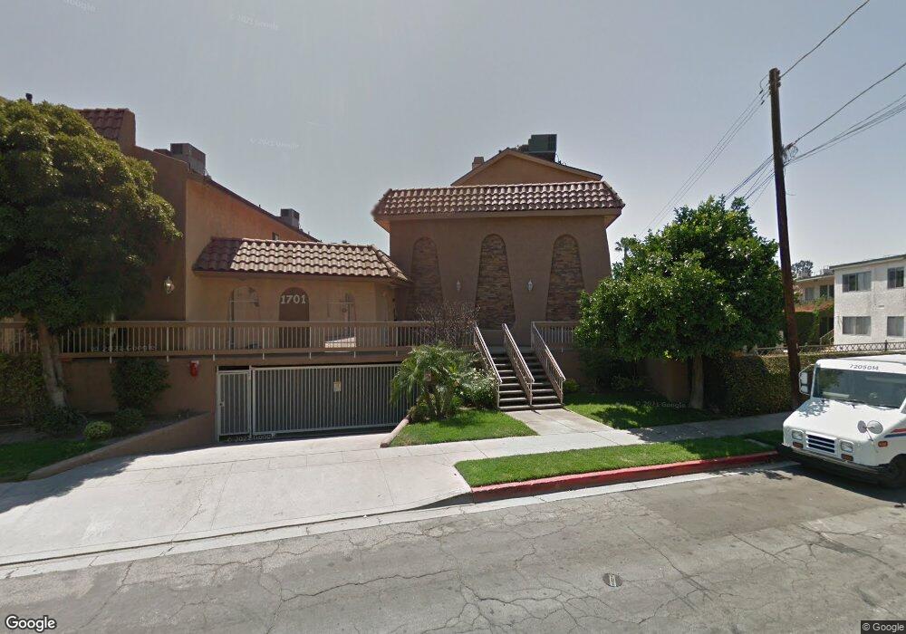
1701 Scott Rd Unit 116 Burbank, CA 91504
Hillside District NeighborhoodEstimated Value: $589,357 - $671,000
2
Beds
3
Baths
1,176
Sq Ft
$540/Sq Ft
Est. Value
About This Home
This home is located at 1701 Scott Rd Unit 116, Burbank, CA 91504 and is currently estimated at $635,589, approximately $540 per square foot. 1701 Scott Rd Unit 116 is a home located in Los Angeles County with nearby schools including Thomas Jefferson Elementary School, John Muir Middle School, and Burbank High School.
Ownership History
Date
Name
Owned For
Owner Type
Purchase Details
Closed on
Oct 18, 2000
Sold by
Ohanian Ohan and Kevoganian Garabed
Bought by
Ohanian Ohan and Ohanian Maral A
Current Estimated Value
Purchase Details
Closed on
Mar 24, 1994
Sold by
Cattani John J and Cattani Carolee J
Bought by
Ohanian Ohan and Kevoganian Garabed
Home Financials for this Owner
Home Financials are based on the most recent Mortgage that was taken out on this home.
Original Mortgage
$99,750
Interest Rate
7.15%
Create a Home Valuation Report for This Property
The Home Valuation Report is an in-depth analysis detailing your home's value as well as a comparison with similar homes in the area
Home Values in the Area
Average Home Value in this Area
Purchase History
| Date | Buyer | Sale Price | Title Company |
|---|---|---|---|
| Ohanian Ohan | -- | Gateway Title | |
| Ohanian Ohan | $105,000 | Stewart Title |
Source: Public Records
Mortgage History
| Date | Status | Borrower | Loan Amount |
|---|---|---|---|
| Previous Owner | Ohanian Ohan | $99,750 |
Source: Public Records
Tax History
| Year | Tax Paid | Tax Assessment Tax Assessment Total Assessment is a certain percentage of the fair market value that is determined by local assessors to be the total taxable value of land and additions on the property. | Land | Improvement |
|---|---|---|---|---|
| 2025 | $2,260 | $196,178 | $73,738 | $122,440 |
| 2024 | $2,260 | $192,333 | $72,293 | $120,040 |
| 2023 | $2,237 | $188,563 | $70,876 | $117,687 |
| 2022 | $2,136 | $184,867 | $69,487 | $115,380 |
| 2021 | $2,121 | $181,243 | $68,125 | $113,118 |
| 2019 | $2,037 | $175,869 | $66,105 | $109,764 |
| 2018 | $2,007 | $172,421 | $64,809 | $107,612 |
| 2016 | $1,895 | $165,728 | $62,294 | $103,434 |
| 2015 | $1,857 | $163,240 | $61,359 | $101,881 |
| 2014 | $1,859 | $160,044 | $60,158 | $99,886 |
Source: Public Records
Map
Nearby Homes
- 1711 Grismer Ave Unit 72
- 1814 Grismer Ave
- 1515 Grismer Ave Unit 102
- 1515 Grismer Ave Unit 302
- 441 Dartmouth Rd
- 505 Cambridge Dr
- 501 Birmingham Rd
- 430 Tufts Ave
- 1719 Landis St
- 1901 Peyton Ave Unit N
- 2014 Peyton Ave
- 1924 N Parish Place
- 1113 N Glenoaks Blvd
- 1304 N Griffith Park Dr
- 2316 N Parish Place
- 227 E Burbank Blvd Unit C
- 1331 N Lamer St
- 2109 N Lincoln St
- 2615 Woodstock Ln
- 637 E Fairmount Rd
- 1701 Scott Rd Unit 201
- 1701 Scott Rd Unit 202
- 1701 Scott Rd Unit 203
- 1701 Scott Rd Unit 204
- 1701 Scott Rd Unit 205
- 1701 Scott Rd Unit 206
- 1701 Scott Rd Unit 207
- 1701 Scott Rd Unit 208
- 1701 Scott Rd Unit 109
- 1701 Scott Rd Unit 110
- 1701 Scott Rd Unit 111
- 1701 Scott Rd Unit 112
- 1701 Scott Rd Unit 113
- 1701 Scott Rd Unit 114
- 1701 Scott Rd Unit 115
- 1701 Scott Rd Unit 117
- 1701 Scott Rd Unit 101
- 1701 Scott Rd Unit 102
- 1701 Scott Rd Unit 103
- 1701 Scott Rd Unit 104
Your Personal Tour Guide
Ask me questions while you tour the home.